2.9 km away
Blue Line
An easy trail to start with in Hinterglamm area!
Difficult Mountain Biking
- Distance
- 2.8 km
- Ascent
- 0 m
- Descent
- 428 m
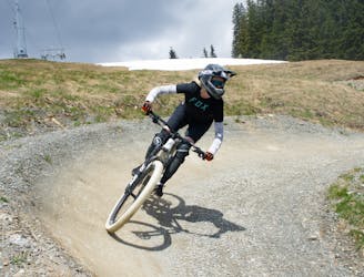
Very varied route in the midst of a magnificent mountain scenery. The route is partly fast, but always easy to control.
Mountain Biking Extreme

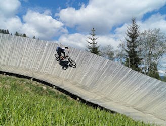
The start of the Z-Line is directly at the middle station of the Zwölferkogelbahn, from where the freeride route winds with a breathtaking view of Saalbach Hinterglemm towards the valley. The trail runs through wallrides, Northshore passages as well as waves, tables and smaller drops, always with the possibility of bypassing, which allows a slow approach to the route. The absolute highlight is the second wallride with the integrated action snapshot station. A spectacular memorial photo is guaranteed here!
The course is predestined for ambitious freeriders but also inspires tour riders with appropriate protective clothing and trail experience.
Extreme
Very steep, difficult, narrow singletrack with widely variable and unpredictable trail conditions. Unavoidable obstacles could be 15in/38cm tall or greater, and unavoidable obstacles with serious consequences are likely to be present. Obstacles could include big rocks, difficult root sections, drops, jumps, sharp switchbacks, and more. Ideal for expert-level riders.
2.9 km away
An easy trail to start with in Hinterglamm area!
Difficult Mountain Biking
7.5 km away
A route top to bottom, connecting two amazing flow trails!
Moderate Mountain Biking