6.4 km away
Niederer Rumpler
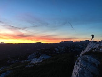
Hike to an exposed point above the Gjald Alm Hut.
Severe Hiking
- Distance
- 4.3 km
- Ascent
- 283 m
- Descent
- 283 m
Dachstein Rundweg Stage 3
Hiking Difficult

This is a popular hiking route which is generally considered to be difficult. It's remote, it features high exposure and is typically done between July and September. From a low point of 2.1 km to the maximum altitude of 2.7 km, the route covers 7.7 km, 256 vertical metres of ascent and 777 vertical metres of descent.
Glacier Crossing
Difficult
Hiking trails where obstacles such as rocks or roots are prevalent. Some obstacles can require care to step over or around. At times, the trail can be worn and eroded. The grade of the trail is generally quite steep, and can often lead to strenuous hiking.

Some trail sections have exposed ledges or steep ascents/descents where falling could cause serious injury.

Away from help but easily accessed.
6.4 km away
Hike to an exposed point above the Gjald Alm Hut.
Severe Hiking