704 m away
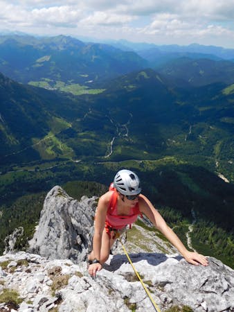
Rumerspitze Traverse
A classic scramble on a beautiful and prominent peak
Moderate Alpine Climbing
- Distance
- 13 km
- Ascent
- 952 m
- Descent
- 952 m
An exciting and challenging 10 pitch scramble along the southern ridge of the Brandjochspitze.
Alpine Climbing Difficult

Starting from the Seegrube cable car station head west, taking the traversing path signposted ‘Vorderes Brandjoch 2558 m’. The walk in feels long, but keep traversing, following signs for Vorderes Brandjoch. You will eventually pass below the cross which signals the start of the climb, and down on the left you will see a small shepherd’s hut. Around 400m after this hut is a large, flat, grassy area, and from here follow a steep path for 30 minutes, which leads up to the cross you passed under previously, indicating the start of the scramble.
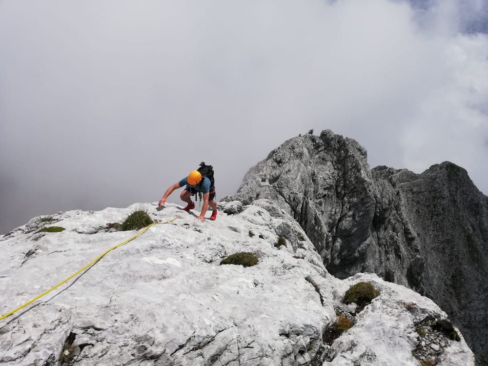
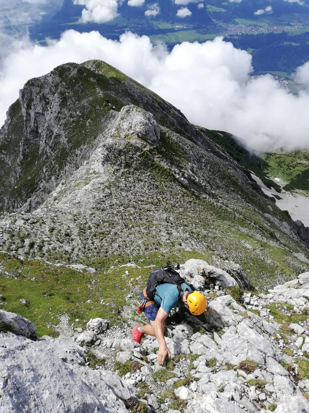
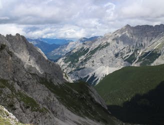
The start of the route is easy scrambling mainly on the ridge itself. Route finding is not easy, although there are sporadic cairns and small, yellow paint marks. The first potential challenging section comes at around 2400m altitude in the form of a chimney 25m high. A yellow arrow and a metal stake up ahead show that you are still on the right track.
After the chimney the next section is rather exposed and can feel pokey. Most will be glad of a rope at this point. Follow the exposed ridge, including a slightly nerve-wracking step down across a gap. The exposure continues until you find your way back to the crest of the ridge, where you can finally breathe easy again. Downclimb to a small notch and follow easy grassy ground round to the left and into a large scree-filled gully. A vague path winds up through this gully and on to the final summit ridge and an easy scramble is the last section before reaching the summit cross.
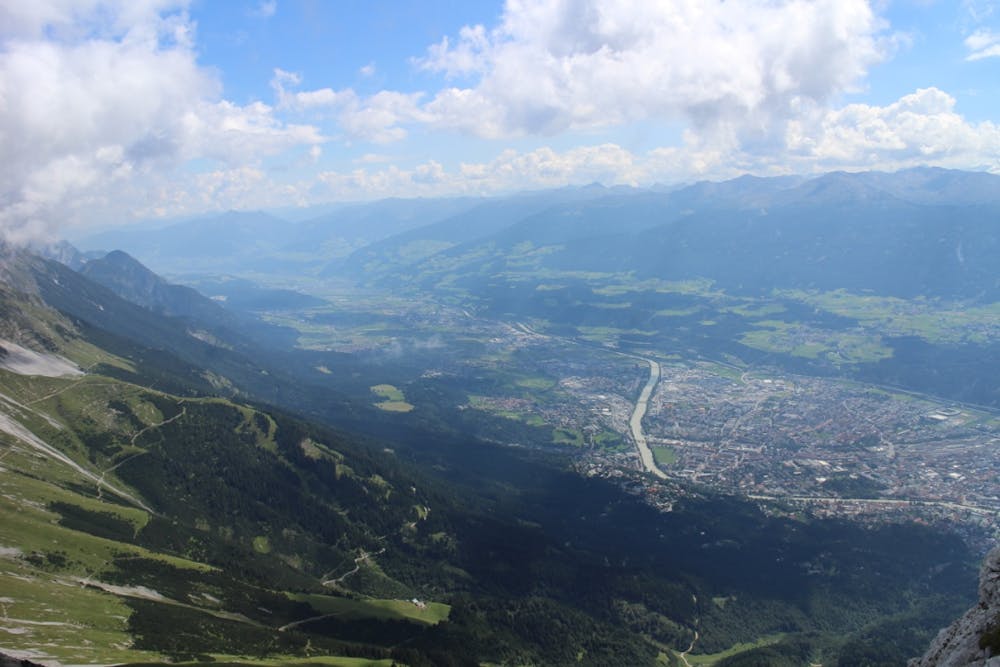
To descend from the summit, there is a clear path down the scree slope of the east ridge of the Brandjochspitze. A couple of sections of the path are a little exposed, and there are occasional sections of via ferrata cable, but the terrain is not difficult and will eventually
bring you back to the Frau-Hitt-Sattel. From here the route back to Seegrube is clearly signposted.
Difficult
The beginning of truly technical terrain which might involve pitched climbing on rock and/or ice, exposed terrain and complex route finding in ascent and descent. Equivalent to AD, AD+

Much of the route is difficult to protect and a fall could be disastrous at certain points.
Little chance of being seen or helped in case of an accident.
704 m away
A classic scramble on a beautiful and prominent peak
Moderate Alpine Climbing
6 routes · Alpine Climbing
9 routes · Alpine Climbing · Hiking