9.2 km away
Polleskogel Peaks
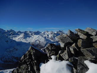
Two superb peaks in the Oetztal Alps, offering an easy tick for two 3000m summits in one day.
Moderate Alpine Climbing
- Distance
- 3.4 km
- Ascent
- 404 m
- Descent
- 404 m
A classic high mountain traverse over the highest peak in the Tirol
Alpine Climbing Moderate

From the Breslauer Hütte, follow the hiking trail signposted ‘Wildspitze über Mitterkarjoch 3 3/4 hours’. The path begins with a fairly gentle ascent and is well marked with red and white paint marks. You will shortly reach a moraine field where the path becomes a little more vague, but the gradient remains pretty much the same, winding upwards and following small cairns rather than paint marks towards Mitterkarferner Glacier (or what little remains of it).
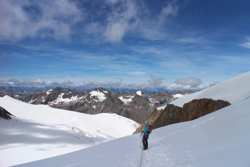
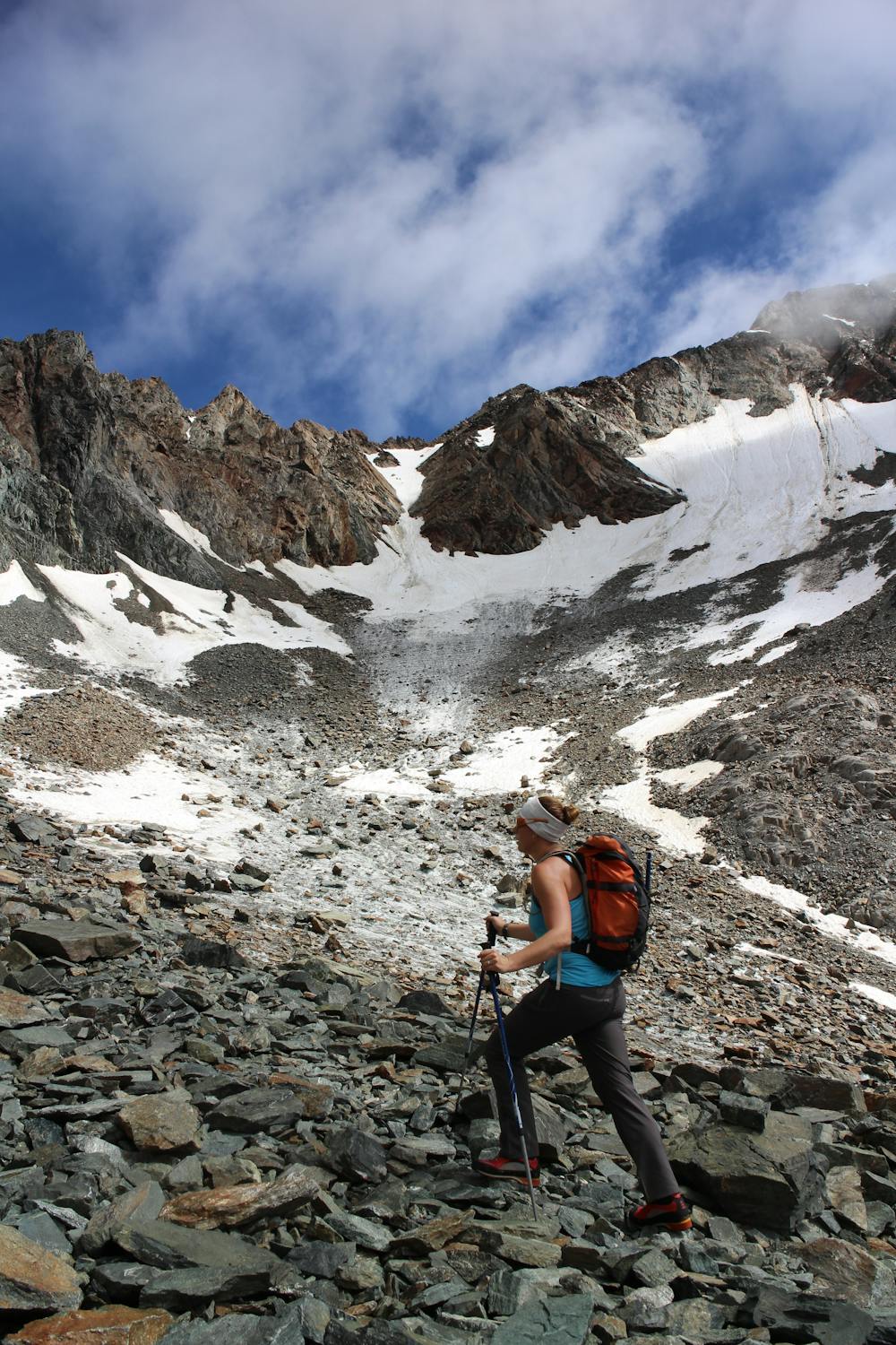
Up ahead you will see the Mitterkarjoch col, and here the route begins to head to the right, and depending on the time of year, is likely to be quite snowy. Up ahead you will see a gully, which again, is likely to be snow-filled and will likely require crampons. Continue up this gully until it starts to narrow, at which point you will see some fixed cables on your left. This is a short, yet enjoyable grade B via ferrata, leading to the Mitterkarjoch col. Prepare for some photo opportunities here as the view which suddenly opens up across the Taschachferner Glacier is remarkable. From the col you also have your first view of the summit of the Wildspitze, so you are able to see how much further it is to the top! From the Breslauer Hütte to here will take approximately 2.5 - 3 hours.
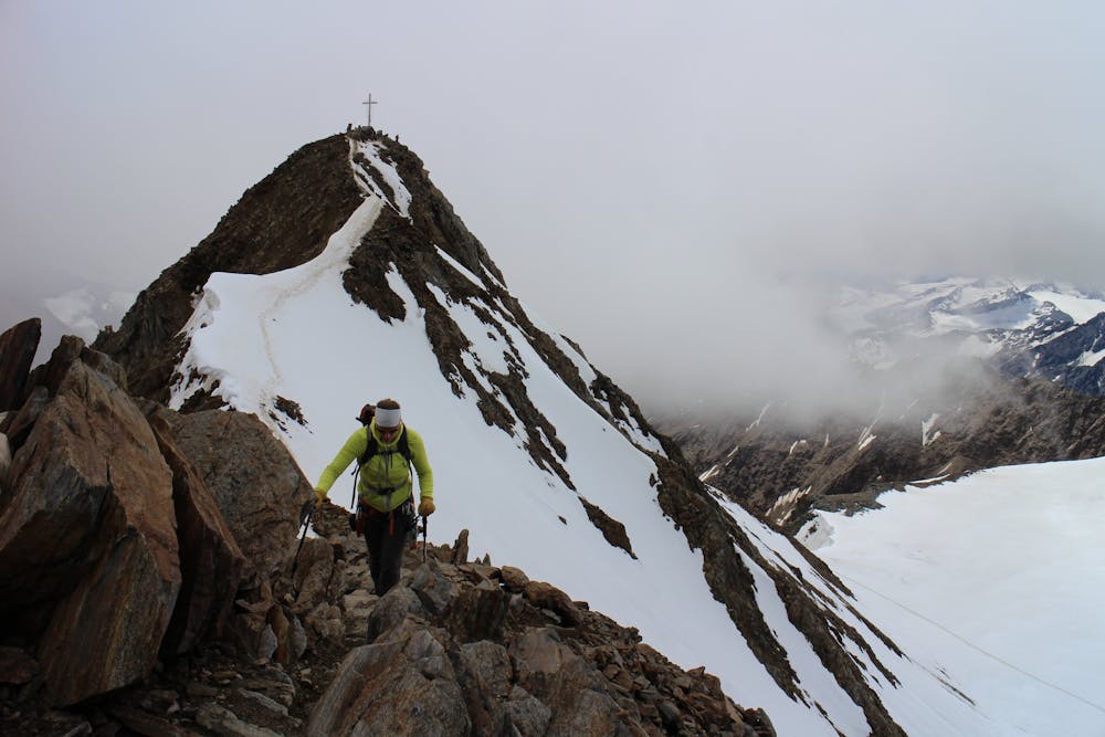
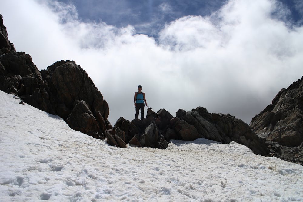
This is the place to rope up and don crampons if you haven’t already as it is all glaciated terrain from here. Cross the col and descend slightly to the right, then follows a long traverse across the snow, and finally a 20 minute ascent up to a small col. This will bring you to the bottom of the Wildspitze’s south ridge from where the final push is a 50m rocky scramble up the ridge to reach the summit cross. If you are lucky enough to be on the summit on a clear day, the views across the peaks and glaciers is certainly worth a stop and a few photos, and don’t forget to sign the summit book!
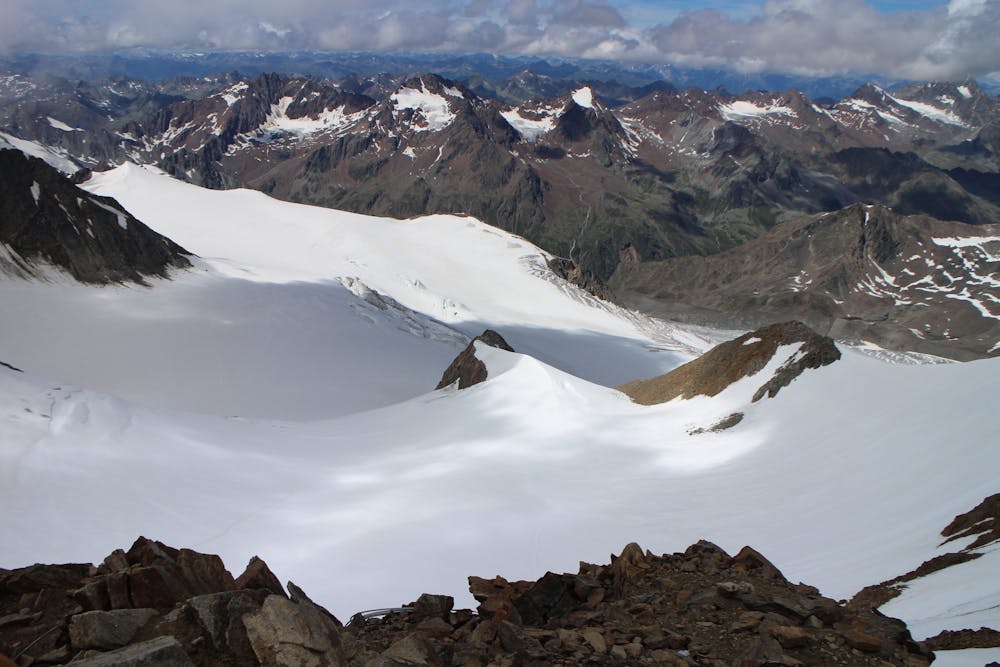
There are 2 options for the descent, and it depends whether you wish to take the same route down or make it in to a round trip. The easiest option is to simply retrace your steps and follow the same route down, however a more interesting, yet more challenging, option is to follow the snowy ridge north-east off the summit, crossing two further peaks (3765m and 3677m). The challenging aspect comes in between these 2 peaks as there is a short, yet rather exposed descent down a snowy ridge. This may provide a challenge too far for all but the most experienced mountaineer and cramponner with a head for heights. After the second peak an easy walk will bring you to the col at 3552m, traverse around the small rocky summit north of the col and descend a rocky ridge towards the Rofenkarjoch (col). Go down the Rofenkarferner Glacier’s right hand side for 1km until it starts to give way to rock, then follow a series of cairns back to the Breslauer Hütte. Taking this route from the summit to the hut should take around 3 hours. From here simply retrace your route back down to Vent.
Moderate
May involve slightly more complex glacier hikes, easy but possibly long rock ridges and steep snow up to 45 degrees. Equivalent to PD, PD+

The route features some exposed and/or difficult to protect sections.

Little chance of being seen or helped in case of an accident.
9.2 km away
Two superb peaks in the Oetztal Alps, offering an easy tick for two 3000m summits in one day.
Moderate Alpine Climbing

9 routes · Alpine Climbing · Hiking

4 routes · Alpine Climbing · Hiking