Härmelekopf Nord Rinne
The Härmelekopf's steep North couloir is a true Tirol classic.
Severe Freeride Skiing
- Distance
- 2.5 km
- Ascent
- 15 m
- Descent
- 723 m
An epic line that feels like a ski tour and takes you through some wild terrain.
Freeride Skiing Severe

For a line that doesn't require any skinning, this is quite a journey and takes you into 2 different valleys, all for less than 250 vertical metres of hiking.
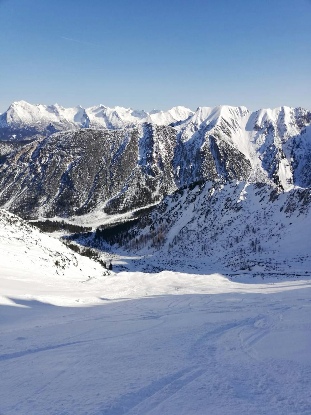
Start by riding the Härmelekopfbahn cable car and bootpack south out from the cable car station, following the line of the summer path towards the summit of the Härmelekopf peak. Depending on conditions it might be possible to walk on the path itself but in all but the leanest of conditions the path will be snow covered and you'll be bootpacking up snow. Not being the first people to do the bootpack will make things easier! Pass just south of the Härmelekopf and bootpack along the peak's south-east ridge. There can be huge cornices on the northern side of this ridge so stay a few metres right of the ridge crest itself. Much of the trip along the ridge is exposed so you will need to be a confident ski mountaineer to do it safely. If conditions are icy, you may be glad of crampons.
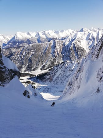
Follow the ridge as it undulates and then descends to the col separating the Härmelekopf from the Reither Spitze. Put skis on and traverse east across the top of a bowl (which makes a great ski line itself and is also described in FATMAP) to reach the foot of a narrow couloir with impressive rock walls on either side of it. The Reither Spitze West Rinne line goes up here.
For this line, take your skis off at the foot of the couloir and then make a very short bootpack up to the col immediately ahead of you. Ski the narrow and exciting (but never overly steep) couloir that goes straight down from the col. Where the couloir opens up into a wide slope, put the pedal to the metal and enjoy some fast turns!
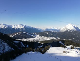
Ski into the valley below, sticking skier's right as you do so, and then follow a track out (via some sections of skating and poling) all the way to the village of Gießenbach, from where you can catch a bus back to Seefeld.
Severe
Steep skiing at 38-45 degrees. This requires very good technique and the risk of falling has serious consequences.

As well as the slope itself, there are some obstacles (such as rock outcrops) which could aggravate injury.

Little chance of being seen or helped in case of an accident.
The Härmelekopf's steep North couloir is a true Tirol classic.
Severe Freeride Skiing
Fun and fast freeride!
Difficult Freeride Skiing

10 routes · Freeride Skiing
5 routes · Freeride Skiing · Ski Touring