Grän > Bad Kissinger Hütte > Aggenstein
Hiking trail up to Aggenstein with a stop at Bad Kissinger Hütte
Hiking Easy
- Distance
- 8.5 km
- Ascent
- 796 m
- Descent
- 809 m
- Duration
- 3-4 hrs
- Low Point
- 1.2 km
- High Point
- 2 km
- Gradient
- 19˚

Parking at the dedicated parking spots, follow the marked hiking trail up to Aggenstein.
- •
- •
Description
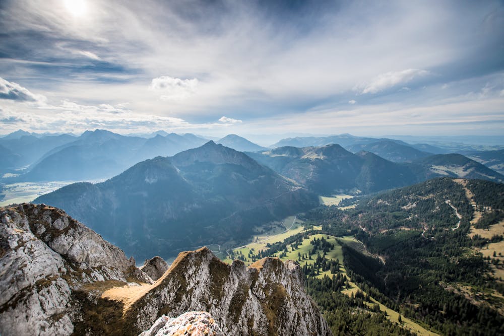
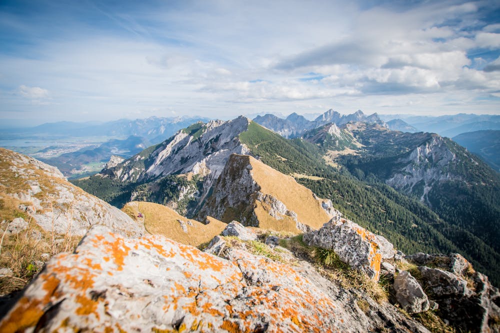
It's a long walk and the trail can be loose and steep at some points, but you are rewarded with a mixture of peaceful forest and open mountain side.
There are stunning views when you emerge on the ridge just below Bad Kissinger Hütte.
From there, you can continue up the steep final trail to the summit. This is definitely a bit of a scramble and not a route suitable for people that are afraid of heights!
Difficulty
Easy
Walking along a well-kept trail that’s mostly flat. No obstacles are present.
Medium Exposure

The trail contains some obstacles such as outcroppings and rock which could cause injury.
Remoteness

Close to help in case of emergency.
Best time to visit
Features
- Alpine
- Wildlife
- Picturesque
- Summit Hike
- Dog friendly
- Wild flowers
- Water features
- Family friendly
- Forestry or heavy vegetation