Wiedersberger Horn-Hochstand-Standkopf loop
Ski Juwel Alpbachtal Wildschönau
A family friendly ridge hike with traditional food and a stunning panorama.
Hiking Moderate
- Distance
- 10 km
- Ascent
- 786 m
- Descent
- 786 m
- Duration
- 3-4 hrs
- Low Point
- 1.6 km
- High Point
- 2.2 km
- Gradient
- 15˚

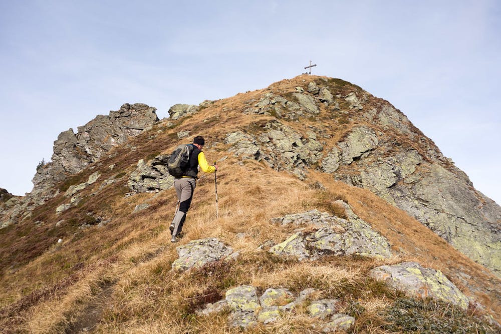
This route starts at the gondola station of the Wiedersbergergerhornbahn in the Alpbach valley. Turn southwards and follow the path in the direction of the Wiedersberger Horn. The trail will lead you to the peak onto a mellow ridge in moderate terrain.
Description
Descend down to the Hornalm hut and continue southwards onto the ridge until the Hochstand peak appears.
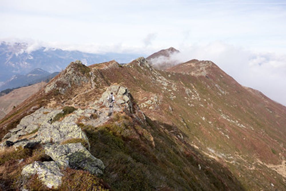
This wider ridge continues for a long time and offers perfect conditions for families and beginners to get used to hiking in more exposed terrain. It beautifully overlooks the surrounding higher mountains. Especially in early summer this hike feels like a promenade through a flower garden as both hillsides begin to bloom.
From the Hochstand you already can overlook the 3 Sagtaler Spitzen (Sagtaler peaks). From east to west the Gamskopf, Tapenkopf and Standkopf form an impressive panorama. The trail aims for the most eastern Standkopf peak, which is often referred to as the Sagtaler Spitze which is, strictly speaking, incorrect.
Continue onto the ridge until it crosses several smaller lakes on both sides, then turn right (south) for the final ascent of the Standkopf (Sagtaler Spitze) via the south ridge.
At the highest point of the tour, this peak overlooks the ridge and allows a stunning view onto the higher alps of the Zillertal.
Descend via the north-west ridge and keep on walking back onto the ridge to the north. In between the Standkopf and the Hochstand turn right (east) at the first opportunity onto a narrow trail down to the Moserbaumgartenalm hut. This hut offers traditional meals and cold drinks for a well deserved rest.
From the hut use the gravel road starting from there to reach the Wiedersbergeralm hut in the north. Gently rising, the trail then leads you to the gondola station of the Wiedersbergerhohrnbahn again.
Difficulty
Moderate
Hiking along trails with some uneven terrain and small hills. Small rocks and roots may be present.
Medium Exposure

The trail contains some obstacles such as outcroppings and rock which could cause injury.
Remoteness
Away from help but easily accessed.
Best time to visit
Features
- Picturesque
- Summit Hike
- Wild flowers
- Water features
- Family friendly