2 km away
Vent to the Breslauer Hütte via the Wildes Mannle
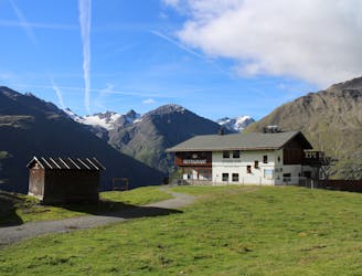
A fun way to reach the Breslauer Hütte and tag a 3000 metre summit on the way
Difficult Hiking
- Distance
- 5.1 km
- Ascent
- 755 m
- Descent
- 267 m
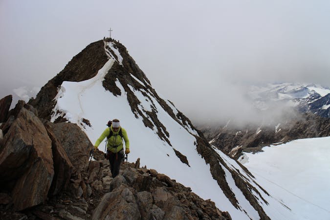
A round trip from the Breslauer hut accross the north and south summits of the Wildspitze
Hiking Difficult

This is a popular hiking route which is generally considered to be difficult. It's remote, it features medium exposure and is typically done between June and September. From a low point of 2.8 km to the maximum altitude of 3.7 km, the route covers 8.6 km, 930 vertical metres of ascent and 928 vertical metres of descent.
An airy traverse accrose the snowy and rocky summits of Tirol´s highest mountain. A classic way for the trained alpinist to visit this high summit.
Book a private or group guided tour of this route with Mountains Mountaineering School:
Difficult
Hiking trails where obstacles such as rocks or roots are prevalent. Some obstacles can require care to step over or around. At times, the trail can be worn and eroded. The grade of the trail is generally quite steep, and can often lead to strenuous hiking.

The trail contains some obstacles such as outcroppings and rock which could cause injury.
Away from help but easily accessed.
2 km away
A fun way to reach the Breslauer Hütte and tag a 3000 metre summit on the way
Difficult Hiking
4 routes · Alpine Climbing · Hiking