2 km away
Blue Line
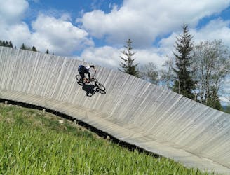
An easy trail to start with in Hinterglamm area!
Difficult Mountain Biking
- Distance
- 2.8 km
- Ascent
- 0 m
- Descent
- 428 m
Enduro fun for everyone
Also in Salzburg, Austria
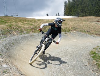
Mountain Biking Difficult

Beautifully crafted singletrail, which really brings spice into every MTB-Tour at the Reiterkogel. Ideal for enduro and touring. The easy singletrail leads you to the Reiteralm. As a perfect finish, a forest road leads past the Heilkräuterweg and back to the Reiterkogelbahn mountain station, where the Pro Line and Blue Line are waiting for you.
Difficult
Mostly stable trail tread with some variability featuring larger and more unavoidable obstacles that may include, but not be limited to: bigger stones, roots, steps, and narrow curves. Compared to lower intermediate, technical difficulty is more advanced and grades of slopes are steeper. Ideal for upper intermediate riders.
2 km away
An easy trail to start with in Hinterglamm area!
Difficult Mountain Biking
4.3 km away
A route top to bottom, connecting two amazing flow trails!
Moderate Mountain Biking