1.4 km away
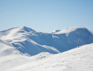
Vennspitze
A mellow peak with great views across the landscape of the Wipptal.
Moderate Ski Touring
- Distance
- 5.7 km
- Ascent
- 808 m
- Descent
- 808 m
www.runskitirol.com/skimo/silleskogel
Ski Touring Moderate

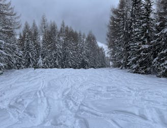
This is a popular ski touring route which is generally considered to be moderate. It's not remote, it features low exposure (e1) and is typically done between December and April. From a low point of 1.5 km to the maximum altitude of 2.4 km, the route covers 7.2 km, 926 vertical metres of ascent and 926 vertical metres of descent. It's graded 1.3 and Labande grade 1. You'll need skins to complete it safely.


A very popular and relatively easy summit tour to Silleskogel is a great option for beginners or sub-optimal avalanche conditions. North orientation means the snow cover remains relatively long.
Moderate
Slopes become slightly steeper at around 25-30 degrees.

Exposure is limited to that of the slope itself. Getting hurt is still likely if the slope is steep and/or the snow is hard.
Close to help in case of emergency.
1.4 km away
A mellow peak with great views across the landscape of the Wipptal.
Moderate Ski Touring
4.5 km away
A classic ski tour new the Italian border following an old ski slope.
Easy Ski Touring