1.2 km away
Stubai Ski Tour: Lift System to the Amberger Hut
This is a mainly downhill day to get the ski legs in, with the option of a ski summit by going up a side valley.
Moderate Ski Touring
- Distance
- 11 km
- Ascent
- 831 m
- Descent
- 1.7 km
A long tour through the northern Stubai Alps.
Ski Touring Extreme

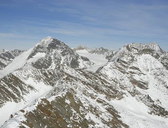
Stubai valley is known for its high peaks, which for years have been attracting skiers from all over the country. Wether you are visiting the area for a short period only or you are a local, many different tours up to marvellous peaks (covering all different difficulty grades) are waiting to be discovered in this region and, sometimes, it is even possible to link more of them and push your legs the extra mile. This route is a good example.
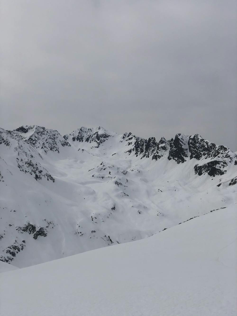
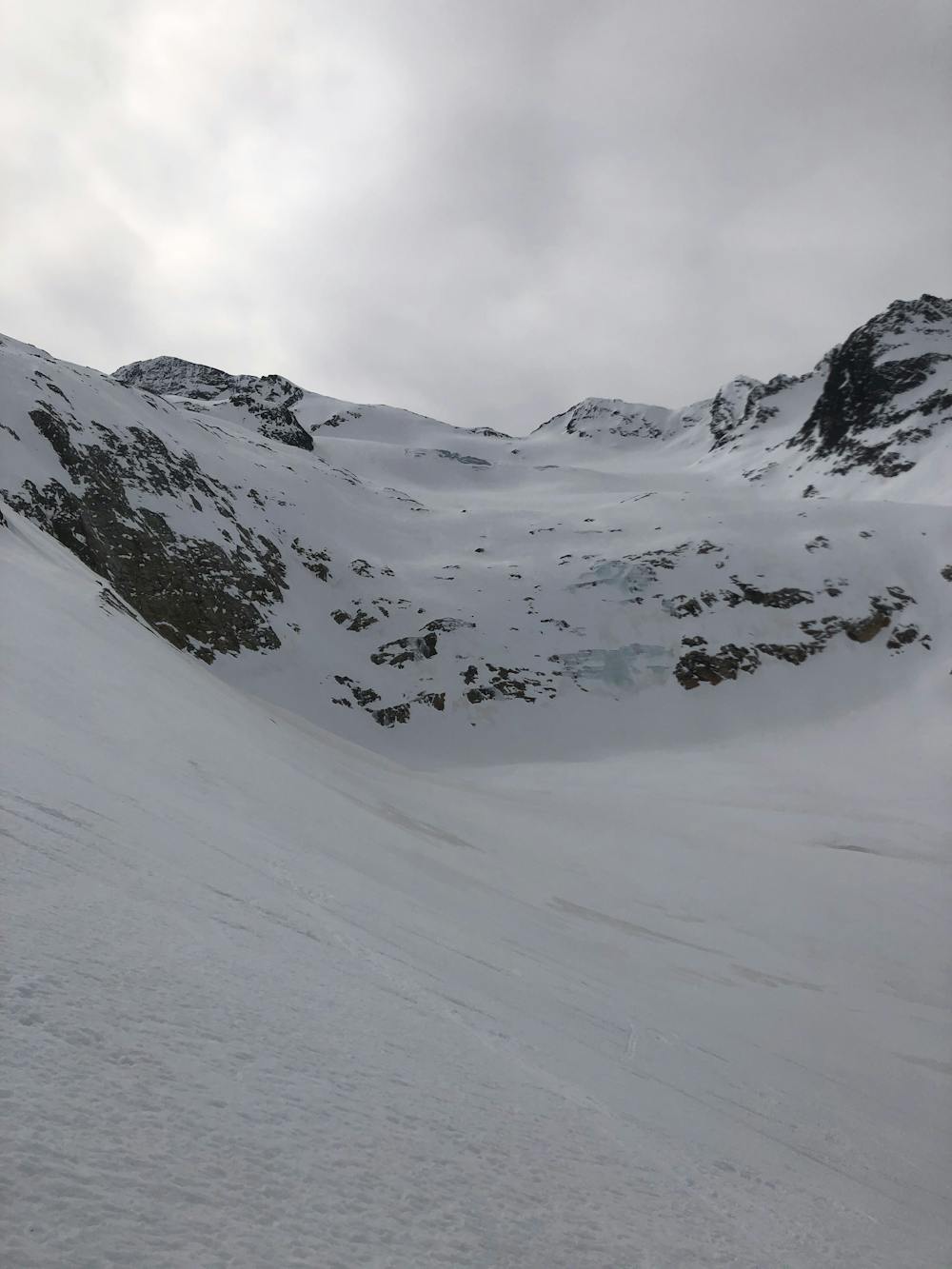
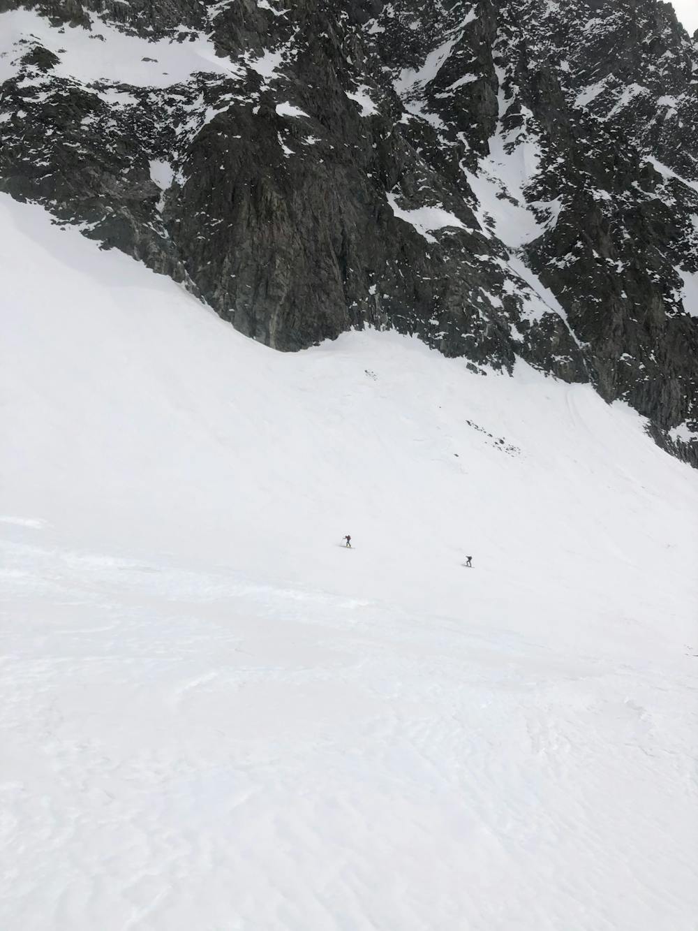
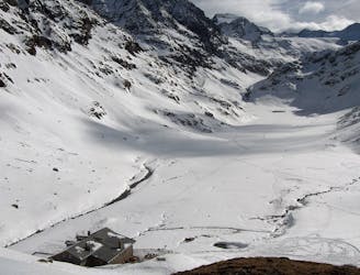
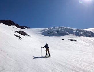
Getting ready with your equipment and starting from the lifts at Stubai Gletscher - precisely from the bottom of the Sesselbahn Daunjochl (it is indeed very rarely open) you will skin up all the way to the top station then keep on going to the peak of the Hinterer Daunkopf. At this point the first peak has been reached and the landscape is amazing, especially on a sunny day. The majority of the skiers on the peak will probably ski down back to the resort, but today you will instead ski down towards Amberger Hütte through a mellow alpine valley shaped by glaciers back in the previous centuries. Before reaching the hut, you will put the skins on again and get into the valley towards the Schwarzenbergfern glacier, which lies below the Schrankogel peak. From here, you need to cross a tiny range which divides this glacier from the Alpine Ferner: there is a couloir that will let you climb to the ridge and walk down couple of vertical metres onto the next glacier.
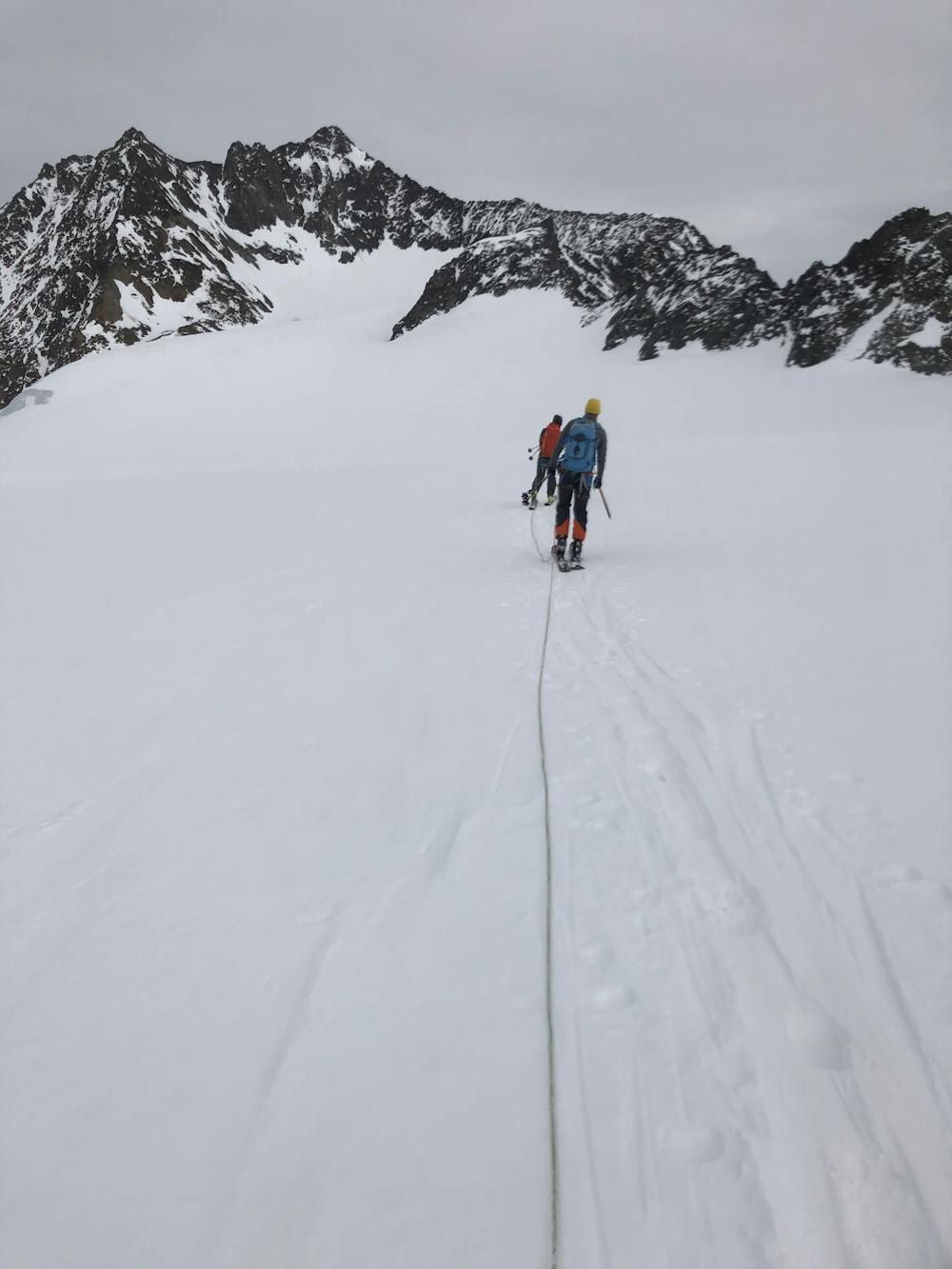
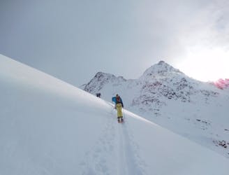
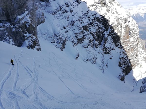
You'd better don your glacier kit now as you are crossing the whole glacier until the start of the ridge walk which will lead you to the Ruderhofspitze peak. This climb is quite exposed and requires confidence - be sure of not pushing yourself over your limits: if you don’t feel confident you can always ski out from the east through Franz-Seen Hütte and down to the valley. Crampons are mandatory to make sure to not slip, you definitely want to avoid this scenario up here. As you are reaching the end of the ridge, the walk gets less and less technical. You can now walk your last steps to the peak, admire the landscape and get ready for the descent. The descent follows the normal Ruderhofspitze South Face route.
This a very long and demanding tour, both on the mental and physical aspect. It is highly recommended to start in the very early morning, keep a consistent pace, bring enough water and food and emergency gear as it is - in certain spots - quite remote. The tour could be split in two days by adding a stop at the Amberger Hütte, only a few hundreds meters away from this track.
Extreme
Extreme skiing terrain above 45 degrees. These routes are reserved for experienced experts.

In case of a fall, the skier faces certain death.

Little chance of being seen or helped in case of an accident.
1.2 km away
This is a mainly downhill day to get the ski legs in, with the option of a ski summit by going up a side valley.
Moderate Ski Touring
3.1 km away
A wonderful, varied and scenic tour to the highest peak in the Stubai range.
Difficult Ski Touring
3.3 km away
Get top to the top of this iconic peak in the Stubaier Alps!
Difficult Ski Touring
5.7 km away

Skitour über den Schwarzenbergerferner und Gratkletterei auf einen Gipfel mit einer Rundumsicht, die ihresgleichen sucht!
Difficult Ski Touring
5.8 km away

Über Eis und Steilrinnen auf einen Panoramagipfel der Stubaier Alpen
Difficult Ski Touring
5.8 km away

Eine einfache, unvergletscherte Skitour im Schatten steiler Felswände.
Moderate Ski Touring
5.8 km away

Einsame sonnseitige Frühjahrsabfahrt.
Moderate Ski Touring
5.8 km away
A day tour up the classic Kuhscheibenspitze, 3189m
Difficult Ski Touring
5.8 km away
A long glacial skin to a short roped climb leading to one of two cols, before a long descent to the Franz Senn Hut.
Difficult Ski Touring
8.7 km away
A tour to the peak of one of the Stubai Seven Summits.
Severe Ski Touring
5 routes · Ski Touring

17 routes · Ski Touring

25 routes · Ski Touring
6 routes · Ski Touring