97 m away
Ifen Hahnenköpfle Schneiderkürenalpe Wäldele
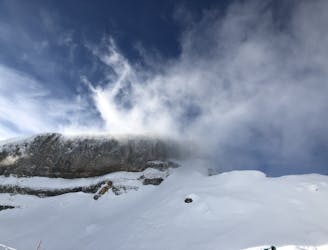
A beautiful freeride line that's safe in most conditions
Moderate Freeride Skiing
- Distance
- 8 km
- Ascent
- 42 m
- Descent
- 966 m
A beautiful Freeride run from Ifen over the Gottesacker into Wäldele. Good in most conditions.
Freeride Skiing Difficult

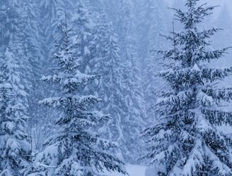
Take the blue Piste 5 down to where the hiking path ends and you see a bench on your left. If possible, join the hiking path on the last few metres. There is a second bench set back a little bit. Behind that, there is a small hill you'll have to climb, and then you drop into the Gottesacker plateau. Find your line between the hills, and at the end of the plateau you drop into the trees (Wäldele). Follow the hiking path all the way down to the ski de fond track, and then follow that to the street. There is a bus stop right next to the bridge that takes you back to Riezlern.
Difficult
Serious gradient of 30-38 degrees where a real risk of slipping exists.

In case of a fall, death is highly likely.

In the high mountains or remote conditions, all individuals must be completely autonomous in every situation.
97 m away
A beautiful freeride line that's safe in most conditions
Moderate Freeride Skiing
3.6 km away

There are many ways down and in good conditions (and for good skiers) you can actually go straight and blast through the bushes.
Difficult Freeride Skiing
3.6 km away
There are many ways down, and even more entrances!
Difficult Freeride Skiing