3.7 km away
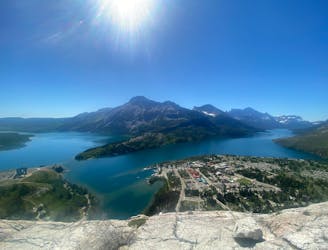
Crypt Lake Trail
An exciting and beautiful trail, which is just as much about the journey as it is the destination.
Severe Hiking
- Distance
- 19 km
- Ascent
- 937 m
- Descent
- 934 m
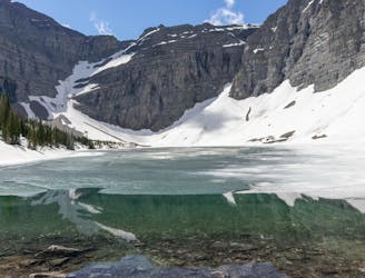
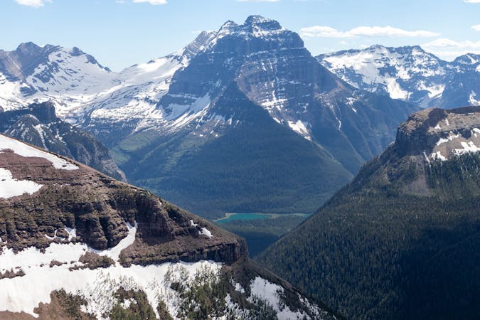
A classic finish to the CDT that ends at Waterton Park in Canada.
Also in Montana, United States of America
Hiking Moderate

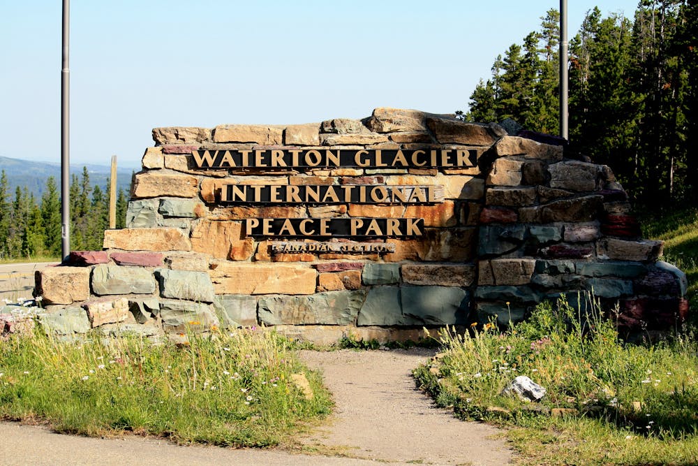
If you're wrapping up the traditional finish to the 3,300-mile CDT, then you're faced with two options when you arrive at the Border Monument Terminus on Waterton Lake. Either turn back, and retrace your steps 35-miles to Many Glacier Hotel, or continue north 4-miles into Waterton-Glacier International Peace Park. These final few miles lead into Canada to a site that earned its designation in 1932 when both countries chose to celebrate "the longstanding peace and friendship" between our two nations, the CDT Coalition notes.
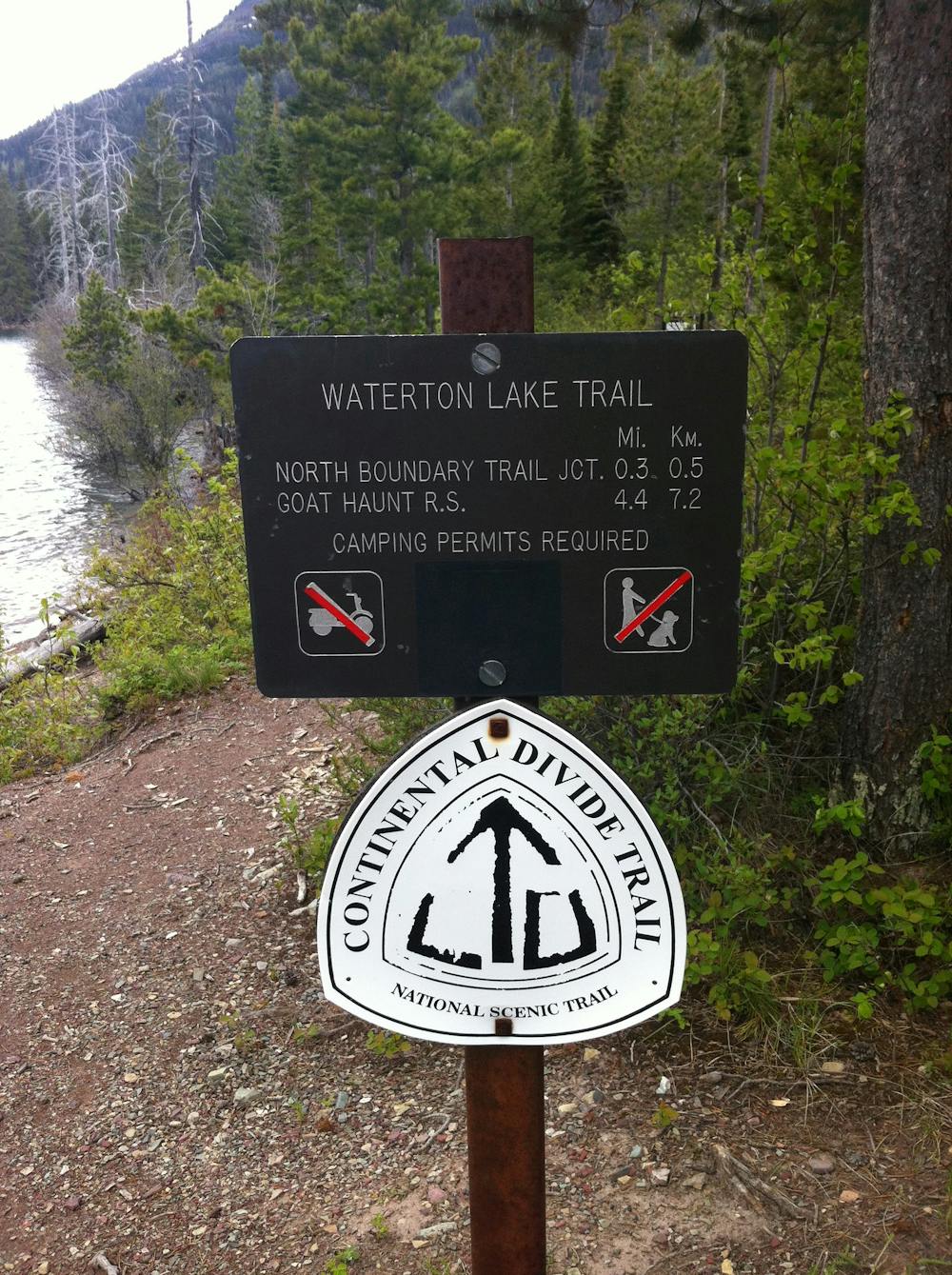
Given its ease, the obvious choice for most is to continue north into Canada. That, however, brings about a few other logistical details that you must consider. For instance, if you have someone coming to pick you up, a passport will be required to gain entry into Canada and to enter the park. The same is true for hikers, and any number of variables can cause closures at the border. In fact, during the Covid-19 pandemic, this particular section of trail was closed to international travelers, requiring hikers to opt for alternative routes, such as this one that ends just south of the Canadian border.
When deciding how to complete your thru-hike, snow, wildfires, and trail closures are all variables to consider. Wildlife encounters are also not unheard of, though well-traveled trails tend to lead to fewer sightings. Some thru-hikers even opt for a road walk from Many Glacier Hotel to the border if snow hits earlier than expected. And, as with all of Glacier National Park, pets are prohibited on trails - so plan to leave your 4-legged friend at home even if you're just out for a day hike.
Sources: https://continentaldividetrail.org/project/northern-terminus-of-the-continental-divide-trail-glacier-national-park/ https://en.wikipedia.org/wiki/ContinentalDivideTrail
Moderate
Hiking along trails with some uneven terrain and small hills. Small rocks and roots may be present.

The trail contains some obstacles such as outcroppings and rock which could cause injury.
Away from help but easily accessed.
3.7 km away
An exciting and beautiful trail, which is just as much about the journey as it is the destination.
Severe Hiking
5.4 km away
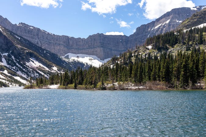
A beautiful trail with numerous viewpoints along the way as you climb up to the picturesque Bertha Lake.
Moderate Hiking
6.9 km away
A short hike with superb views as you look out over Waterton Lake.
Moderate Hiking

40 routes · Hiking
13 routes · Hiking
3 routes · Hiking
3 routes · Hiking