1.7 km away
South Lawson Peak | C'est Notre Monde
A bird's eye view of the Kananaskis Lakes
Difficult Hiking
- Distance
- 7.6 km
- Ascent
- 699 m
- Descent
- 699 m
An intermediate winter hike in Kananaskis country
Hiking Moderate

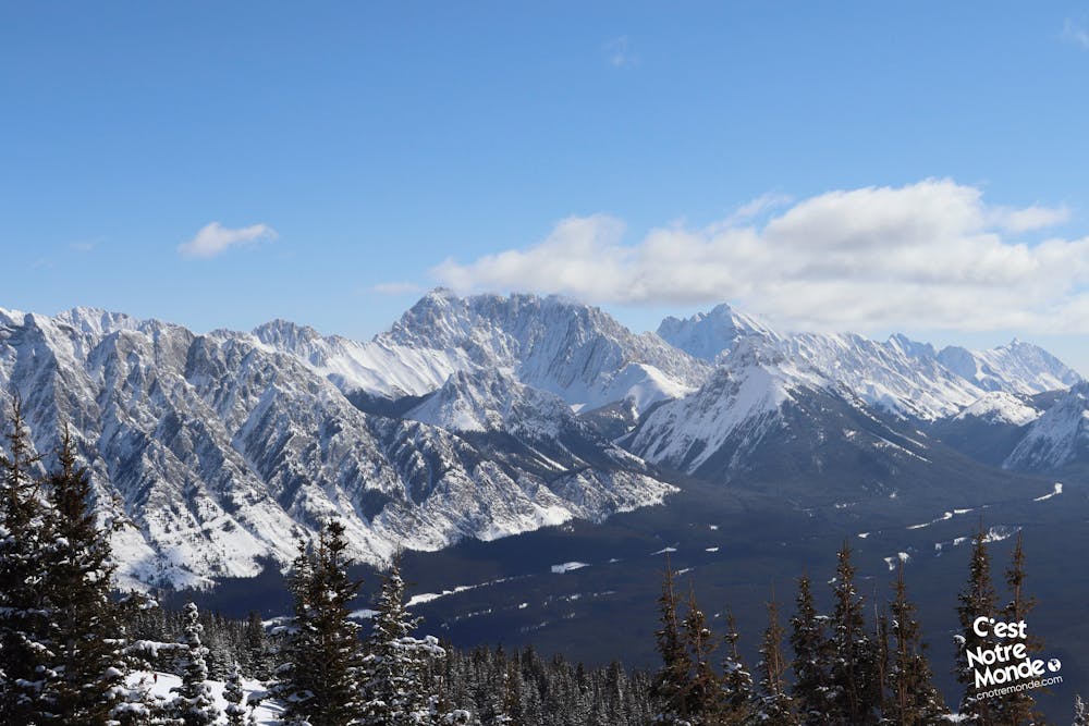
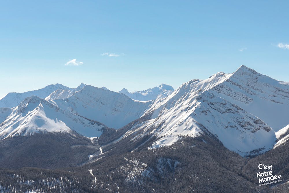
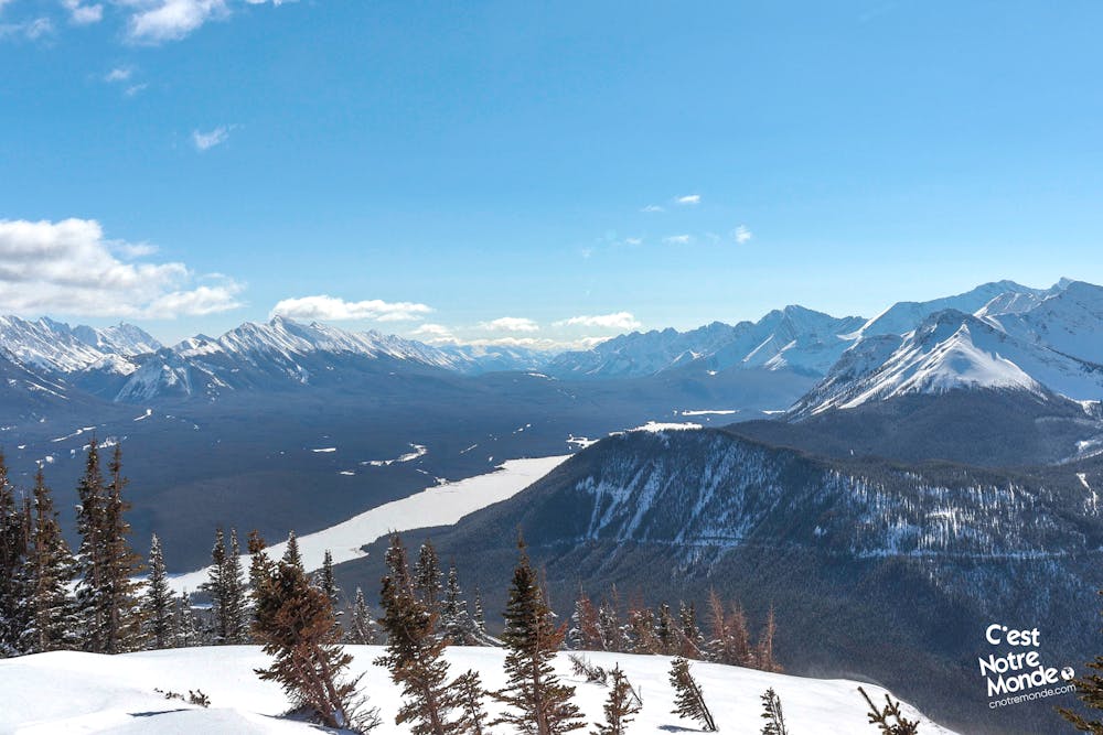
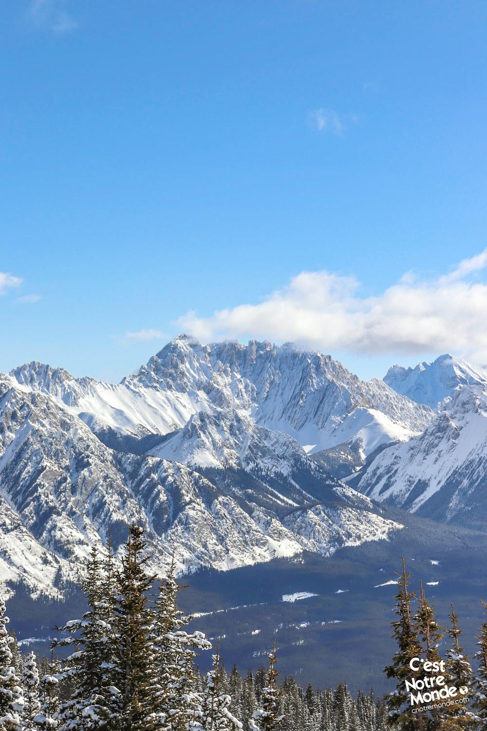
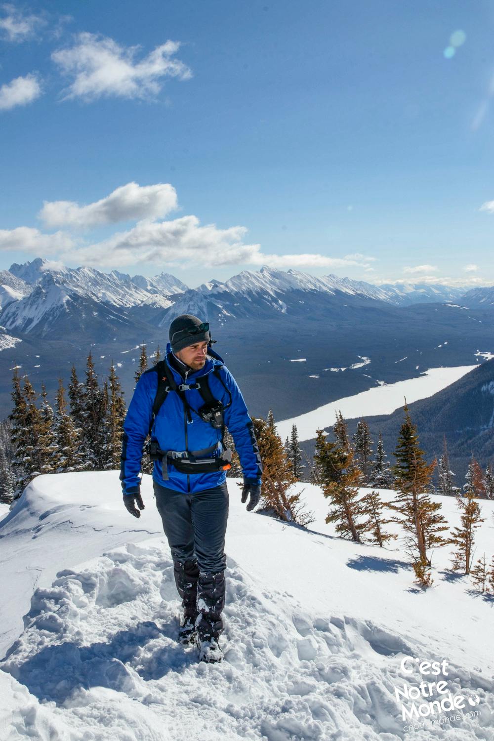
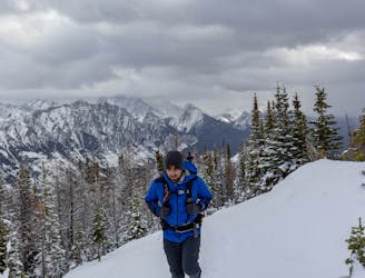
ENGLISH https://www.cnotremonde.com/en/itineraries/alberta-en/kent-south-peak-en/ Kent South Peak (2365m) is an intermediate hike located in Kananaskis Country, Alberta. Accessible all year long, this mountain can be climbed without any technical difficulties and offers a 360-degree panorama of the surrounding mountains (such as South Lawson Peak) and Lower Kananaskis Lake. C’est Notre Monde recommends doing this hike in the winter.
DIRECTIONS For the most part, this hike is in the forest. While less interesting in summer, winter offers more openings to the surrounding landscape through the trees.
The hike starts by climbing a slope directly off the road to reach the forest. The first 2.5 km (1.55 mi) will climb continuously with a few steep, albeit non-technical, sections. Next is the summit ridge offering scenic views on one side.
After 500 meters, you will reach the summit after a last (and short) return to the forest. The 360-degree view at the top is worth the effort. You will be surrounded by high summits and can appreciate part of the Lower Kananaskis Lake.
Retrace your steps to get back to the parking lot.
FRANÇAIS https://www.cnotremonde.com/randonnees/alberta/kent-south-peak/ Kent South Peak (2365m) est une randonnée intermédiaire située dans la région de Kananaskis en Alberta. Accessible toute l’année, cette montagne peut se gravir sans difficultés techniques. Elle permet d’accéder à un panorama de 360 degrés sur les sommets environnants tels que South Lawson Peak ainsi que sur le Lower kananaskis Lake. Une randonnée que C’est Notre Monde conseille de faire durant une belle journée d’hiver.
ITINÉRAIRE La randonnée se déroule principalement en forêt (ce qui la rend moins attractive en été), avec quelques ouvertures sur les montagnes environnantes avant le sommet.
Le sentier démarre en remontant une petite pente sur le bord de la route, avant de s’enfoncer dans la forêt. Les premiers 2.5km (1.55 mi) montent de manière soutenue avec quelques passages un peu plus abrupts, mais rien de très difficile. Tu atteindras ensuite la crête sommitale qui est partiellement découverte (seulement d’un côté) mais qui rend le sentier plutôt scénique.
Au bout de 500 mètres, tu arriveras au sommet après un dernier petit passage en forêt. La vue y est panoramique. Tu seras entouré de hauts sommets et pourra apprécier au loin une partie du Lower Kananaskis Lake.
Le retour se fait par le même sentier.
Moderate
Hiking along trails with some uneven terrain and small hills. Small rocks and roots may be present.

The path is on completely flat land and potential injury is limited to falling over.

Away from help but easily accessed.
1.7 km away
A bird's eye view of the Kananaskis Lakes
Difficult Hiking
4.6 km away
A winter hike on a panoramic ridge
Difficult Hiking
6.7 km away
A vertiginous hike in Kananaskis Country
Difficult Hiking