4.1 km away
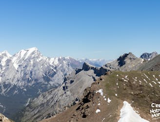
King Creek Ridge | C'est Notre Monde
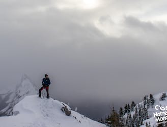
A winter hike on a panoramic ridge
Difficult Hiking
- Distance
- 6.7 km
- Ascent
- 763 m
- Descent
- 764 m
A vertiginous hike in Kananaskis Country
Hiking Difficult

VIDEO: https://youtu.be/q5e4OQM-gHs
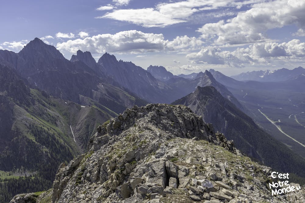
ENGLISH https://www.cnotremonde.com/en/itineraries/alberta-en/grizzly-peak/ Grizzly Peak is a 2545 meter-high (8350 ft) mountain located in Peter Lougheed Provincial Park in Kananaskis country (Canadian Rockies). The trail taking you to the top is short but steep. Therefore, this hike shouldn’t be taken lightly. There are some easy scree sections that also contribute to the intensity of this scramble. The views at the top, however, are worth the effort. C’est Notre Monde considers this hike a favorite and invites you to discover this beautiful mountain!
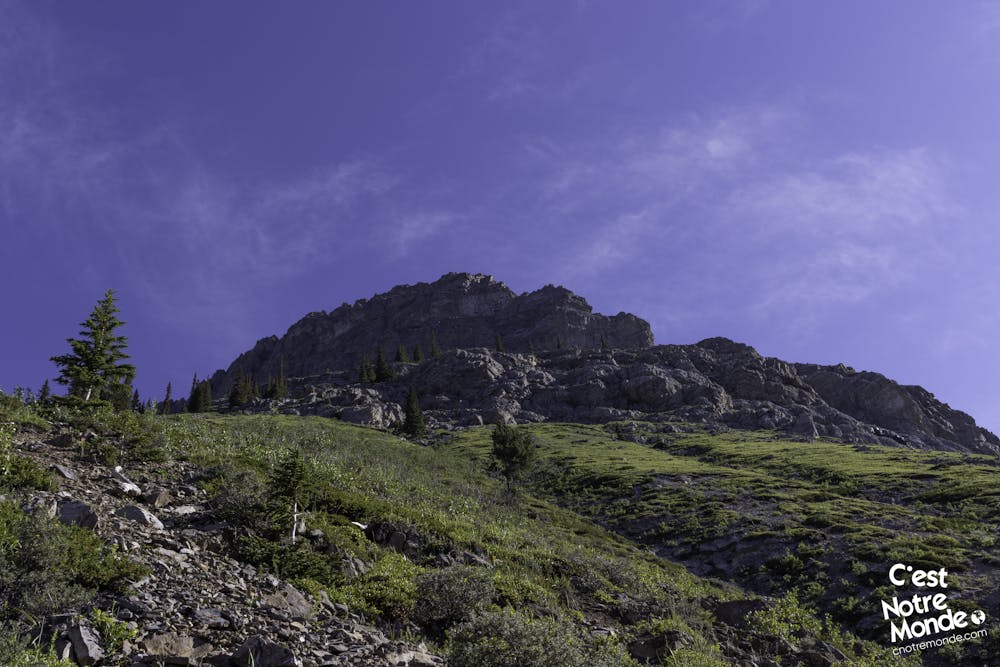
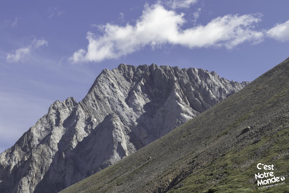
DIRECTIONS From your very first steps, it is going up! Departing from the road, you will find a well worn trail going up on the left of Grizzly Creek. This hike is mostly clear of trees (which is more motivating than walking in the forest). After a steep rocky section (easy to pass), the vegetation becomes scarce and gives way to meadows with wildflowers as far as the eye can see. Also, a few short flat sections allow you to catch your breath.
After 1.6 km (1 mi), the trail takes another turn that we will call “more vertical”. The next 700 meters (0.44 mi) are indeed quite steep with fairly unstable sections of small rocks giving you the impression of retreating while advancing. Take your time, this passage is the most challenging part of the hike in our opinion. During our ascent, we were lucky enough to encounter a herd of wild mountain goats! Be careful, these charming creatures can trigger rock falls tumbling at full speed toward you. Do not hesitate to wear a helmet to protect yourself.
Finally, after this short but exhausting steep section, you will arrive at a magnificent plateau covered with wildflowers. This idyllic and calming area is one of the most beautiful places in Kananaskis in our opinion. The summit of Grizzly Peak is on the left. Just 400m of distance with one final climbing section to reach it.
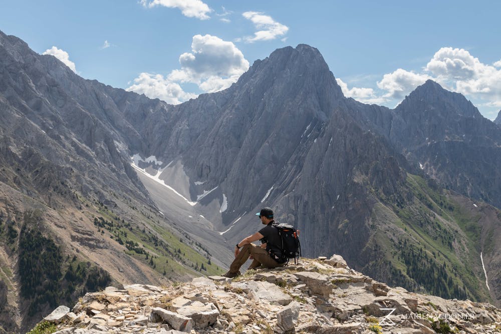
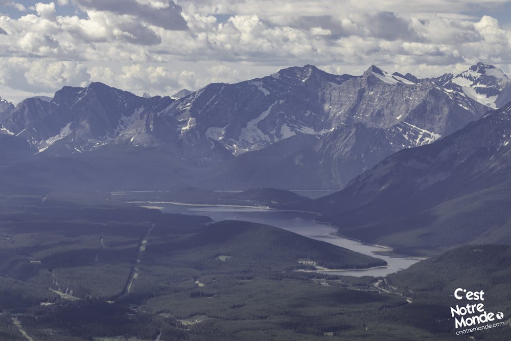
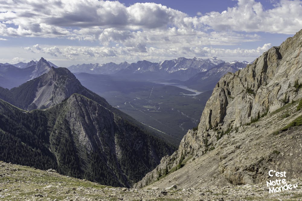
Once at the summit (2545m), you will find yourself at the top of a cliff, overlooking the AB-40 road. You’ll be able to see where you parked your car, 870m below. Quite vertiginous ! If you are not afraid of heights, you can walk along the summit ridge. The view of Lower and Upper Kananaskis Lakes is incredible. You may also notice South Lawson Peak, King Creek Ridge and Opal Ridge surrounding you.
Retrace your steps to return to your car. Note that walking sticks are very useful for keeping your balance on steep sections.
FRANÇAIS https://www.cnotremonde.com/randonnees/alberta/grizzly-peak/ Grizzly Peak est une montagne de 2545m d’altitude (8350 ft) située dans le Parc Provincial Peter Lougheed dans la région de Kananaskis (Rocheuses Canadiennes). Le sentier pour arriver au sommet est court mais très abrupt. Cette randonnée ne doit donc pas être prise à la légère et une bonne condition physique est nécessaire. Certains passages dans un pierrier font de cette randonnée un scrambling facile mais intense. La vue au sommet vaut en revanche tous les efforts. C’est Notre Monde considère cette randonnée comme un coup de coeur et t’invite toi aussi à découvrir cette montagne pleine de charme !
ITINÉRAIRE Dès les premiers pas, ça monte ! Au départ de la route, tu trouveras un sentier bien tracé montant sur la gauche de la rivière Grizzly. Le sentier est assez dégagé sur la totalité de la montée (ce qui motive d’autant plus à grimper). Après un passage rocheux facile à traverser, la végétation se fait rare et laisse place à une ambiance de prairie avec une multitude de fleurs sauvages. Quelques courts passages plats te permettent alors de reprendre son souffle.
Au bout d’1.6km (1mi), le sentier prend une autre tournure, disons plus “verticale”. Les 700 mètres qui suivent (0.44 mi) sont en effet assez abrupts avec des passages de petites pierres assez instables te donnant l’impression de reculer tout en avançant. Prend ton temps, ce passage est le plus délicat. Durant notre ascension, nous avons eu la chance de rencontrer un troupeau de chèvres sauvages. Mais attention, ces charmantes créatures n’hésitent pas à décrocher des roches qui déboulent à toute vitesse vers toi. Dans le doute, prend un casque pour te protéger.
Enfin, après cette montée éprouvante, tu arriveras à un espèce de plateau fleuris magnifique. Cette endroit idyllique et apaisant est un des plus bel endroit de Kananaskis à nos yeux. Le sommet de Grizzly Peak se trouve vers la gauche. Il te reste alors 400m de montée pour l’atteindre.
Une fois au sommet (2545m), tu te retrouves en haut d’une falaise, surplombant la route AB-40. Assez vertigineux, tu pourras voir ton véhicule au loin, 870m plus bas. Tu peux alors te balader le long de la crête sommitale si tu as le coeur bien accroché. La vue sur les lac Lower et Upper Kananaskis est incroyable. Tu pourras aussi remarquer les sommets de South Lawson Peak, King Creek Ridge et Opal Ridge autour de toi.
La descente se fait par le même chemin. Des batons de marche sont très utiles pour garder l’équilibre dans le pierrier abrupt.
Difficult
Hiking trails where obstacles such as rocks or roots are prevalent. Some obstacles can require care to step over or around. At times, the trail can be worn and eroded. The grade of the trail is generally quite steep, and can often lead to strenuous hiking.

The trail contains some obstacles such as outcroppings and rock which could cause injury.
Away from help but easily accessed.
4.1 km away
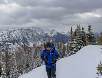
A winter hike on a panoramic ridge
Difficult Hiking
4.3 km away
A fun hike up to Opal ridge, with views of the jagged rocky mountains on all sides & Kananaskis Lakes off in the distance, this hike offers some of the best views in Kananaskis.
Severe Hiking
4.3 km away
A panoramic hike in Kananaskis Country
Severe Hiking
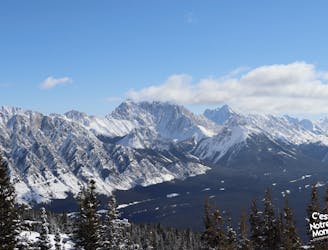
6.2 km away
A bird's eye view of the Kananaskis Lakes
Difficult Hiking
6.7 km away
An intermediate winter hike in Kananaskis country
Moderate Hiking