ENGLISH
https://www.cnotremonde.com/en/itineraries/alberta-en/opal-ridge-2/
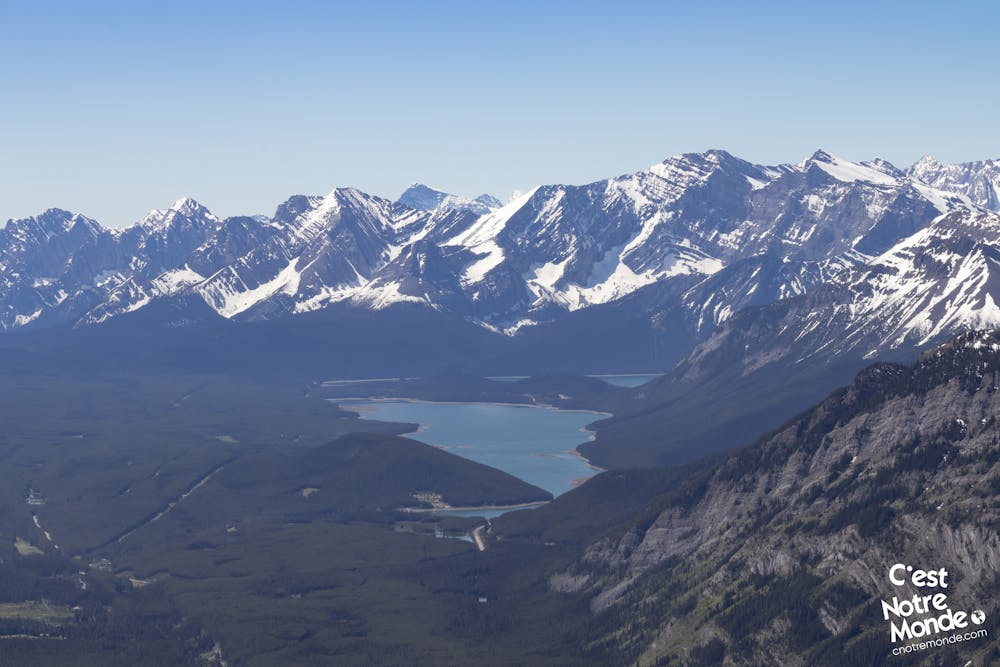
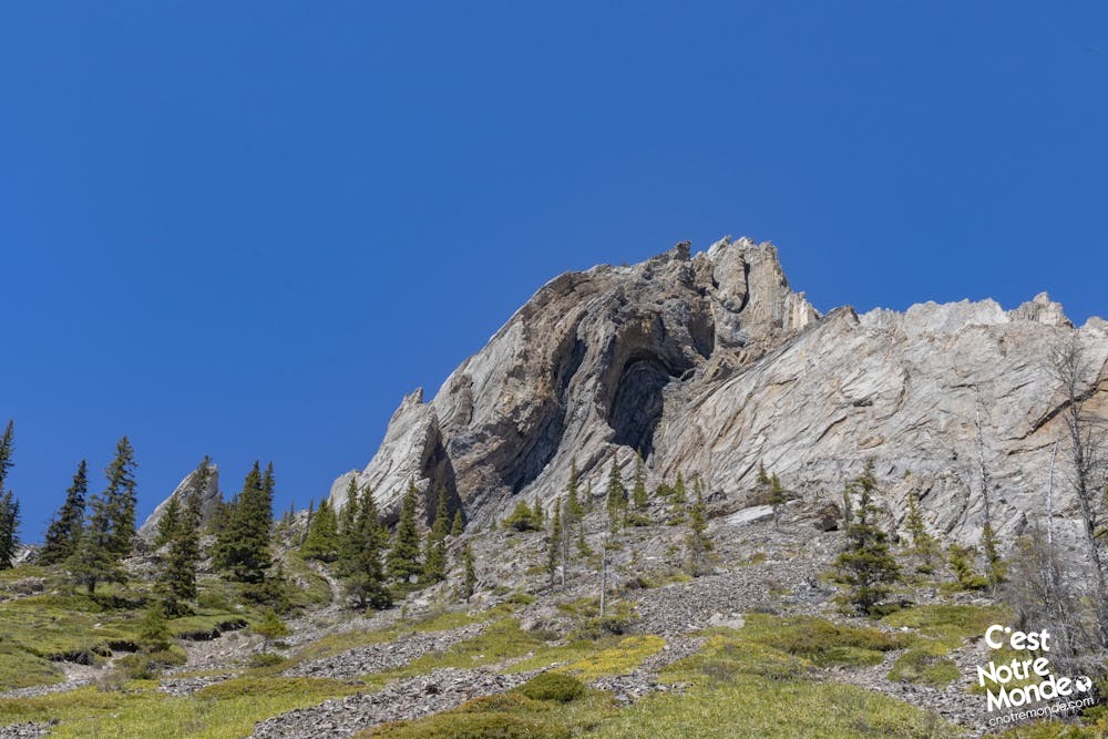
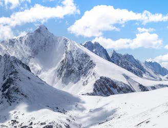
Opal Ridge is a 2575-meter-high mountain located in Kananaskis, Alberta. This difficult hike is a real favorite for C'est Notre Monde. We suggest the whole loop for those who have experience in scrambling and bushwacking. The loop crosses a panoramic and slightly exposed ridge, a beautiful spot to appreciate the surrounding peaks and the magnificent Upper and Lower Kananaskis Lakes. If you just want to reach the top (where the view is also incredible), it will be a shorter round trip. In any case, this hike is a must in our opinion! So go for it!
DIRECTIONS
From the parking lot, take the path climbing away from the road. After 200 meters you will join a wide service road. Turn left and follow it for 300 meters until you reach a trail on the right. It will take you all the way up to Opal Ridge Summit. The trail begins to climb rapidly through a small forest. The vegetation quickly becomes scarce as the panorama of the valley appears.
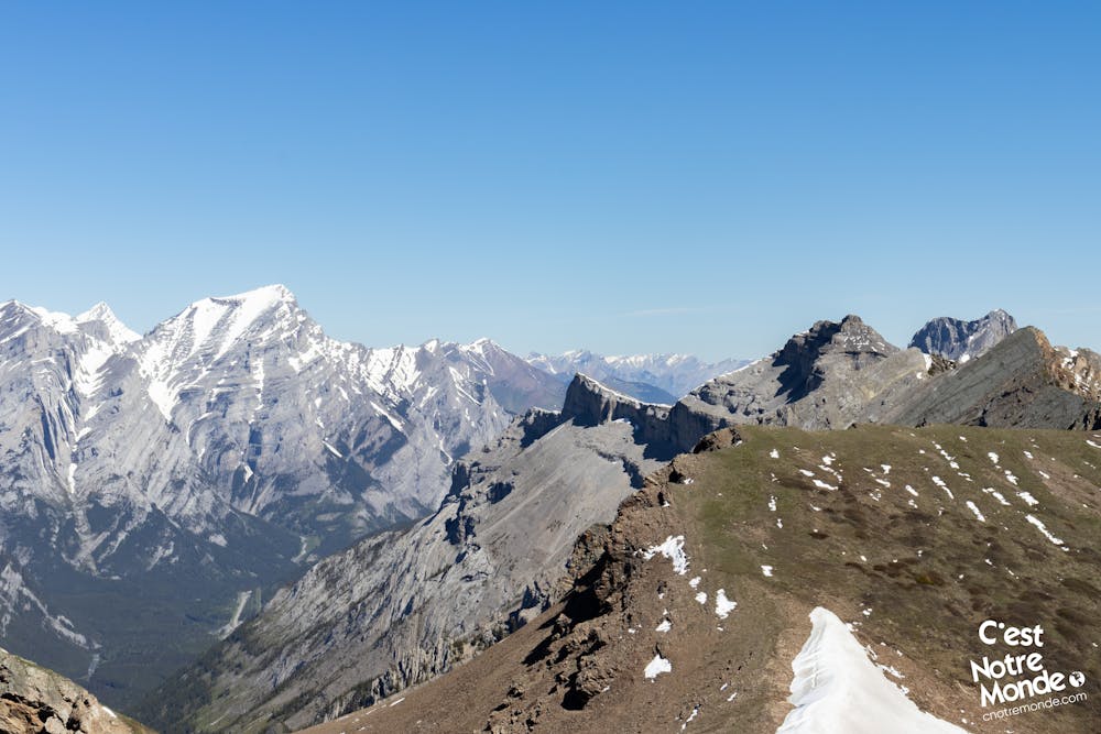
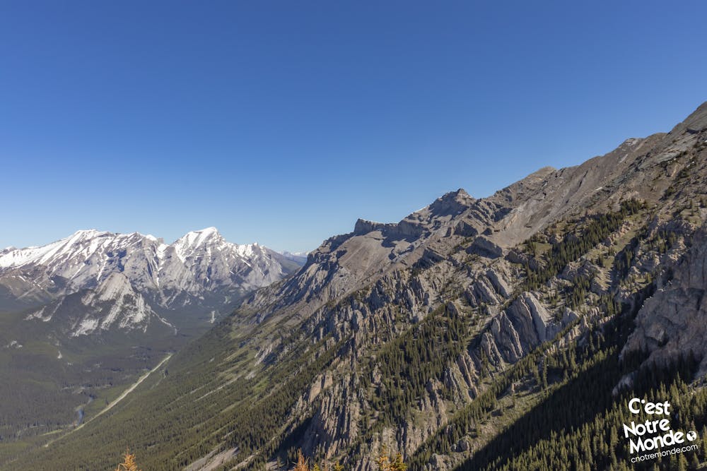
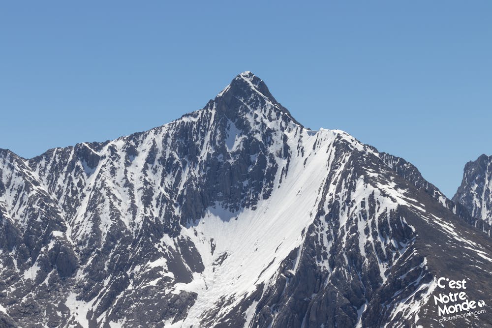
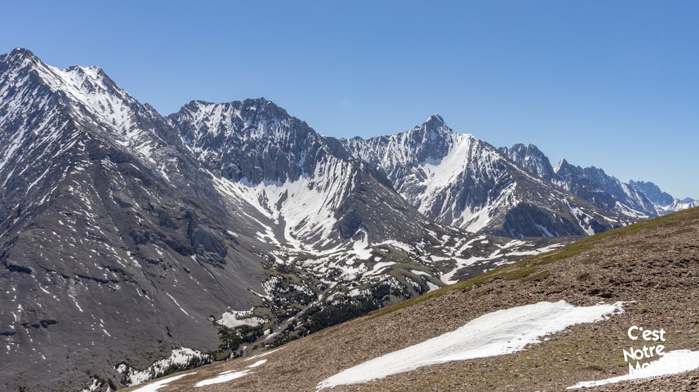
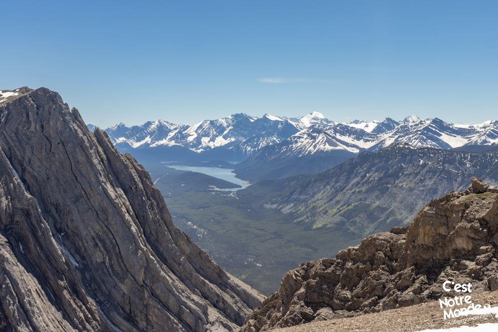
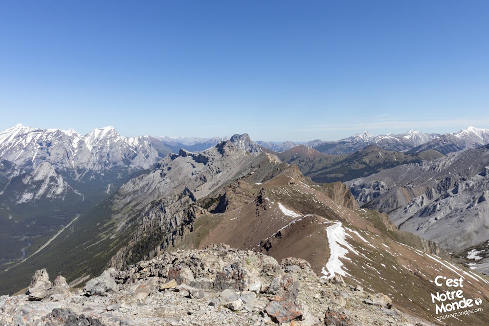
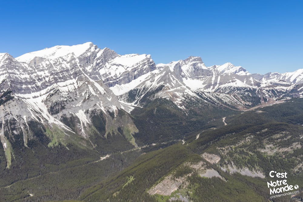
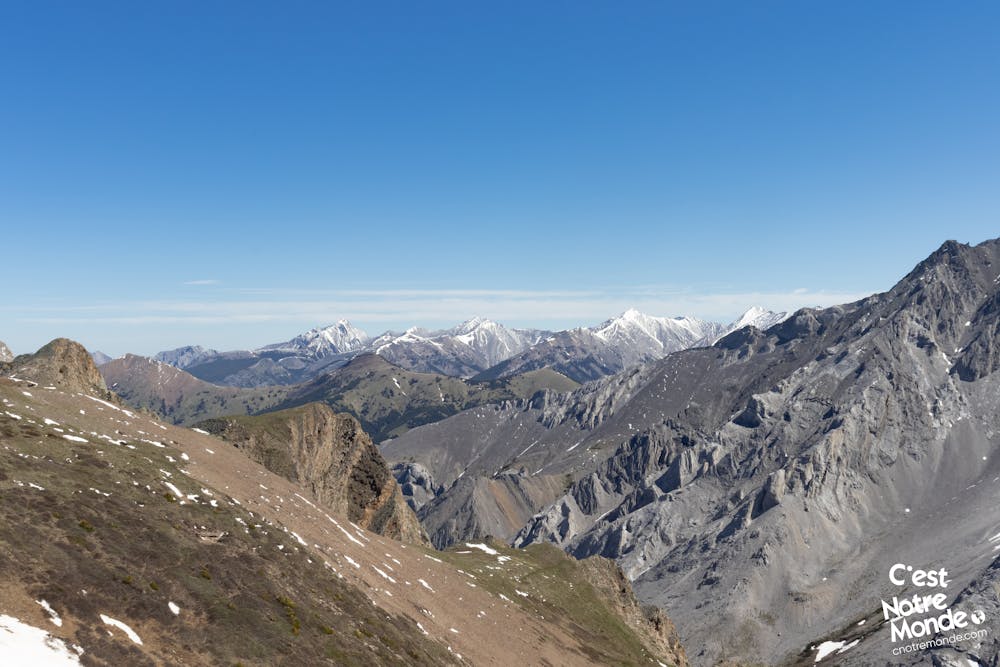
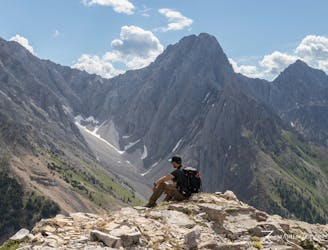
During the climb, you will pass through some easy scrambling sections where you will have to use your hands. The landscape will also alternate between meadow and rocky terrain. After 1.6km and 600m of elevation, you will reach a beautiful plateau with a view of your path to the summit ridge. This last part is quite steep. But once on the ridge, there will be 700m of walking and a hundred meters of elevation left to reach the highest point of Opal Ridge. The summit offers a 360-degree view of the region, including Opal North Peak, Grizzly Peak, South Lawson Peak and the Kananaskis Lakes. Absolutely breathtaking.
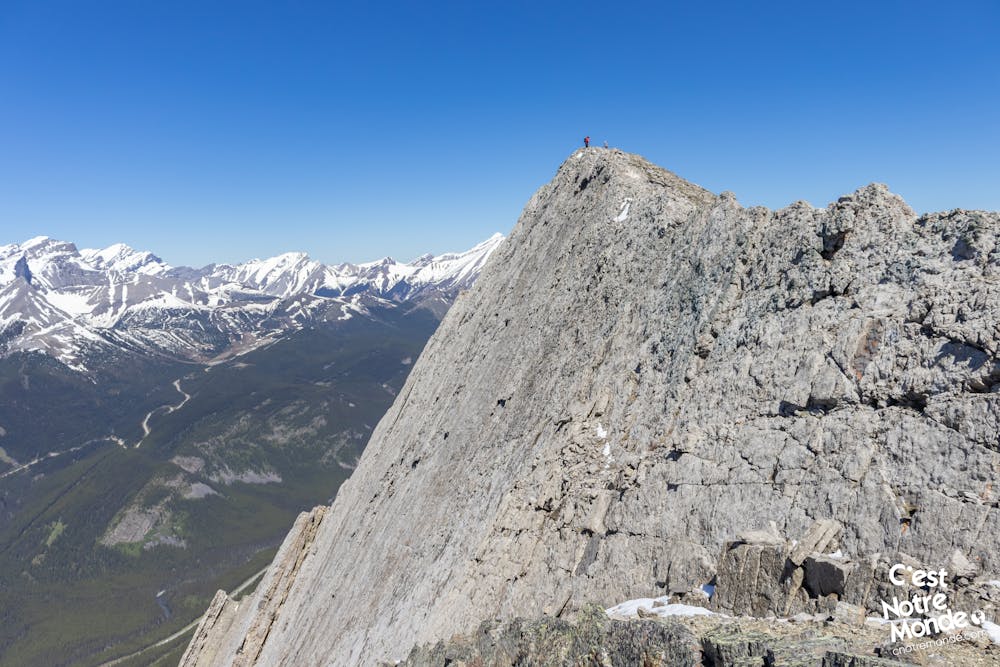
You can then decide to retrace your steps to reach the parking lot (3.6 km, 2.2 mi), or go for the complete loop. The latter (for experienced hikers) consists of following the low-exposed ridge for about 1.7 km (1.1 mi). We liken it to walking on air! Once reaching the end of the ridge, descend in the opposite direction of the road to reach a plateau below and enter the valley between Opal Ridge and Grizzly Peak, which then leads back to the road.
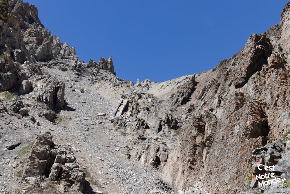
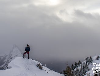
Once you have reached the plateau, there is a small path (difficult to identify in places) that will take you through several scree sections on the mountains. Be careful! These sections are very poorly maintained and require a lot of bushwacking (route finding). We do not recommend this part to inexperienced hikers. After 2.3 km (1.4 mi), you will reach a service road, following the AB-40 road. Follow this for 3 km (1.9 mi) to reach the parking lot.
FRANÇAIS
https://www.cnotremonde.com/randonnees/alberta/opal-ridge/
Opal Ridge est une montagne de 2575m d’altitude située dans la région de Kananaskis en Alberta. Cette randonnée difficile est un véritable coup de coeur pour C’est Notre Monde. Nous te conseillons de faire la boucle au complet si tu as de l’expérience en scrambling et que tu as un bon sens de l’orientation. Elle te permet de parcourir une crête panoramique et peu exposée afin d’admirer les sommets environnants et les magnifiques Upper et Lower Kananaskis Lakes. Si tu souhaites juste atteindre le sommet (où la vue est déjà incroyable), il est possible de faire un aller-retour beaucoup moins demandant. Dans tous les cas tu l’auras compris, cette randonnée est incontournable à nos yeux ! À toi de la découvrir !
ITINÉRAIRE
Depuis le stationnement, emprunte le sentier qui monte en direction opposée à la route. Au bout de 200 mètres, tu arriveras sur un large chemin de service. Il te faudra alors tourner à gauche et le suivre sur 300 mètres. Alors un sentier sur la droite apparait et te menera jusqu’au sommet de Opal Ridge. Le sentier commence à monter rapidement et te fera passer dans un premier à travers une petite forêt. Mais très vite, la végétation se rarifie et tu découvriras peu à peu le panorama sur la vallée.
Au cours de ta montée, tu passeras à travers certaines sections de scrambling faciles où il te faudra utiliser les mains. Tu alterneras entre des terrains ressemblant à des prairies d’altitude et des terrains plutôt rocheux. Au bout de 1.6km et 600m de dénivelé, tu arriveras sur un petit plateau magnifique où tu pourras apercevoir le reste de ta montée jusqu’à la crête sommitale. Cette partie est assez abrupte. Mais une fois sur la crête, il restera 700m de marche et une centaine de mètres de dénivelé pour atteindre le point culminant de Opal Ridge. Le sommet offre une vue panoramique à 360 degrès sur Opal North Peak, Grizzly Peak, South Lawson Peak ou encore sur les Lacs Kananaskis. Un panorama coup de coeur.
Tu peux alors décider de revenir sur tes pas pour rejoindre le stationnement (3.6 km ou 2.2 mi), ou alors t’engager sur la boucle complète. Cette dernière (pour randonneurs expérimentés) consiste à suivre la crête peu exposée sur environ 1.7 km (1.1 mi). On a l’impression de marcher dans le ciel, face à la vallée, c’est magnifique ! Une fois au bout de la crête, il te faudra alors descendre en direction opposée de la route pour rejoindre le plateau en contrebas et t’engager dans la vallée entre Opal Ridge et Grizzly Peak.
Une fois que tu auras rejoint le bas de la crête, il existe un petit sentier (difficilement identifiable par endroit) qui te fera passer à travers plusieurs champs de roches, à flan de montagne, en direction de la route. Attention ! Cette section est très mal tracée et nous a demandé beaucoup de bushwacking (Débrousaillage ou recherche d’itinéraire). Nous déconseillons cette partie aux randonneurs non-expérimentés. Certaines parties sont exposées et chaotiques. Au bout de 2.3 km (1.4 mi), tu atteindras alors une route de service, suivant la route AB-40. Il te restera donc à la suivre sur 3 km (1.9 mi) pour rejoindre le stationnement.