3.8 km away
Akamina Ridge
A spectacular ridge walk with outstanding 360 Degree views the entire way along the ridge.
Severe Hiking
- Distance
- 18 km
- Ascent
- 1.1 km
- Descent
- 1.1 km
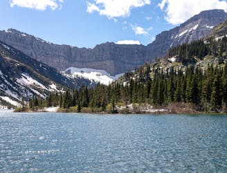
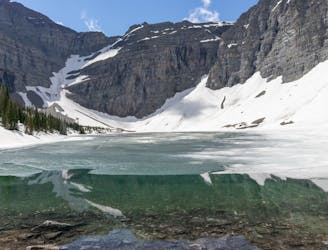
A long but rewarding trail with lakes, wildflowers and outstanding alpine views.
Hiking Difficult

Lineham Ridge is one of the less travelled trails in Waterton Lakes National Park and it's the perfect place to avoid the large crowds found on some other trails in the area.
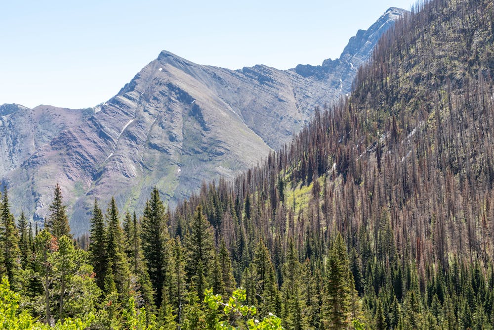
The trail starts with a long but easy approach through the forest, which can be a great place to see wildflowers if you visit during the season.
The fun part of this trail really starts when you arrive at the meadows, which is where the trail splits with the Upper Rowe Lake Trail.
The meadows are much more open and give you a glimpse of some of the fantastic views you find on this trail. It's also where the easy trail ends and the more challenging elevation gain begins.
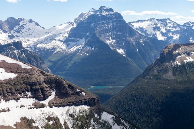
As you gain elevation on the traverse up to the ridge, the views really start to open up. You will soon find yourself above the treeline with outstanding views looking back down the valley you just hiked up.
If you are hiking this trail in the early summer, the traverse up to the ridge can be hazardous. This is a steep east facing avalanche slope that remains snow covered until late June. For that reason, if you plan to hike this in June, an ice axe and crampons are highly recommended.
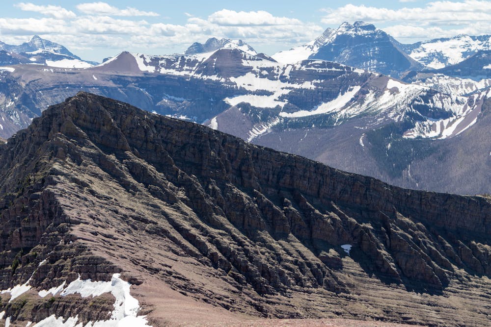
From July onwards, snow should no longer be an issue and you will have no problems gaining the ridge. From here it's a short hike up to the high point on the ridge.
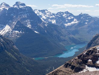
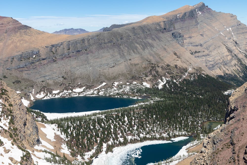
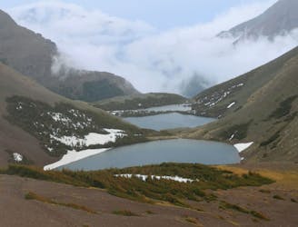
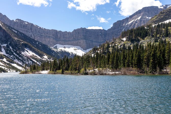
The views from the summit of the ridge are spectacular and make it well worth the effort to get here. You can see the picturesque Lineham Lakes to the north and the huge glaciated Peaks in Glacier National Park to the south.
Allow yourself plenty of time for a lunch break on the summit to take in the stunning scenery before turning around to head back out the same way you came in.
Difficult
Hiking trails where obstacles such as rocks or roots are prevalent. Some obstacles can require care to step over or around. At times, the trail can be worn and eroded. The grade of the trail is generally quite steep, and can often lead to strenuous hiking.

The trail contains some obstacles such as outcroppings and rock which could cause injury.

Little chance of being seen or helped in case of an accident.
3.8 km away
A spectacular ridge walk with outstanding 360 Degree views the entire way along the ridge.
Severe Hiking
4.8 km away
A fantastic day hike with stunning views all along this diverse trail.
Difficult Hiking
7 km away
A beautiful trail with numerous viewpoints along the way as you climb up to the picturesque Bertha Lake.
Moderate Hiking
7.6 km away
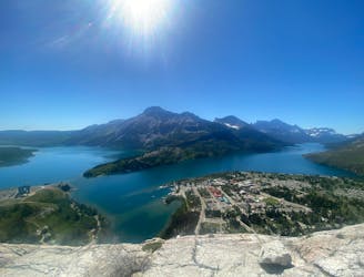
A short hike with superb views as you look out over Waterton Lake.
Moderate Hiking
9.1 km away
An exciting and beautiful trail, which is just as much about the journey as it is the destination.
Severe Hiking
3 routes · Hiking
3 routes · Hiking