6.4 km away
Overlook Loop
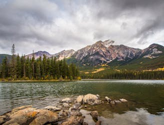
Scenic and convenient loop with a view over Jasper.
Easy Hiking
- Distance
- 5.9 km
- Ascent
- 186 m
- Descent
- 186 m
Walk along a deep and narrow gorge filled with waterfalls and cloaked in greenery..
Hiking Easy

This canyon is a true oddity for the Canadian Rockies. It’s a slot canyon cut sharply into limestone––a much different form than the broad glacial valleys where you’ll typically find flowing water. In this miniature gorge, you’ll peer down at a string of rushing waterfalls and churning pools, squeezed tight between narrow rock walls. At its narrowest, the canyon is barely 2 meters across.
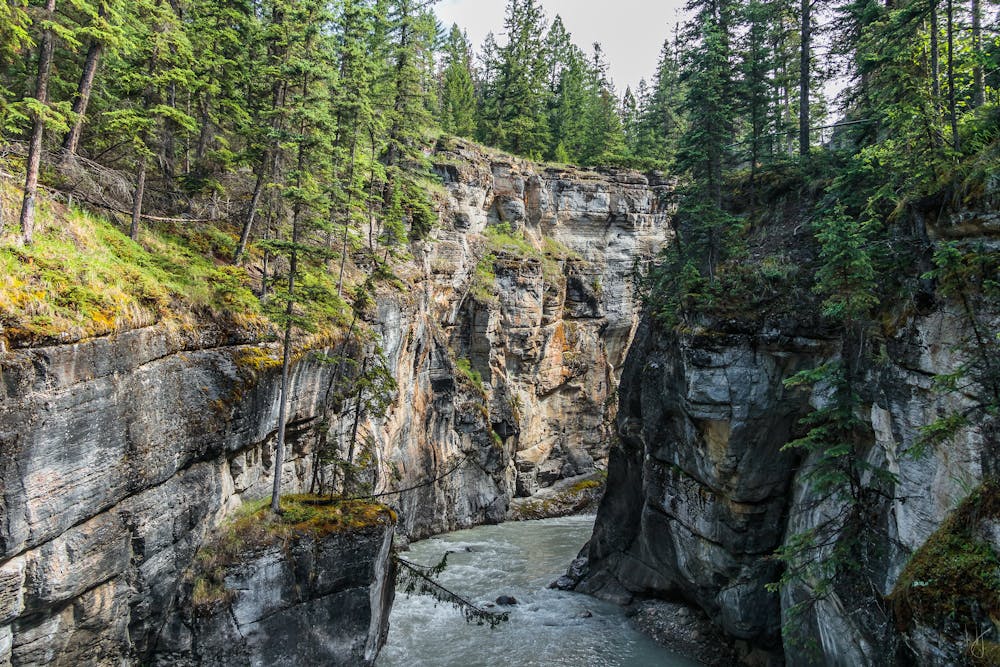
This is an easy stroll on a constructed walkway, complete with guardrails because the drop-off is sheer. Numerous overlooks provide a glimpse into the canyon, and signs teach about the geology and surrounding ecology. You can even see fossils in the stone. The short loop mapped here includes the most popular viewing decks and bridges, but you can extend the hike to see more of the canyon downstream.
The trail is open year-round, but in winter, it changes character significantly. Snow blankets the canyon, and the river freezes solid. Because the trail is still often traveled, snowshoes are not usually necessary, but traction devices are always recommended. When it’s frozen, you can actually walk along the bottom of the canyon on the ice, but this should only be attempted if you are experienced in winter hiking.
Sources: http://albertawow.com/hikes/MaligneCanyonHike/MaligneCanyonHike.htm https://www.pc.gc.ca/en/pn-np/ab/jasper/activ/itineraires-itineraries/canyon-Maligne
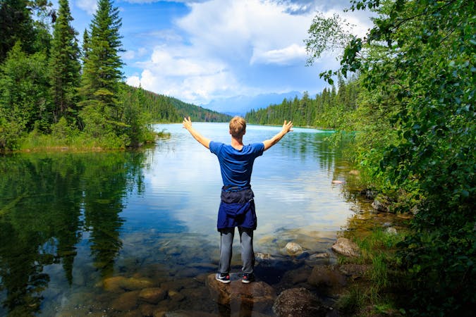
Easy
Walking along a well-kept trail that’s mostly flat. No obstacles are present.
6.4 km away
Scenic and convenient loop with a view over Jasper.
Easy Hiking
9 routes · Hiking
6 routes · Hiking