9.7 km away
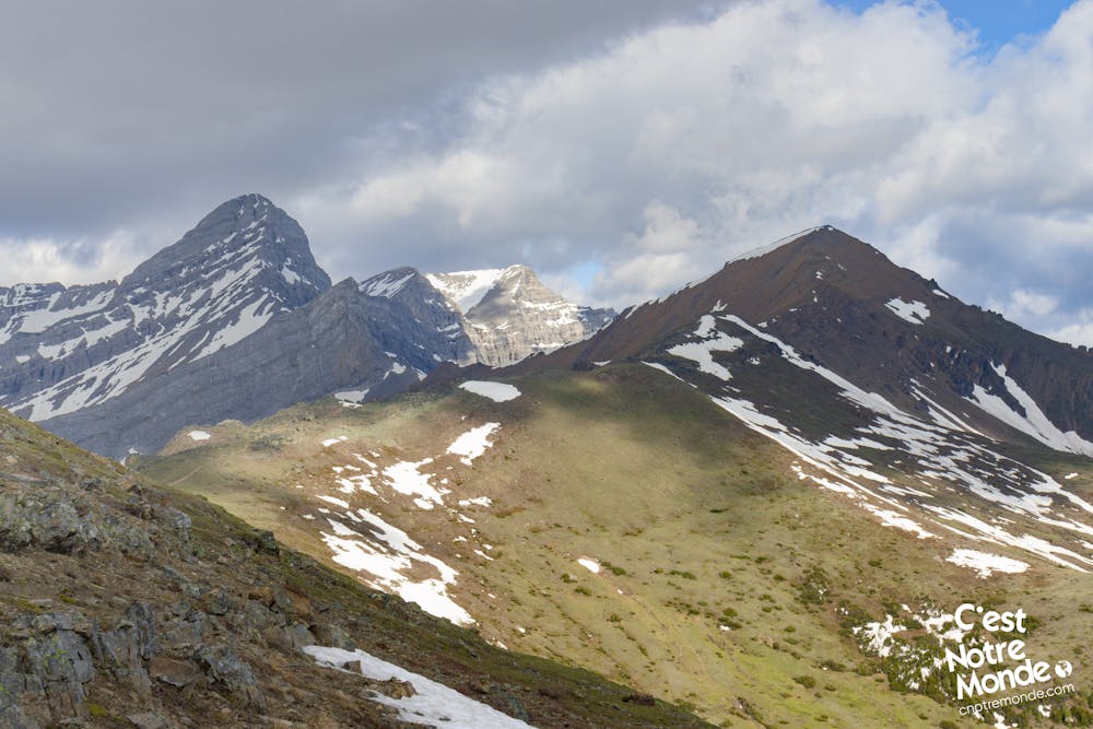
Opal North Peak | C'est Notre Monde

A Vertiginous Ascent in the Heart of Kananaskis
Difficult Hiking
- Distance
- 10 km
- Ascent
- 1.1 km
- Descent
- 1.1 km
Mount Allan via Centenial Ridge, a panoramic hike in Kananaskis Region
Hiking Severe

ENGLISH https://www.cnotremonde.com/en/itineraries/alberta-en/mount-allan-en/ Considered one of the most beautiful hikes in the Kananaskis Region of Alberta, Mount Allan via Centennial Ridge has many surprises. To reach the 2819 meter-high summit of Mount Allan, you will make your way up Olympic Summit, walk a panoramic ridge, explore an unusual rocky environment inhabited by furry creatures, and finally scramble to the top of a breathtaking viewpoint. This extraordinary hike is difficult but its beauty is worth all the effort. Don’t wait any longer and go explore one of the most stunning hikes this region has to offer.
DIRECTIONS When you enter the parking lot the trail head for Mount Allan is located on the right hand side not to be confused with the trail head at the end of the parking lot which is the departure point for many other hikes. You will take this forestry road and turn left in about 400 m, at the first intersection. At the second intersection continue straight (a sign will indicate “Centennial Ridge”). This trail will begin to climb and continue that way until you reach Olympic Summit, 4km (2.6 mi) further.
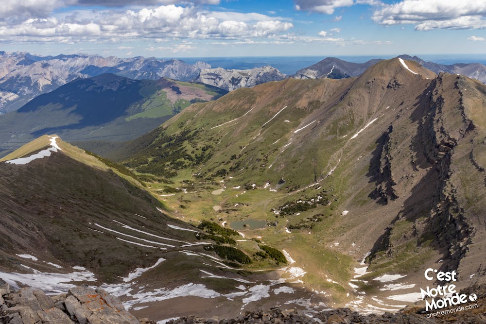
Little by little, you will pass the tree line and begin to appreciate the view. In spring and summer, the trail is surrounded by Prairie grass and colourful wild flowers. A beautiful sight! After 920 m of hiking on a well maintained trail, you will finally reach Centenial Ridge and the Olympic Summit (2470 meters-high). A big part of the ascent is now complete but you still have 2.7km to go and 400 meters to climb to reach the summit of Mount Allan.
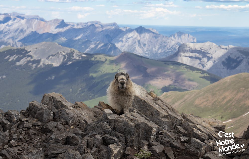
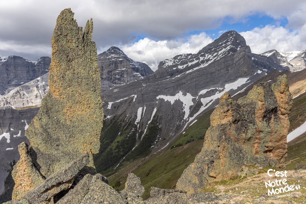
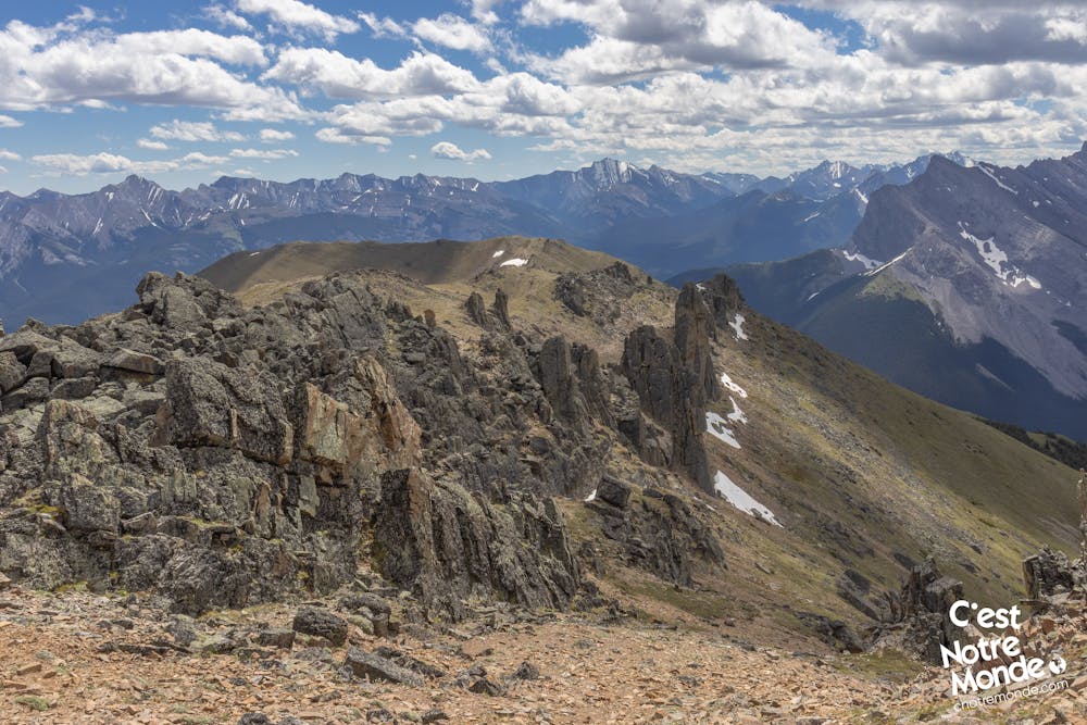
You will start a small descent while following the ridge and will arrive at a very unique and surprising area called the “Mushroom Garden”. An area with large rock formations jutting out of the ground, giving the impression of a natural wall. This section is a smooth part of the hike and will require a short and easy scrambling toward its end. You will also note that this place is inhabited by many marmots. Do not feed them! We were surprised how comfortable these little guys were with humans. They approached very closely to ask for food. This unnatural behavior should not be encouraged.
After the Mushroom Garden, your final objective will be just in front of you. This last section is made up of scree and while it is not technically difficult it can be tiring. Your effort will be rewarded however, at the summit of Mount Allan, 2819 meters-high! With a 360° view, you can see Wasootch Peak, Big Sister, Sparrowhawk, Mount Kidd and even the city of Canmore. A real balcony view of the region.
Retrace your steps to get back to the parking lot.
FRANÇAIS https://www.cnotremonde.com/randonnees/alberta/mont-allan/ Considérée comme une des randonnées incontournables de la région de Kananaskis en Alberta, l’ascension du Mont Allan via Centenial Ridge n’a pas finis de te suprendre. Pour atteindre son sommet à 2819m d’altitude, tu devras gravir une première montagne, parcourir une crête panoramique, passer à travers un dédale de roches incongrues habité par de petites créatures montagnards et terminer par un scrambling facile mais épuisant. Cette randonnée hors du commun est difficile mais la beauté et les surprises qui t’y attendent valent tous les efforts. N'attends pas plus longtemps et pars découvrir l’une des plus belles rando de la région.
ITINÉRAIRE Le sentier vers le Mont Allan se trouve sur le côté du stationnement et non au fond comme le départ de nombreux autres randonnées. Emprunte le chemin qui s’engouffre dans la forêt et tourne à gauche à l’intersection 400m plus loin. Tu arriveras alors à un autre croisement sur lequel tu continuera tout droit en suivant le panneau indiquant “Centenial Ridge”. Le sentier commence alors à monter assez abruptement et ne s’arrêtera qu’à ton arrivée au Olympic Summit environ 4km (2.6mi) plus loin.
Peu à peu, tu commenceras a sortir de la forêt et pourra apprécier les premières vues que t’offre cette randonnée. Au printemps et en été, le sentier est entourée d’herbe de prairie avec de nombreuses fleurs sauvages de toutes les couleurs. C’est vraiment magique ! Après une ascension de 920m de dénivelé sur un sentier bien tracé, tu arriveras enfin à la crête “Centenial Ridge” et un peu plus loin à un premier sommet : Olympic Summit (2470m). Le plus gros de la montée est fait, mais il te reste encore 2.7km (1.7mi) et 400m de dénivelé pour atteindre le Mont Allan.
Il faut redescendre un peu en suivant la crête pour rejoindre un endroit assez unique et surprenant : Un champs de grandes roches incongrues appelé “Mushroom Garden”. Certains rochers sont plantés verticalement et donne l’impression d’une muraille naturelle. Cette section géologique particulière se traverse facilement avec une ou deux sections où il faut utiliser les mains. Elle est habitée par de nombreuses marmottes sauvages. Attention à ne pas les nourrir ! Nous avons été surpris par la facilité avec laquelle elles nous ont approchés pour nous demander de la nourriture. Ce comportement n’est pas naturel et ne doit pas être encouragé.
Une fois le “Mushroom Garden” passé, tu auras ton objectif final en vue, avec une montée abrupte dans un pierrier. Ce dernier effort est éprouvant mais ne présente pas de difficulté technique. Tu arriveras alors au point le plus haut de ta randonnée, à 2819m d’altitude, au sommet du Mont Allan. Une vue magnifique à 360 degrès se présente à toi ! Tu peux apercevoir Wasootch Peak, Big Sister, La ville de Canmore ou encore le Mont Sparrowhawk ou le Mont Kidd. Un vrai promontoire dans la région de Kananaskis.
Le retour se fait par le même chemin, environ 8.5km plus loin.
Severe
Hiking challenging trails where simple scrambling, with the occasional use of the hands, is a distinct possibility. The trails are often filled with all manner of obstacles both small and large, and the hills are very steep. Obstacles and challenges are often unexpected and can be unpredictable.

The trail contains some obstacles such as outcroppings and rock which could cause injury.
Away from help but easily accessed.
9.7 km away
A Vertiginous Ascent in the Heart of Kananaskis
Difficult Hiking