189 m away
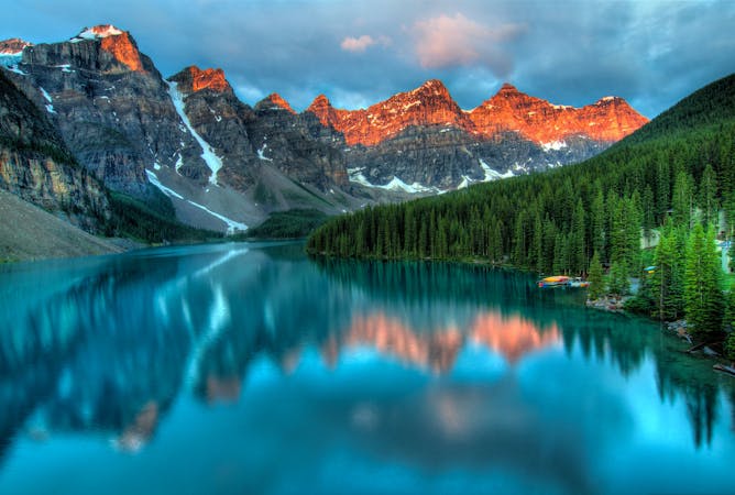
Moraine Lake Lakeshore Trail
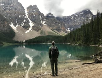
Stroll along the tranquil shore of Moraine Lake
Easy Hiking
- Distance
- 2.8 km
- Ascent
- 47 m
- Descent
- 47 m
Lake Louise Classic Alpine Scramble
Hiking Extreme

Towering above the surrounding peaks Mt Temple makes for a awe inspiring sight. The hike to it’s alpine flank at Sentinel Pass is a popular day hike for many. Despite it’s sheer looking face there is a route that does not require ropes any are exceptional skill to ascend. For those equipped with helmets, some route finding skills, and a taste for mountaineering it offers a tremendous if strenuous adventure. Most people take 10-12hours to complete the route. Helmets, solid boots, and a full days kit are required. If you can see snow on the south western summit an ice axe, crampons and the training to use them will be required.
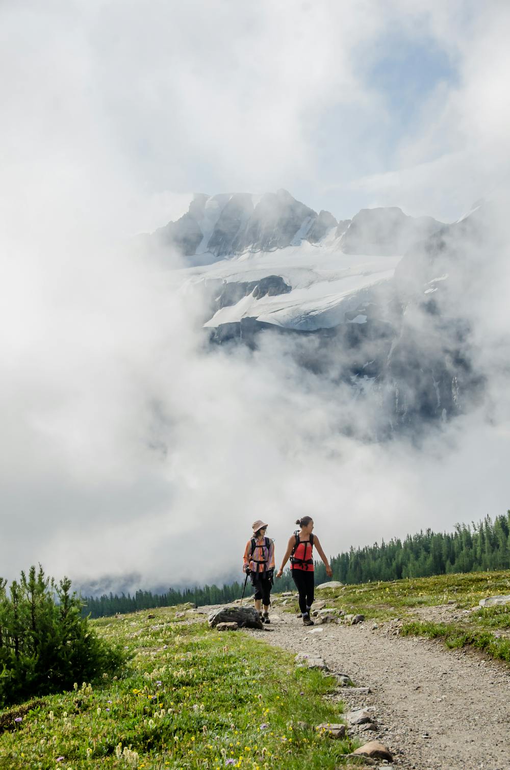
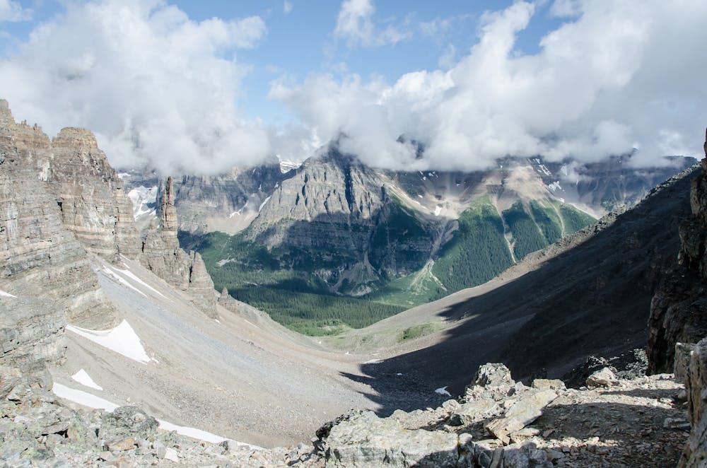
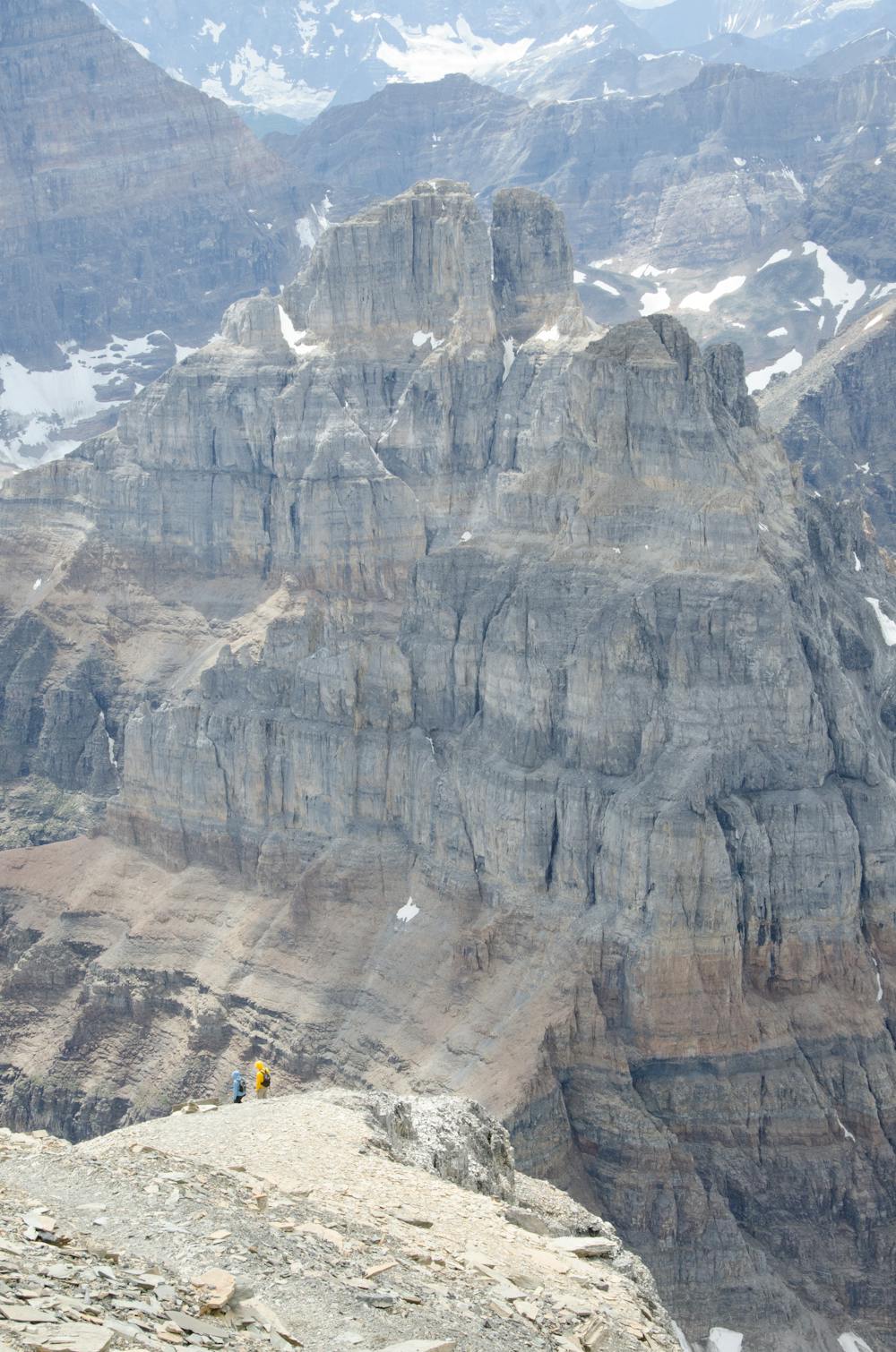
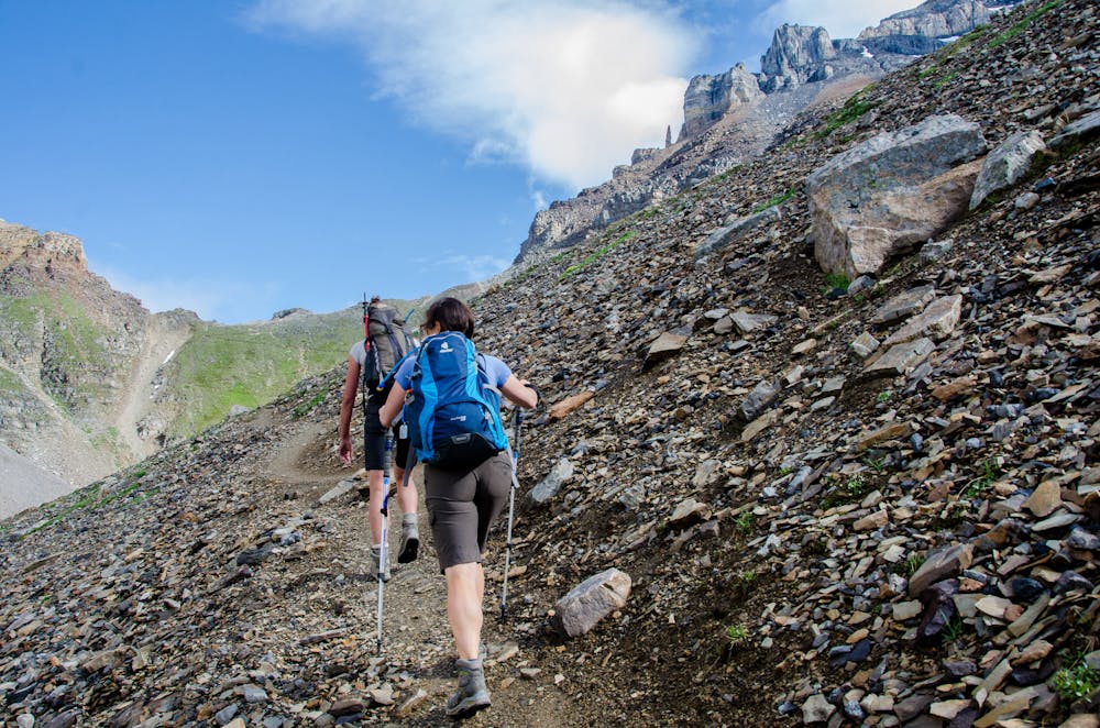
The small parking lot that services the Valley of Ten Peaks fills up early, so it’s best to get an alpine start and be leaving the parking lot at 7am. Considering this will be a long day, even earlier is a good idea. Follow the well marked, and wide trail towards Sentinel Pass. It’s switchbacks steeply up into the sub-alpine, with the trial branching at the top. Take the righthand trail that heads for Sentinel Pass. The trees thin and the incredible larches and alpine forests give way to rolling meadows filled with flowers. The trail clears the trees into a wide bowl where you can get an excellent look at the route. It’s worth taking a break to study the route which follows fairly close to the ridge on the horizon.
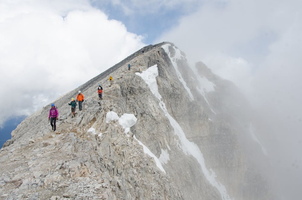
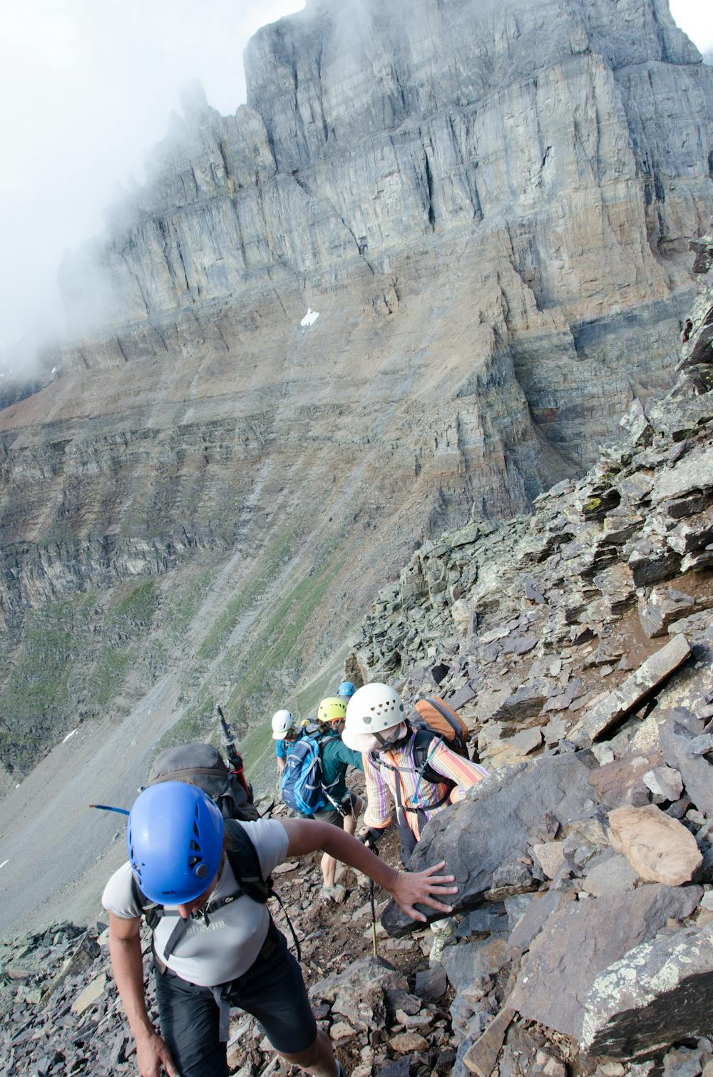
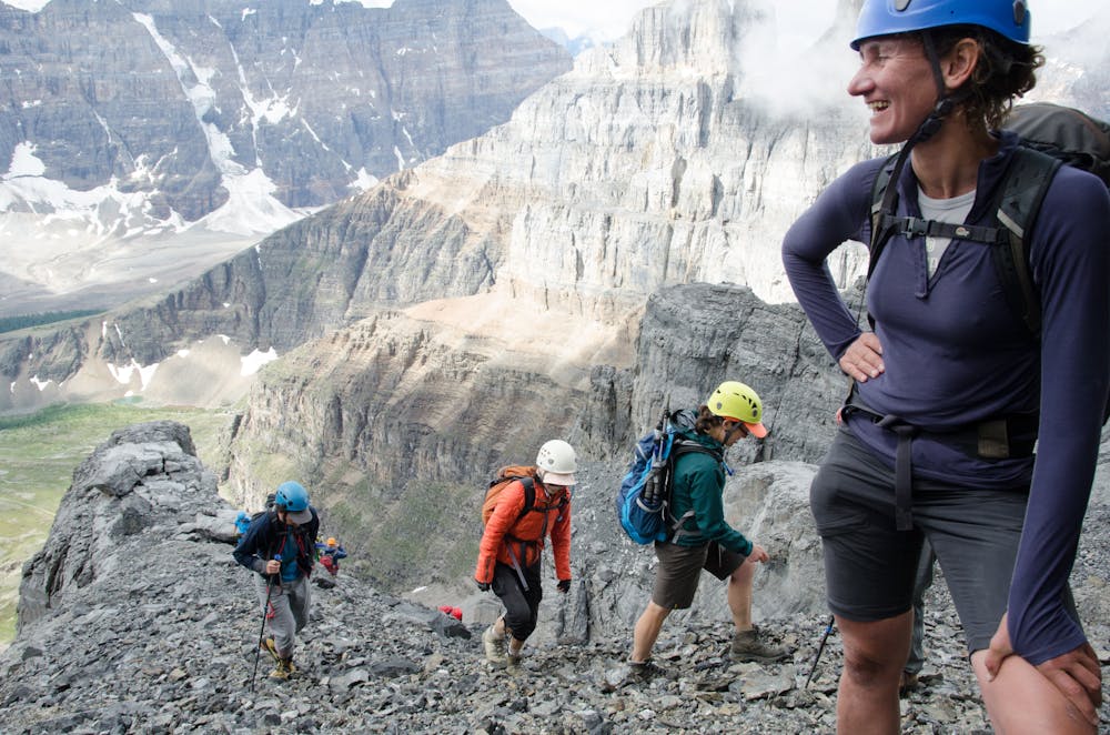
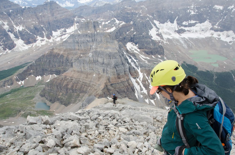
Sentinel Pass is a steep hike with good shelter and space for a break at the top. This is a good spot to put on your helmet. Rockfall is incredibly common, and even more so when the route is busy. You may see folks not wearing helmets, but injuries are common, and this not a good idea. If you need a helmet they are available for rental at Wilsons Sports.
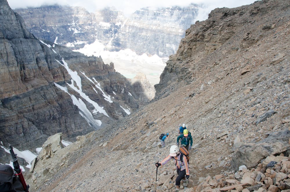
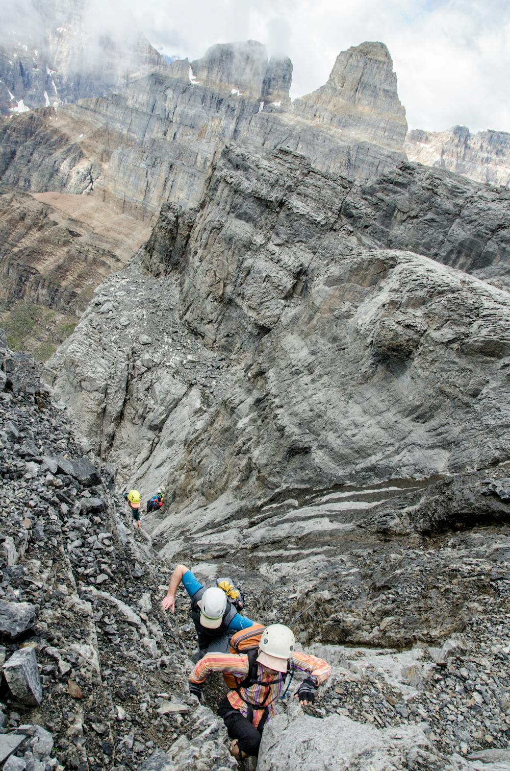
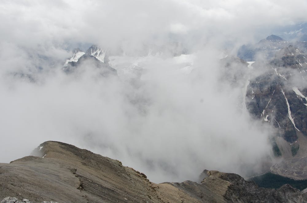
The route follows a trail through the Talus that is mostly big steps upwards to the cliff faces. Because the trails are faint there are numerous trails, so it’s good to look ahead and try and find the best trail. Eventually it pass a prominent spire, and edges up against a steep band of grey rock. Traverse climbers right beneath this cliff until it you get to a section of short climbing where you will need to use both hands (3rd to 4th class climbing). Above this is scree, so be sure to walk gently and not dump rocks on those bellow. A series of rock steps leads to another band of less steep rock. While tempting avoid the gulley as it is a common rock fall trap. There is blue painted marks at the correct point. Above this is mostly scree leading to a open plain. The route continues between rocks, but the scrambling here is not at all exposed, and quick simple. This leads to the long scree slog upwards to the final ridge. At the ridge it’s a straight walk across to the summit. Be warned that if there is snow it may hide a cornice, particularly in the early season.
The descent follows the same route down. It’s a hard pounding ascent, so trekking poles are highly recommended.
Extreme
Scrambling up mountains and along technical trails with moderate fall exposure. Handholds are necessary to navigate the trail in its entirety, although they are not necessary at all times. Some obstacles can be very large and difficult to navigate, and the grades can often be near-vertical. The challenge of the trail and the steepness of the grade results in very strenuous hiking. Hikes of this difficulty blur the lines between "hiking" and "climbing".

Some trail sections have exposed ledges or steep ascents/descents where falling could cause serious injury.

Away from help but easily accessed.
189 m away
Stroll along the tranquil shore of Moraine Lake
Easy Hiking
190 m away
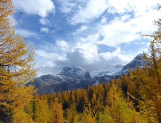
The best hike in Banff for golden larches and snowy peaks in autumn.
Difficult Hiking
190 m away
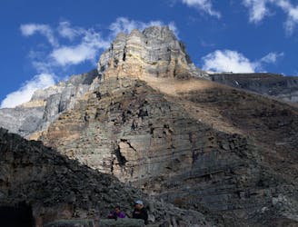
The easiest route on Mount Temple, an 11,000er in Banff National Park.
Extreme Hiking
7.7 km away
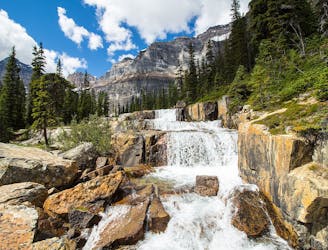
A longer day hike that leaves the crowds behind, passing a small lake and reaching a unique waterfall in the Banff backcountry.
Moderate Hiking
7 routes · Hiking
6 routes · Hiking
5 routes · Hiking