13 m away
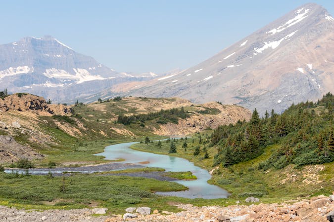
Owen Creek to Pinto Lake
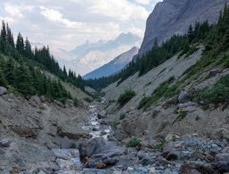
A challenging start to an epic multi-day adventure that is sure to test your resilience.
Severe Hiking
- Distance
- 24 km
- Ascent
- 1.7 km
- Descent
- 1.4 km
A 3 day trip in a beautiful remote area near and in Banff national Park.
Hiking Moderate

Up Owen creek to Michelle lakes on the first night. Second night to Pinto lake over 2 passes. 3rd day find horse trail (follow gpx track) to gain Sunset pass and down to the Icefields parkway. the horse trail from pinto lake to sunset pass is not where shown on the NTS map. We had to wander a while to find it. Folks talk about some steep gully leading to sunset pass but there is a horse trail! you will know when you are on itl
Moderate
Hiking along trails with some uneven terrain and small hills. Small rocks and roots may be present.

The path is on completely flat land and potential injury is limited to falling over.

Away from help but easily accessed.
13 m away
A challenging start to an epic multi-day adventure that is sure to test your resilience.
Severe Hiking
8 routes · Hiking