Cavell Meadows Loop
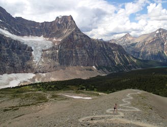
Ascend to eye level with the Angel Glacier, high above the valley floor.
Moderate Hiking
- Distance
- 6.1 km
- Ascent
- 442 m
- Descent
- 442 m
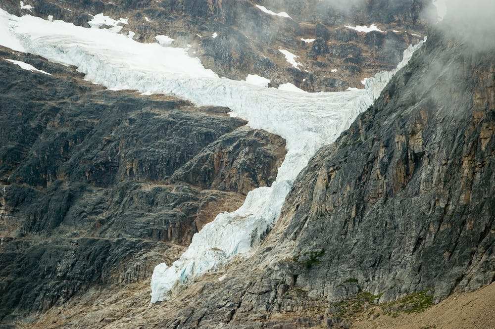
Hike to an overlook of the Angel Glacier and an icy pond at the base of Mount Edith Cavell.
Hiking Easy

This easy trail makes an excellent tour of a landscape in flux. Glacial ice covered much of this past century, but now it is largely ice-free in the summer as the glaciers retreat. You can view the remnants of the glaciers, clinging to the mountain slopes, and see the new vegetation now moving up the valley. You’ll see icebergs in a blue pond, which have fallen from the Angel Glacier above. Signs along the way explain these processes, and the photo opportunities are endless. The Path of the Glacier trail is short and paved (but still rough for strollers and wheelchairs). If you want a longer outing with even better views, simply extend your hike on the Cavell Meadows Trail.
Easy
Walking along a well-kept trail that’s mostly flat. No obstacles are present.

The trail contains some obstacles such as outcroppings and rock which could cause injury.

Close to help in case of emergency.
Ascend to eye level with the Angel Glacier, high above the valley floor.
Moderate Hiking
1.8 km away
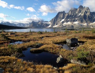
Point-to-point overnight trek through wildlife-rich valleys beneath soaring mountains, featuring the Amethyst Lakes in Jasper National Park.
Difficult Hiking
1.8 km away
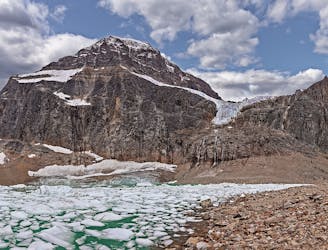
High meadows beneath twin cirques on Mount Edith Cavell’s lesser-seen backside.
Difficult Hiking
9 routes · Hiking
5 routes · Hiking