7.5 km away
South Lawson Peak | C'est Notre Monde
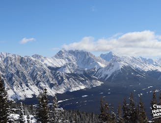
A bird's eye view of the Kananaskis Lakes
Difficult Hiking
- Distance
- 7.6 km
- Ascent
- 699 m
- Descent
- 699 m
Tentative route for Sep push to these peaks
Also in British Columbia, Canada
Hiking Difficult

This is a popular hiking route which is generally considered to be difficult. It's very remote, it features medium exposure and is typically done between August and September. From a low point of 1.5 km to the maximum altitude of 3 km, the route covers 119 km, 4374 vertical metres of ascent and 4434 vertical metres of descent.
Summit Duke III route to 3 peaks
Difficult
Hiking trails where obstacles such as rocks or roots are prevalent. Some obstacles can require care to step over or around. At times, the trail can be worn and eroded. The grade of the trail is generally quite steep, and can often lead to strenuous hiking.

The trail contains some obstacles such as outcroppings and rock which could cause injury.

Little chance of being seen or helped in case of an accident.
7.5 km away
A bird's eye view of the Kananaskis Lakes
Difficult Hiking
7.6 km away
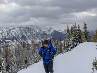
An intermediate winter hike in Kananaskis country
Moderate Hiking