7.6 km away
Prairie View -> Jewel Pass
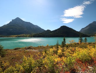
A short but epic loop to the top of a mountain.
Difficult Mountain Biking
- Distance
- 14 km
- Ascent
- 570 m
- Descent
- 570 m
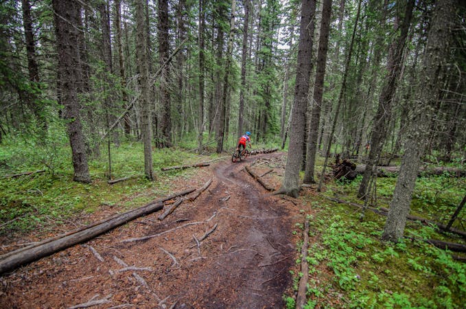
Shred technical, exposed rock slabs on the razor's edge of the mountain range!
Mountain Biking Extreme

"An awesomely-technical test piece with amazing views, Razor's Edge is like no other trail in the Canmore area," writes BikeCanmore.ca. The ride is anchored by tricky sections of slab rock riding, with a final long, exposed descent down a rocky, slab-filled ridgeline, "with spectacular views of the surrounding peaks," according to BikeCanmore.
The route as mapped begins on the shoulder of the Trans-Canada Highway and climbs up a narrow valley on the Quaite Creek Trail. About halfway up, be sure to bear right to stay on the Quaite Creek Trail.
Soon, you'll reach a junction with the Prairie View and Jewel Pass trails, and join that route briefly before turning left onto the main attraction: Razor's Edge. If you want to form a massive loop with Prairie View -> Jewel Pass, that's entirely plausible, and would make for a fantastic full-day ride out in the mountains!
After taking a left on Razor's Edge, there's still a bit more climbing before gaining the exposed edge of the mountain. Here, the technicality of the ride really ratchets up, with exposed rock sections, rock rolls, and chunky rock gardens.
And of course, it's all about the final descent: technical high-speed ripping down exposed rock slabs, stupendous views of the surrounding mountains, and some not-insignificant fall danger off the cliffs.
Keep the rubber side down, stay on the trail, and enjoy this fantastic rock slab rip back down to the highway!
Sources: Singletracks.com BikeCanmore.ca
Extreme
Very steep, difficult, narrow singletrack with widely variable and unpredictable trail conditions. Unavoidable obstacles could be 15in/38cm tall or greater, and unavoidable obstacles with serious consequences are likely to be present. Obstacles could include big rocks, difficult root sections, drops, jumps, sharp switchbacks, and more. Ideal for expert-level riders.

Some trail sections have exposed ledges or steep ascents/descents where falling could cause serious injury.
Little chance of being seen or helped in case of an accident.
7.6 km away
A short but epic loop to the top of a mountain.
Difficult Mountain Biking

25 routes · Mountain Biking
6 routes · Mountain Biking