10 routes · Alpine Climbing · Hiking · Trail Running
A massive easy ramble up beautiful granite slabs!
Alpine Climbing Moderate

One of the best sustained scrambles in BC? Maybe it's an easy alpine climb but whatever you want to call it, it's rad! Do the long drive up the Chehalis FSR and then turn onto the Skwellepil Creek FSR. Things get pretty bumpy and the waterbeds are big so 4x4 HC is needed. Ignore spur roads and go until you hit a massive impassable washout.
From the end of the drivable section, it's 4km of relatively flat road. A mountain bike would make pretty quick work of this so that's definitely an option but it's a pretty easy hike/jog as well.
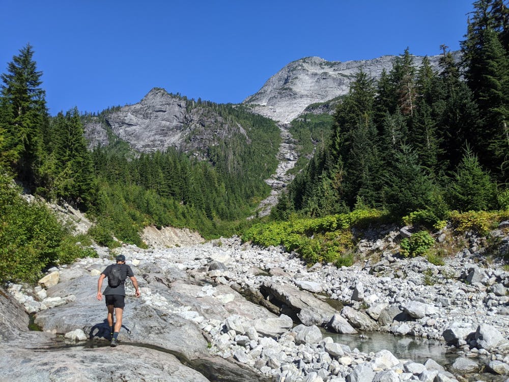
The road ends in another massive washout with a long slide path that clearly leads to the face of Stonerabbit. If you can't see the peak/path, you're not there yet.
Start scrambling up the creek bed. You'll generally be cruising up easy slabs with steps that are slightly harder. Lots of water on this portion of the route so don't worry about getting thirsty.
A bench at 1200m marks the "start" of the actual face. This is also the last of the water until you get back to here so fill up. If there's big snow patches still hanging above this point on the face, it's probably not worth risking continuing up. Come back later in the summer!
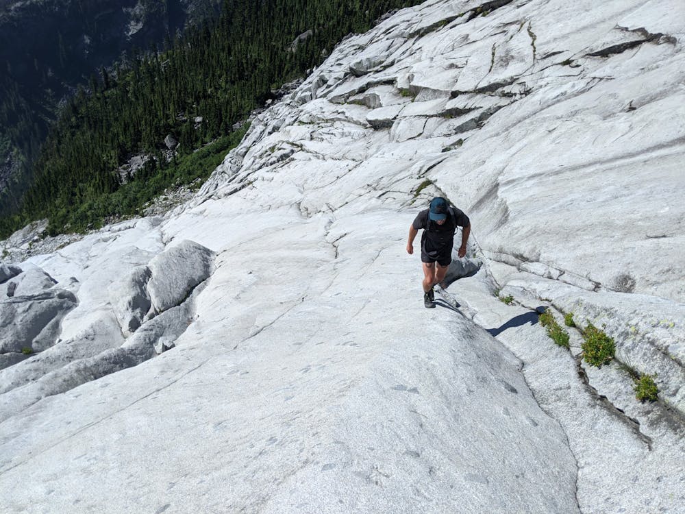
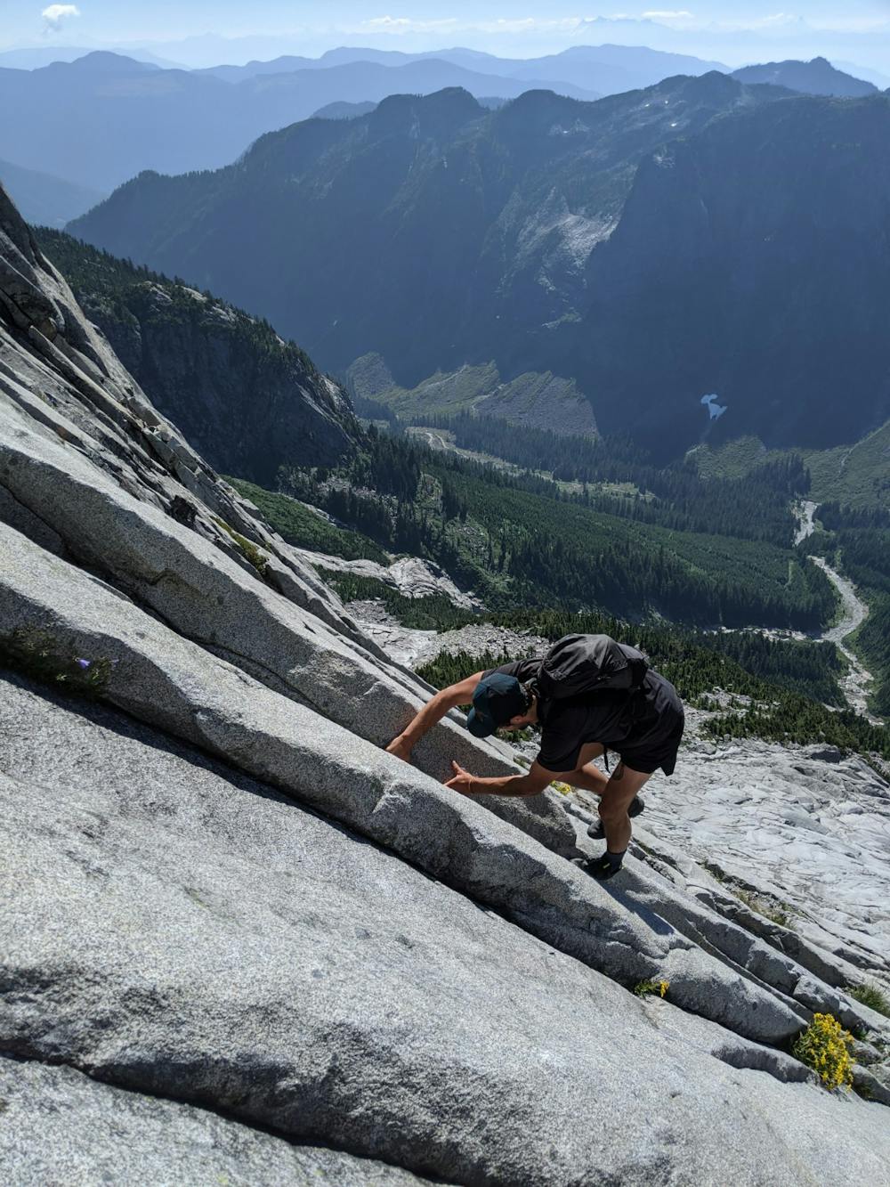
Cruise up easy granite slabs to a major ledge system. Head right up the cleavage and look for the lowest-angle corner system up here. This is the crux and the steepest point on the face. Most of the corners have cracks for protection so if yours doesn't, find a different one. We stuck slightly closer to the right side to find the easiest climbing. 3-4 pitches of low-5th class lead to another major ledge and then easier blocky scrambling to the summit!
Enjoy the epic views of the Chehalis Range, Stave Lake, Robie Reed, and Mt. Judge Howay! Descend 3rd class heather ledges down the West Ridge until it starts to peter out. Around 1500m traverse skier's left back towards the face and regain the lower angle slabs at the bottom. If you descend below 1200m without regaining the ascent route, you've gone too far!
Reverse the route, back down the slide path to the road and be sure to jump in a few of the tarns on the way down! Once you're back at the car, blast down to the bridge where the Chehalis FSR crosses Skwellepil Creek to take a dip in the water!
Don't climb the route when it's wet. I'd also definitely avoid it if there's any snow remnants visible clinging to the face. A short rope and a small rack of C3->finger sized cams would protect the crux pitches and allow for belaying if anyone in the party is uncomfortable. Having climbing shoes to change into for the crux sections and sticky approach shoes for the rest seems like the best option. For the curious, a stonerabbit is another name for a pika!
Moderate
May involve slightly more complex glacier hikes, easy but possibly long rock ridges and steep snow up to 45 degrees. Equivalent to PD, PD+

The route features some exposed and/or difficult to protect sections.

Little chance of being seen or helped in case of an accident.
10 routes · Alpine Climbing · Hiking · Trail Running