19 m away
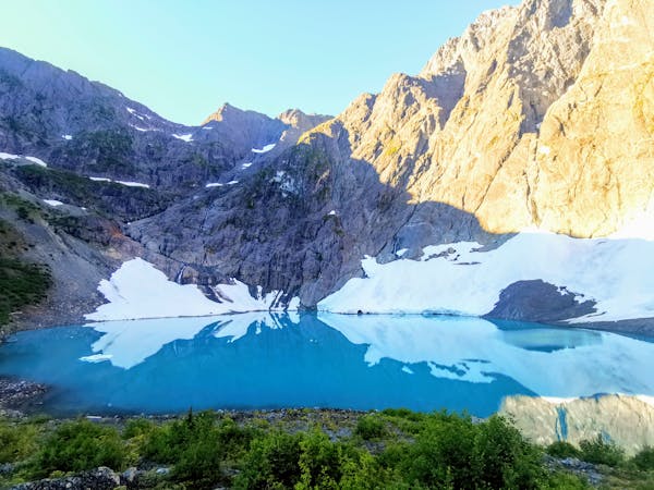
Mt Albert Edward
The well maintained trails make this a very achievable peak with stunning scenery all the way up to the summit.
Difficult Hiking
- Distance
- 33 km
- Ascent
- 1.6 km
- Descent
- 1.6 km
Point-to-point hike from Forbidden Plateau to Buttle Lake in Strathcona Park.
Hiking Difficult

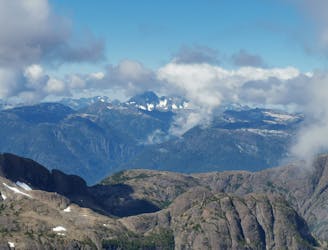
The Augerpoint Traverse accesses some of the best mountain scenery in Strathcona Provincial Park. Most hikers complete the trek as a multi-day hike from east to west, starting at the Paradise Meadows trailhead of the Forbidden Plateau zone (accessed via Mt. Washington Ski Resort, a shortcut to the subalpine). The route takes you up and over Mt. Albert Edward, the 6th largest mountain on Vancouver Island, to a pristine backcountry campsite at Ruth Masters Lake at the base of Augerpoint Mountain. It continues back up to Jack's Ridge overlooking Buttle Lake before beginning a steep descent down to the lake itself.
Difficult
Hiking trails where obstacles such as rocks or roots are prevalent. Some obstacles can require care to step over or around. At times, the trail can be worn and eroded. The grade of the trail is generally quite steep, and can often lead to strenuous hiking.

Some trail sections have exposed ledges or steep ascents/descents where falling could cause serious injury.

Away from help but easily accessed.
19 m away
The well maintained trails make this a very achievable peak with stunning scenery all the way up to the summit.
Difficult Hiking
3 routes · Hiking