3.3 km away
Lower Myra Falls
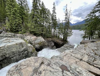
A stunning series of cascades located on the southern end of Buttle Lake.
Easy Hiking
- Distance
- 1.2 km
- Ascent
- 42 m
- Descent
- 43 m
Hike up the tallest mountain on Vancouver island
Hiking Extreme

This is a popular hiking route which is generally considered to be extreme. It's extremely remote, it features extreme exposure and is typically done between June and September. From a low point of 375 m to the maximum altitude of 2.1 km, the route covers 48 km, 4006 vertical metres of ascent and 4012 vertical metres of descent.
Hike up the tallest mountain on Vancouver island
Extreme
Scrambling up mountains and along technical trails with moderate fall exposure. Handholds are necessary to navigate the trail in its entirety, although they are not necessary at all times. Some obstacles can be very large and difficult to navigate, and the grades can often be near-vertical. The challenge of the trail and the steepness of the grade results in very strenuous hiking. Hikes of this difficulty blur the lines between "hiking" and "climbing".

Some trail sections are extremely exposed where falling will almost certainly result in serious injury or death.
In the high mountains or remote conditions, all individuals must be completely autonomous in every situation.
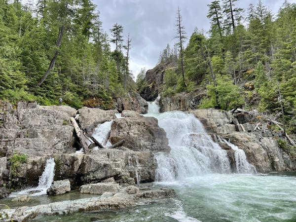
3.3 km away
A stunning series of cascades located on the southern end of Buttle Lake.
Easy Hiking
3 routes · Hiking