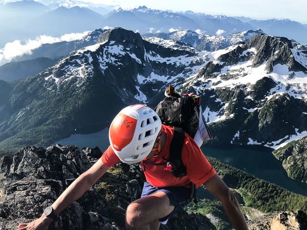
5 routes · Alpine Climbing · Hiking
A steep grunt from sea-level to the Tantalus Hut at Lake Lovely Water!
Hiking Severe

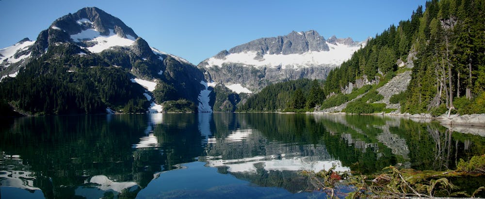
The hike to Lake Lovely Water is challenging but rewarding! Currently (Summer 2020) the access to the start of the hike is complicated. Use of the Survey Cable and the road approach the survey cable is not allowed.
This is Squamish Nation land and is posted no trespassing. The only existing legal way to reach the trailhead is to put a watercraft in up-river where the river comes alongside the Squamish Valley Road and paddle down to the trailhead, then continue down to Squamish at the end of the day. OR hire a jet boat driver in town to drop you at the trailhead.
A short flat portion along the river is a bit misleading when you turn uphill after the first kilometer. Some river rock hiking gives way to a better trail up into big forested terrain. The trail works up and up, likely affected by blowdown here and there. Several small stream crossings offer chances for water. At approximately 3/4 height, you arrive at a major waterfall on the main creek. This is a good chance for a break before the final approach to the Lake. The trail flattens out and a junction left heads to the Sandspit Camp and the right follows the creek to the lake and the Tantalus Hut!
Severe
Hiking challenging trails where simple scrambling, with the occasional use of the hands, is a distinct possibility. The trails are often filled with all manner of obstacles both small and large, and the hills are very steep. Obstacles and challenges are often unexpected and can be unpredictable.

Some trail sections have exposed ledges or steep ascents/descents where falling could cause serious injury.

Away from help but easily accessed.
5 routes · Alpine Climbing · Hiking
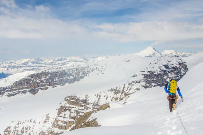
10 routes · Alpine Climbing · Hiking · Trail Running