3.5 km away
Kalamalka Lake Provincial Park Loop
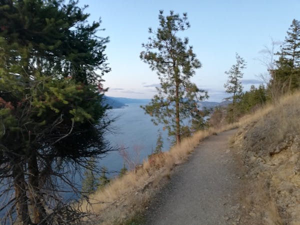
A fabulous journey through one of the Okanagan's finest parks.
Moderate Hiking
- Distance
- 13 km
- Ascent
- 483 m
- Descent
- 483 m
A long and peaceful journey through some beautiful forests.
Hiking Severe

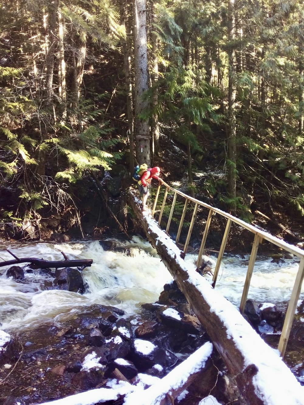
Most hikers take around 3 - 4 days to complete this hike, and it can be done in either direction. Extremely keen trail runners do the trip in a single day, but the terrain (plenty of uneven ground, some tricky river crossings and countless fallen logs across the trail) is not really conducive with moving quickly, so doing this route in one go is even tougher than it might look from the basic statistics!
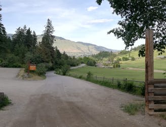
The trail is basically a long undulating traverse with a climb at the start and a descent at the end. Once you've gained the initial height, you stay up high for most of the trail and then descend down to the finish point. This is true whichever way you do the trail, but doing the route north-south (as it's drawn here) makes the ascent longer than the descent. If you want to reverse this formula, go south-north, and if you REALLY want to cut down on ascent then go south-north and begin by driving up Goudie Road (which branches off Highway 33 7kms east of Black Mountain Elementary School) and joining the High Rim Trail about 8kms (and 1000 vertical metres) from its southern terminus.
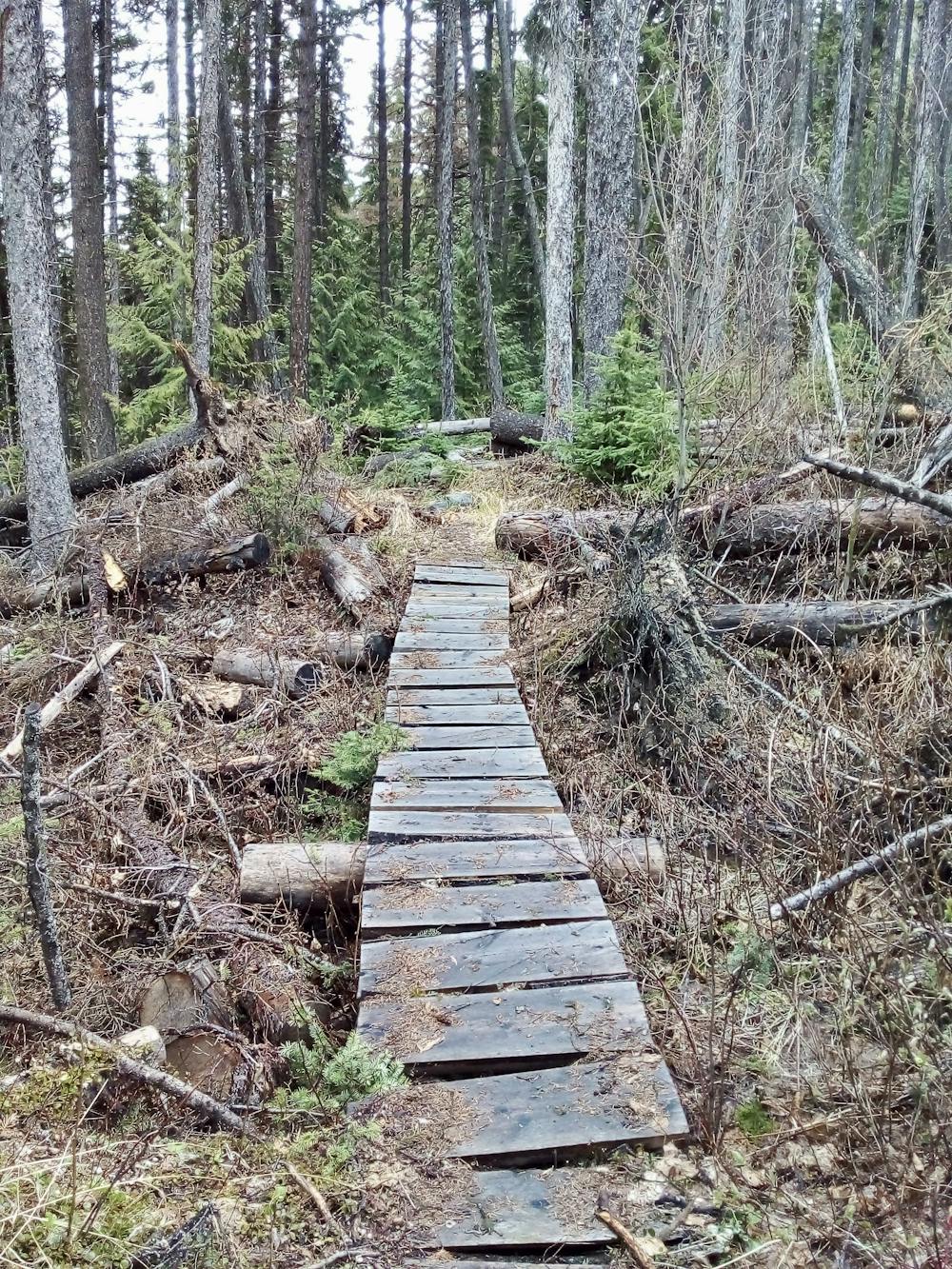
Regardless of which direction you choose, the trail is well signposted throughout by pink and black tape around trees branches, and regular small metal signs with pink and black tabs, and "HRT" written on them. At times you need to be quite attentive to spot the tape and metal signs, so keep looking for them any time you're not on a clear trail. If you go 10 minutes without seeing any sign of trail marking, pull FATMAP out and double check that you're en route! Generally you won't need to look at the map more than about once an hour, but there are little trails everywhere so it's always worth double checking that you're on track if there's any doubt at all.
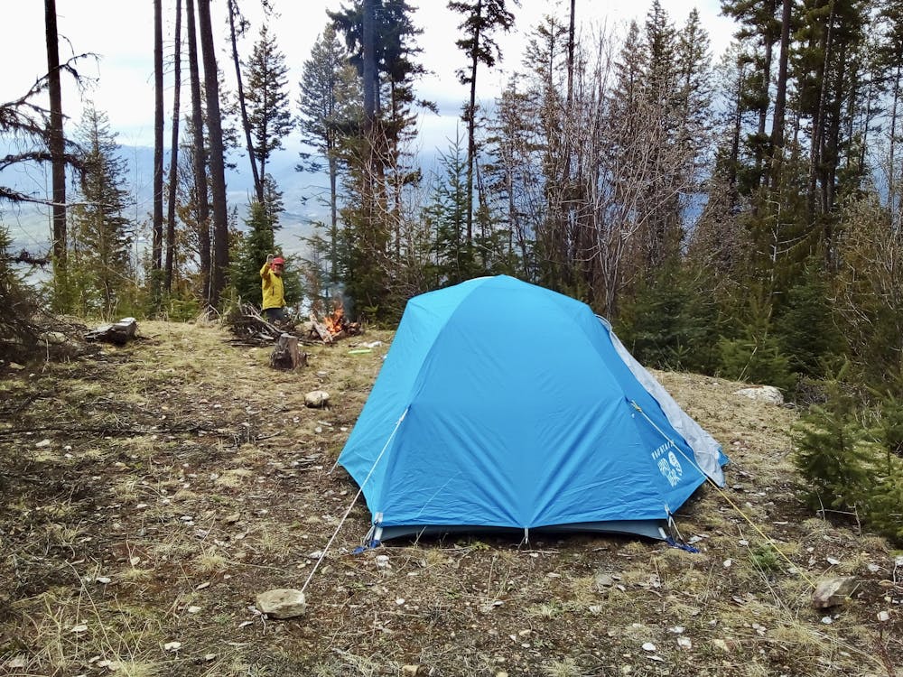
One of the big challenges on the trail is locating water. In early summer there will be running water through virtually all of the creeks you cross on the trail, but by mid-summer many of these will have dried up. The larger creeks will generally have some sort of flow all year, but smaller creeks will dry up and your choices of campsites will likely be restricted by proximity to water. It's a good idea to carry a spare 2 litre bottle per person, and to fill it up at any water source you pass in the afternoon. You might not see another water source before finding a campsite and having enough water to get you through a night will give you the flexibility to choose a suitable spot to camp. There are countless good places for a wild camp on the route, but if you can't access water and didn't fill up at the last chance you had, you're going to either be very thirsty or have to keep walking until you find a water source!
The only 2 spots with camping platforms are The Grand View (which is 13.5 km north of the HRT's southern terminus and, hence the name, enjoys a fabulous panorama across Kelowna) and Damer Lake Recreation site, which is a short detour from the HRT, about 13km south of the northern terminus. Neither of these options is particularly well placed because they're both a bit close to the 2 ends of the trail, so wild camping is a better option for most parties. Virtually all of the HRT is on Crown Land, so wild camping is permitted - just make sure you leave no trace of your presence after you break camp.
Whether you start at the northern or southern end of the trail, you'll either need to drop a vehicle at the far end, or get a ride to the trail. Getting these logistics sorted before you set off is advised because there is zero public transport to access the route! BC Transit do run a bus service from Vernon to Kelowna (via a change at UBCO) so using this and hitchhiking to the trailheads might be feasible, but not to be counted on. Getting a ride is the best option.
The logistical issues are well worth solving because the HRT is a lovely trip. Most of the trail is deep in the forest so the trip is more about ambience than views, although there are a handful of excellent viewpoints along the way. Most of the trail is easy and clear, but there are some tricky river crossings if water levels are high, and there are usually a few dozen trees across the trail, each of which needs to be passed over or under. There's no climbing required, and the route is attainable for fit and experienced hikers.
Severe
Hiking challenging trails where simple scrambling, with the occasional use of the hands, is a distinct possibility. The trails are often filled with all manner of obstacles both small and large, and the hills are very steep. Obstacles and challenges are often unexpected and can be unpredictable.

Some trail sections have exposed ledges or steep ascents/descents where falling could cause serious injury.
Little chance of being seen or helped in case of an accident.
3.5 km away
A fabulous journey through one of the Okanagan's finest parks.
Moderate Hiking
3 routes · Hiking