4.2 km away
Lower Myra Falls
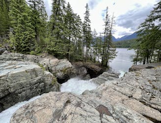
A stunning series of cascades located on the southern end of Buttle Lake.
Easy Hiking
- Distance
- 1.2 km
- Ascent
- 42 m
- Descent
- 43 m
Downloaded from Bivouac.net
Hiking Difficult

This is a popular hiking route which is generally considered to be difficult. It's remote, it features medium exposure and is typically done between July and October. From a low point of 1.2 km to the maximum altitude of 1.7 km, the route covers 15 km, 1752 vertical metres of ascent and 1447 vertical metres of descent.
Goes from Buttle Lake up to Arnica Lake on Phillips Ridge, along the ridge and dropping down to Schielderup Lake, then up and over to E end of Burman Lake and up to Golden Hinde.
Difficult
Hiking trails where obstacles such as rocks or roots are prevalent. Some obstacles can require care to step over or around. At times, the trail can be worn and eroded. The grade of the trail is generally quite steep, and can often lead to strenuous hiking.

The trail contains some obstacles such as outcroppings and rock which could cause injury.
Away from help but easily accessed.
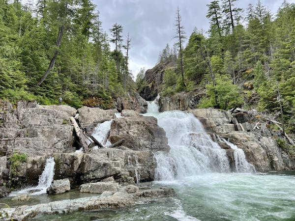
4.2 km away
A stunning series of cascades located on the southern end of Buttle Lake.
Easy Hiking
3 routes · Hiking