3.3 km away
Joffre Lakes
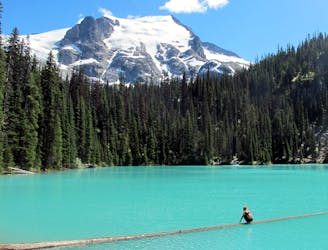
A popular hike to three turquoise-blue alpine lakes.
Difficult Hiking
- Distance
- 8.9 km
- Ascent
- 442 m
- Descent
- 442 m
Rohr Lake is a popular alternative to Joffre Lakes, but it's a much more challenging hike!
Hiking Extreme

Joffre Lakes has become one of the most popular hiking trails in the Sea to Sky corridor. BC Parks recently had to institute a permit system to limit the number of hikers on the trail, capping the visitors at 1,700 per day. Even with 1,700 permits per day, the free hiking permits for Joffre Lakes get snapped up every single day during the summertime.
Naturally, many hikers will be looking for nearby alternatives to experience the beauty of the Cayoosh Range that aren't regulated by a permit system. Rohr Lake, just up the road from Joffre Lakes, is a popular alternative.
But be warned: Joffre Lakes is a manageable hike that plenty of tourists can tackle without too much preparation. Rohr Lake, on the other hand, is a much more demanding adventure.
There are a few parking options for Rohr Lake, depending on how early you arrive at the trailhead and how much ground clearance your vehicle has. The route, as shown here, begins from a parking area directly off the highway, which is the safest bet for a parking spot. However, the first mile of the hike follows a dirt forest service road, which will prompt many hikers to drive up the road and shorten the hike. Within a few hundred feet of the highway, there are a few parking spots that are easily accessible. About halfway up the dirt road, there's a small parking lot next to an outhouse that forms one of the major trailheads. Beyond this point, two-wheel-drive cars are not recommended, yet truck owners will inevitably press on. The remainder of the road is much rougher and wetter, but most high-clearance vehicles can easily reach the end of the road. However, when you reach the end, you'll see a sign telling you to turn around and not park in the very small clearing there. There are a few pull-outs along the 4x4 section of road that some people will inevitably park in, but not many.
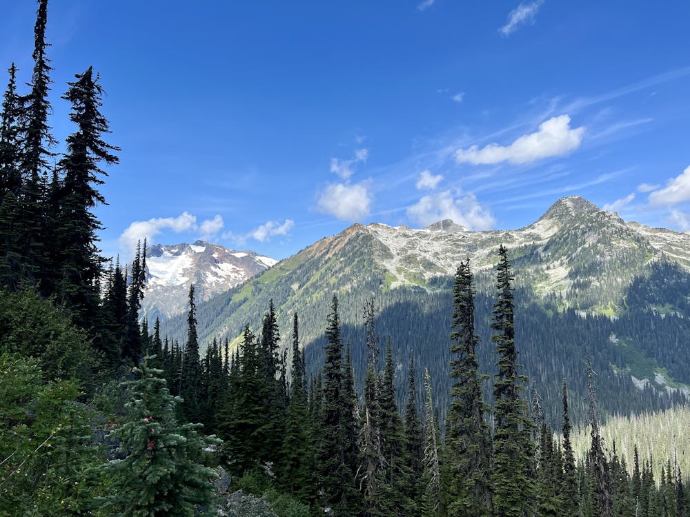
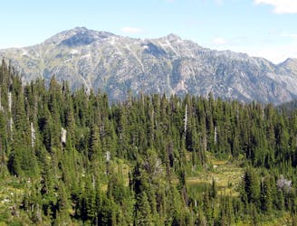
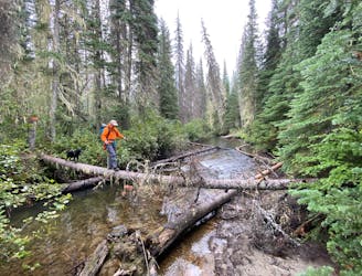
However you choose to reach the singletrack, the hiking begins in earnest once you're on the trail. It's immediately apparent that you're not on a well-maintained tourist track and are instead venturing into a true British Columbia wilderness. The track is narrow and twisty, traversing slick root webs and steep, rocky pitches. You'll inevitably have to work your way around, up, and over some downed trees. You'll have to skirt a couple of vast muddy areas in the first section, but due to the popularity of this section (which also heads to Marriott Basin), there's usually an obvious line that bypasses the worst of the mud. Keep your eyes peeled for a signed right turn to head up to Rohr Lake.
Did you think you were climbing already? Think again. After the turn-off, the trail steepens dramatically, grunting up a series of root webs and loose dirt singletrack. As you press on, the muddy sections become more and more frequent. Eventually, you'll break out into a bowl with some views of the mountain above you and be confronted with a vast muddy expanse that you might not be able to bypass. If you embark on the Rohr Lake hike, you need to be fully prepared to get dirty and wet.
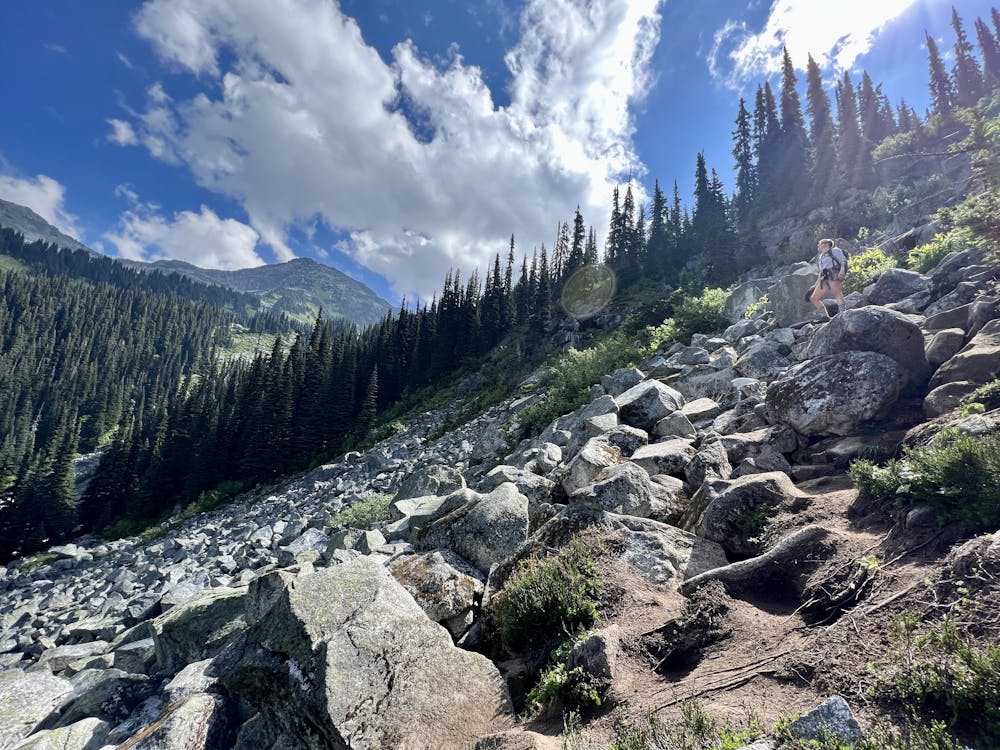
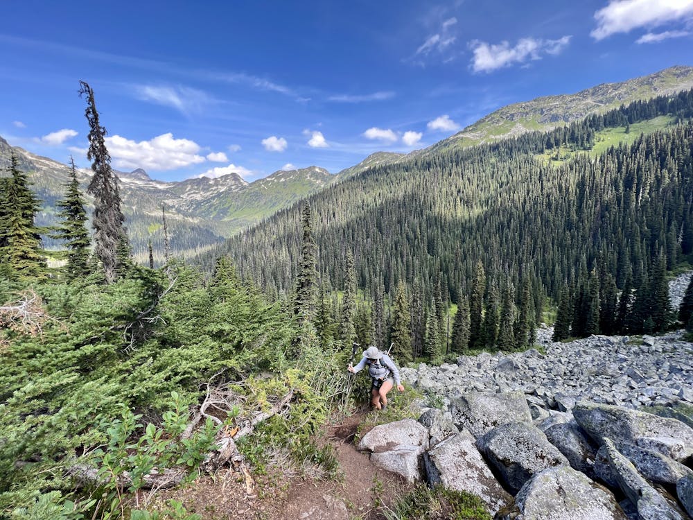
Did you think you were climbing already? Think again! The final pitch of the climb to Rohr Lake requires hikers to scramble up a massive boulder field. The best route up the boulder field is generally easy to spot, but if in doubt, look for small pieces of flagging tied to branches or dirt on the rocks where others have passed.
This boulder field section is a true scramble that will require constant use of all four limbs. As you climb higher and higher, some sections can get quite exposed—you don't want to slip while working your way up these boulders. Unfortunately, a slip isn't out of the question, because somehow, in between all these boulders, you'll still have to slip and slide through sections of slick, black mud. Slippery mud combined with massive boulders, scrambling, and fairly stiff exposure earn this hike a FATMAP "Extreme" rating.
You can see why this isn't a tourist hike for the uninitiated or a good option for unprepared hikers who didn't get a reservation at Joffre Lakes and decided to head out here instead. That said, Rohr Lake is still quite popular, and you'll likely see locals scampering up the boulders with nary a bit of hesitation. During the peak summer season, you're also likely to see heavily-loaded backpackers climbing and descending this trail.
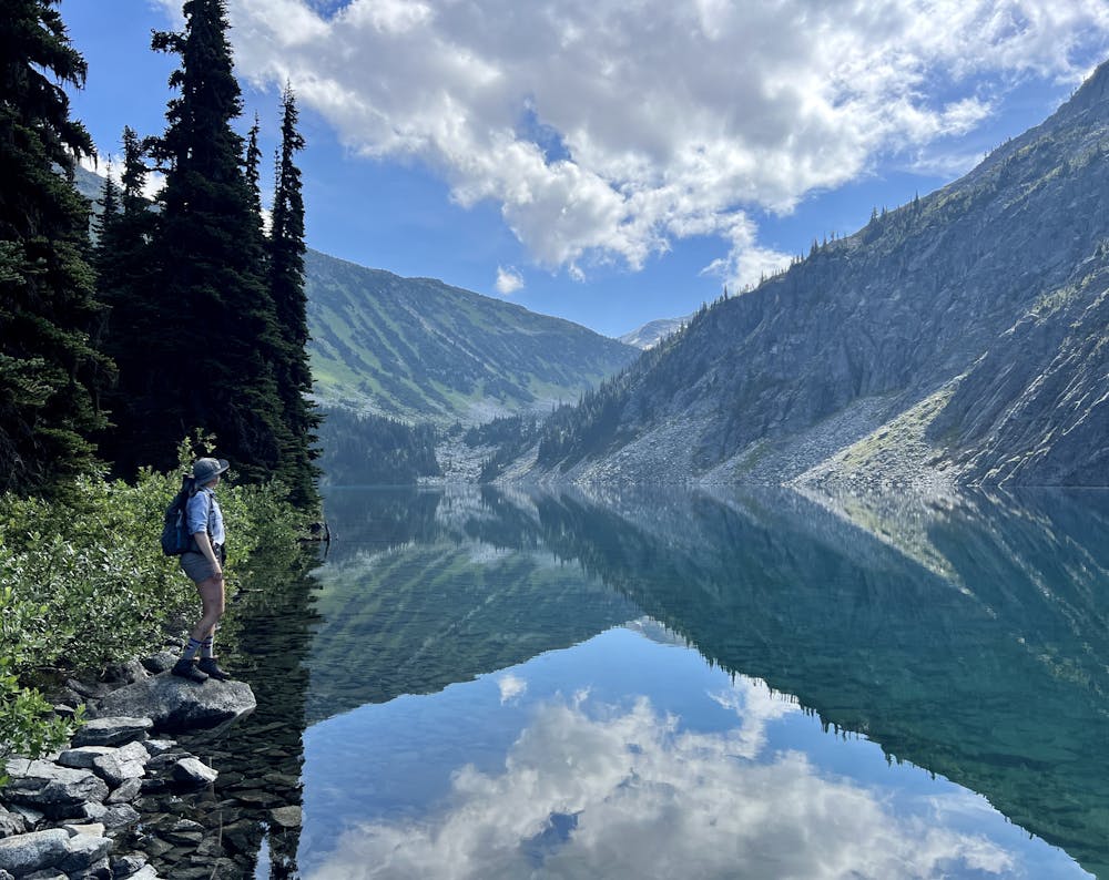
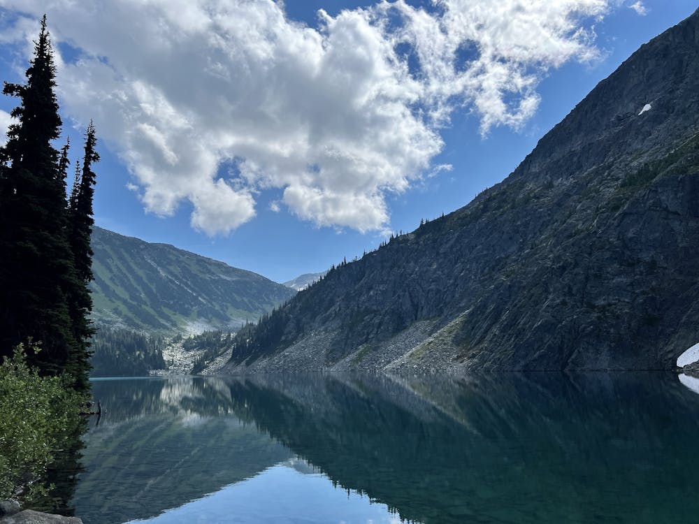
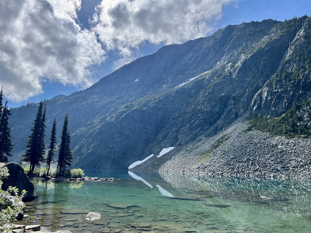
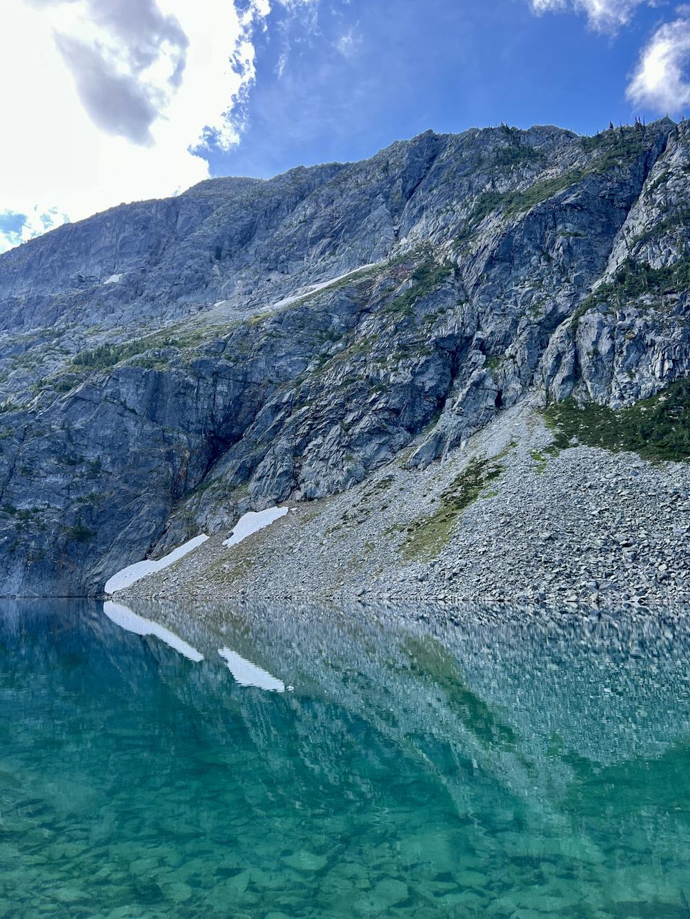
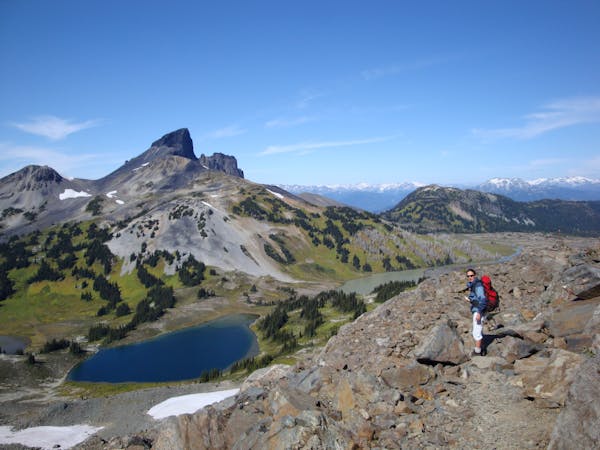
When you finally gain the top of the ridge and walk the final few feet to the lake, you'll see why so many backpackers head up here—this alpine bowl is absolutely idyllic! Vertical granite cliffs flank the crystal-clear waters of Rohr Lake, and you might feel like you've found paradise itself (until you get your first mosquito bite).
There is a popular camping area for backpackers to the right of the lake. While some backpackers undoubtedly hike up here to simply camp and enjoy the lake basin, this is also a popular basecamp area for climbers making an attempt on Mount Rohr, which is high above and out of sight from the lake. There are also several other big alpine objectives that can be reached from this point, but progressing beyond the lake moves the hike firmly into alpine climbing territory. Only continue up the mountain if you're fully prepared for a remote alpine climbing expedition.
After enjoying your time at the lake, turn around and descend the same trail back to your car. Take care on the muddy boulder field especially: descending these rock scrambles is always more difficult than the ascent!
Extreme
Scrambling up mountains and along technical trails with moderate fall exposure. Handholds are necessary to navigate the trail in its entirety, although they are not necessary at all times. Some obstacles can be very large and difficult to navigate, and the grades can often be near-vertical. The challenge of the trail and the steepness of the grade results in very strenuous hiking. Hikes of this difficulty blur the lines between "hiking" and "climbing".

Some trail sections have exposed ledges or steep ascents/descents where falling could cause serious injury.

In the high mountains or remote conditions, all individuals must be completely autonomous in every situation.
3.3 km away
A popular hike to three turquoise-blue alpine lakes.
Difficult Hiking
3.6 km away
A sub-10k day hike with the option to camp at a Keith's Hut.
Moderate Hiking
3.6 km away
Beautifull Glacial Views on a pristine summit
Severe Hiking
10 routes · Hiking

10 routes · Alpine Climbing · Canyoning · Hiking