7.3 km away
Loam Line Loop

The biggest jumps on Mount Tzouhalem.
Severe Mountain Biking
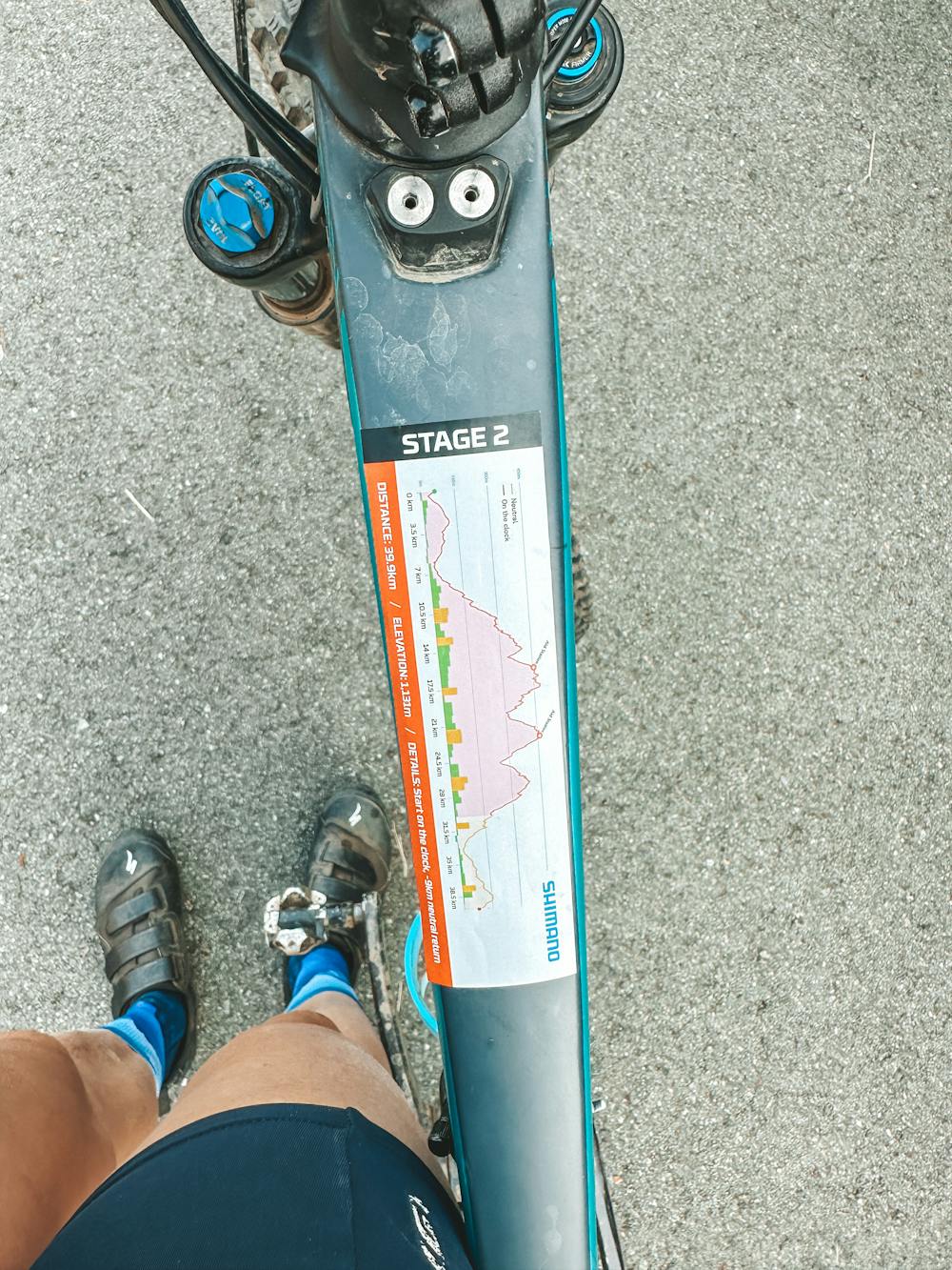
- Distance
- 4.4 km
- Ascent
- 275 m
- Descent
- 275 m
Nice easy uphill followed by fun flowing descents
Mountain Biking Moderate

This is a popular mountain biking route which is generally considered to be moderate. It's not remote, it features medium exposure and is typically done between April and October. From a low point of 26 m to the maximum altitude of 479 m, the route covers 44 km, 1312 vertical metres of ascent and 1302 vertical metres of descent.


Nice easy uphill followed by fun flowing descents
Moderate
Mostly stable trail tread with some variability, with unavoidable obstacles 8in/20cm tall or less. Other obstacles such as rock gullies and steep sections may exist. Ideal for lower intermediate riders.

The trail contains some obstacles such as outcroppings and rock which could cause injury.

Close to help in case of emergency.
7.3 km away
The biggest jumps on Mount Tzouhalem.
Severe Mountain Biking
8.1 km away

The Zoo's most popular flow trail.
Moderate Mountain Biking
8.1 km away

A long loop to the top of Mount Tzouhalem.
Severe Mountain Biking
8.1 km away

A fantastic flow trail mash-up on Mount Tzouhalem.
Difficult Mountain Biking

4 routes · Mountain Biking