528 m away
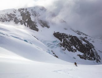
Musical Bumps Ski Tour
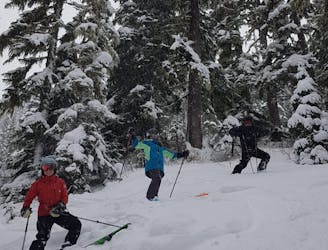
Yo-Yo Turns in the Musical Bumps Area
Moderate Ski Touring
- Distance
- 14 km
- Ascent
- 1.1 km
- Descent
- 1.4 km
A longer Whistler-accessed excursion with some excellent tree line skiing
Ski Touring Moderate

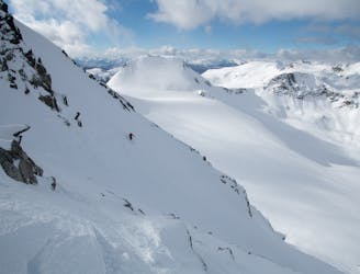
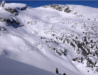
Cowboy ridge is a classic west-facing ski descent just beyond Whistler's Musical Bumps. Although this zone sees a lot of beginner traffic, Cowboy Ridge is steeper and much more prone to avalanches than its neighbouring Oboe summit. These lines are particularly susceptible to cross-loading from south westerly winds and will slide often during major storms.
This route is aimed at intermediate ski tourers who want to venture a little further than the very popular and busy Musical Bumps zone. Access, as with all Whistler ski tours, is from the backcountry gate at the base of Flute Ridge. Ascend the groomed uphill route to the ski area boundary at Flute summit.
From here you have two options. The option shown on this route provides the most downhill available whilst heading out towards Cowboy Ridge. However, if time is an issue you can skip the first two descents. Simply follow the summer 'High Note' trail which takes the most direct route south east, over Oboe Summit and down to Melody Creek.
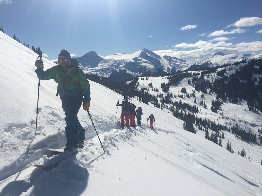
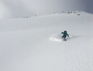
In order to maximise the skiing you can ski a run known as Flute Cruiser from the summit of Flute down into Oboe Creek. The run ends at around 1650m, transition here and head west up towards Oboe shoulder. You can hug the trees on climber's left and weave through the least steep slopes above to gain the shoulder. From here you can ski directly west down one of the 12 Apostle runs, or continue south up the shoulder towards the summit of Oboe (as shown on the map). From here you have many options to descend, but all of these open tree-line descents head west down into Melody Creek.
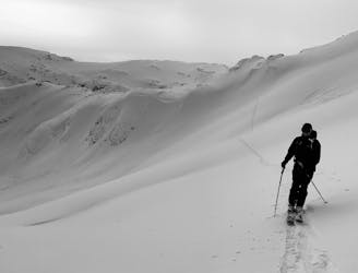
Towards the bottom of this run you will cross the Singing Pass trail. This popular summer route is used in the winter as a ski out to Whistler Village, as well as an up track for those without a lift pass. Transition above the creek and skin south along the drainage. You will see the west face of Cowboy Ridge up to your left whilst skinning along the creek. Continue until you reach the mellower slopes to the south of Cowboy. From here ascend west, linking the mellower slopes and avoiding a few steep mid-slope convexities. The top of Cowboy Ridge is at 1980m, however most parties will skip the flat top and will drop in from around 1960m where the real skiing begins.
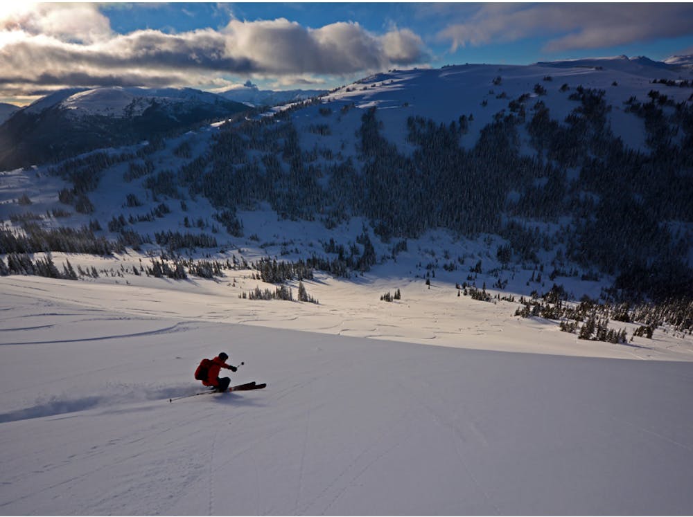
From here you will enjoy a 300m vertical descent on wide open 30-35 degree slopes, back down into Melody Creek. Depending on time, you can either head back up for another lap or start the ski out. Most parties will ski out from here using the Singing Pass trail. This notorious trail involves a lengthy 12km descent, losing around 1,000m of elevation. In the right conditions it provides a quick and easy exit from Melody Creek. In poor conditions, however, it can be icy, rocky and not much fun at all. Beta on the condition of this trail is usually readily available on social media groups such as South Coast Touring on Facebook, or can be found in MIN reports on the Avalanche Canada website.
If the trail is in questionable condition, you can always return to the resort via Oboe and Flute. This is sometimes easier, but will involve more elevation gain and so you should plan your timings accordingly.
Moderate
Slopes become slightly steeper at around 25-30 degrees.

Exposure is limited to that of the slope itself. Getting hurt is still likely if the slope is steep and/or the snow is hard.

Away from help but easily accessed.
528 m away
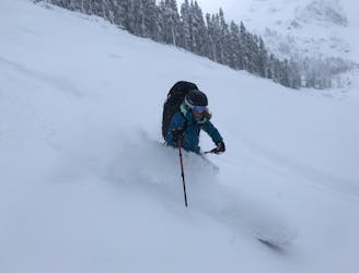
Yo-Yo Turns in the Musical Bumps Area
Moderate Ski Touring
671 m away

A European-style hut close to the resort
Easy Ski Touring
4.8 km away
Blackcomb's Most Popular Yo-Yo Turns
Moderate Ski Touring
6.6 km away
Entry Level Steep Skiing
Severe Ski Touring
6.7 km away
An high value introduction to the Spearhead and Phalanx Glaciers
Moderate Ski Touring
6.8 km away
An excellent first glacier travel experience in the Blackcomb backcountry
Moderate Ski Touring
6.8 km away
An excellent loop through the Blackcomb backcountry with no glacier travel required.
Moderate Ski Touring
7.7 km away
Whistler’s backcountry ski tour rite of passage, taking you through some of the most impressive ski terrain on the continent.
Difficult Ski Touring
9.9 km away
An underplayed classic close to Whistler
Moderate Ski Touring
7 routes · Ski Touring
5 routes · Ski Touring

4 routes · Ski Touring