Superior Hiking Trail
Long-distance footpath through hilly boreal forest and the expansive backcountry of Lake Superior's Minnesota shore.
Also in Minnesota, United States of America • Wisconsin, United States of America
Hiking Difficult
- Distance
- 478 km
- Ascent
- 6.1 km
- Descent
- 5.8 km
- Duration
- 1 day +
- Low Point
- 181 m
- High Point
- 551 m
- Gradient
- 3˚

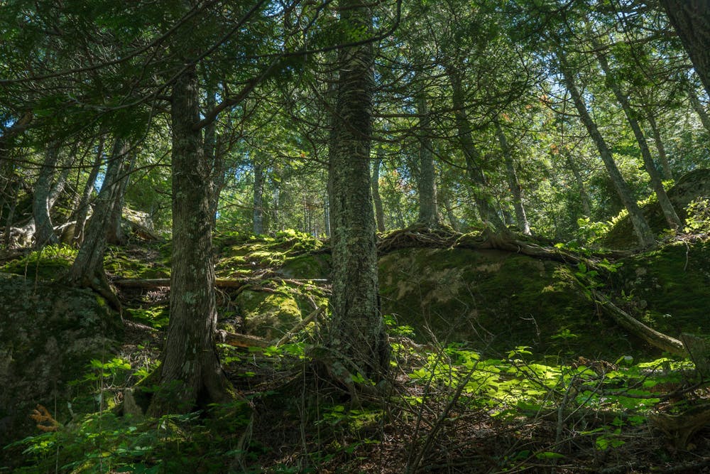
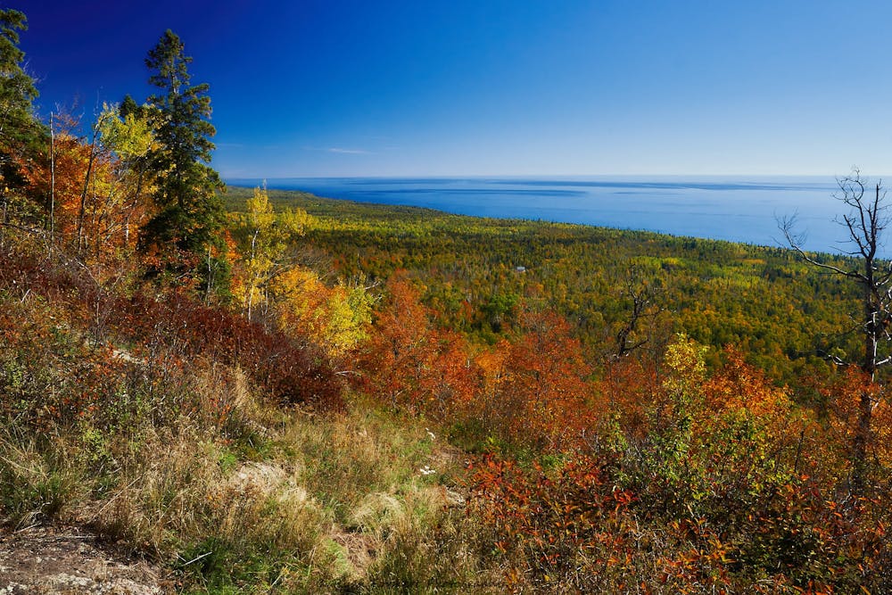
The Superior Hiking Trail (SHT) is a long-distance footpath near Lake Superior’s North Shore. The route reaches the lake in some places, but mostly follows ridges and valleys some distance away. It is primarily a forest hike through diverse boreal woodland.
- •
- •
- •
- •
- •
Description
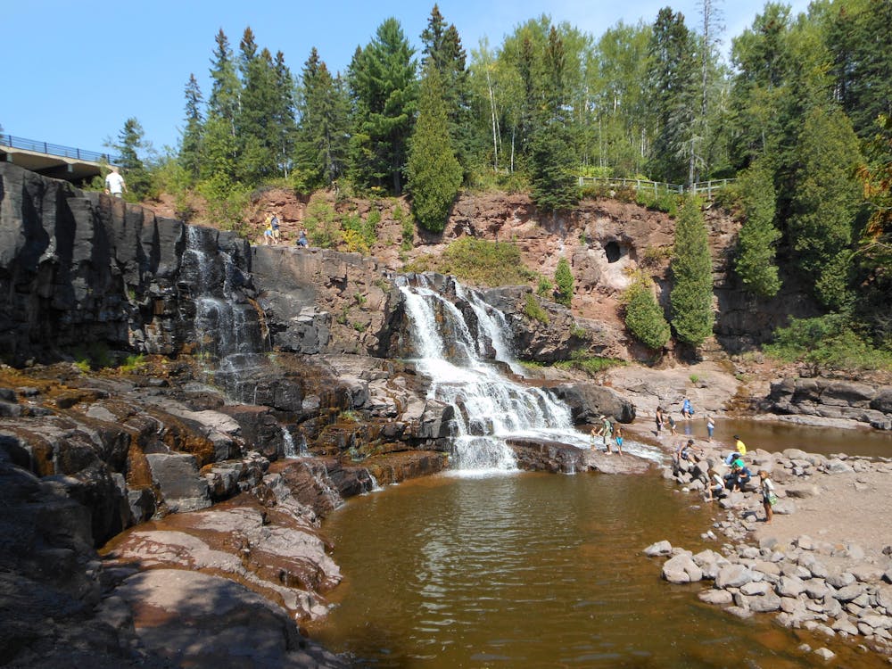
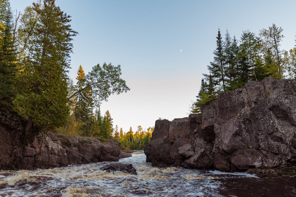
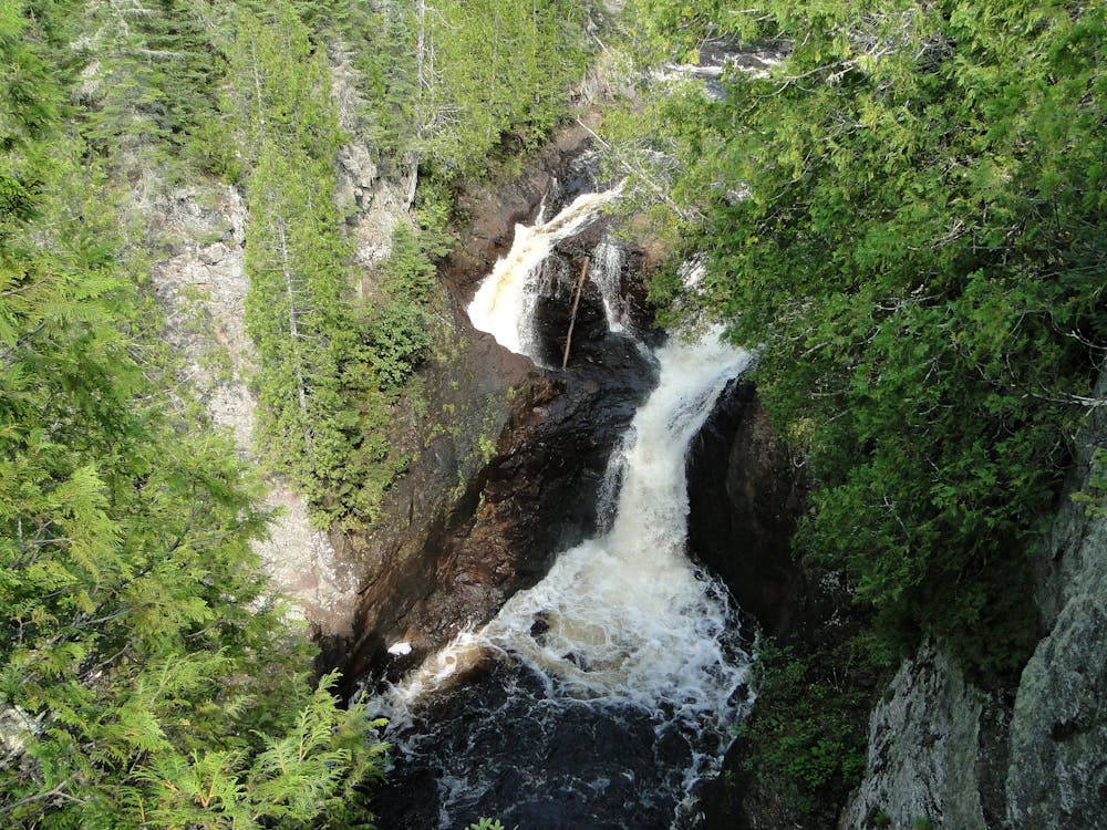
The trail dips in and out of river valleys, crosses whitewater streams, skirts around small lakes and beaver ponds, and climbs to elevated views on craggy hilltops. It is mostly backcountry but passes through the city of Duluth, several small towns, some private property, and through many developed recreation areas. A few specific highlights are: high bluffs near Silver Creek, waterfalls along Gooseberry River, a cliff-top lighthouse at Split Rock Lighthouse State Park, vantage over Lake Superior and the Temperance River Gorge from Carlton Peak, views of the Sawtooth Mountains, and the mysterious disappearing river at Devil’s Kettle Falls. Wildlife you may spot include deer, moose, beaver, foxes, black bears, and eagles.
The full trail officially stretches from the Wisconsin border at Jay Cooke State Park to near the Canadian border in Cook County. Camping is not allowed along the trail from Jay Cooke to Duluth, however, so this part is not typically done by backpackers. A traditional thru-hike covers only the 260 miles north of Martin Road Trailhead in northern Duluth.
Backcountry camping along this section is free and permits are not required, but you must stay in designated sites. There are nearly 100 of them, located either right next to the main trail or along short spur trails. Each site has tent pads, a fire ring, benches, and pit toilet, but no other amenities. You must pack in and pack out all your own gear and food. Natural water sources are generally plentiful, but some can dry up. They all require treatment before drinking. The trail intersects seven state parks that offer campgrounds with many more amenities, but require payment and possibly reservations. Long-distance hiking on the SHT is usually done in summer, but section hiking is popular year-round—for wildflowers in spring, foliage in fall, and for snowshoeing or skiing in winter.
Sources: https://superiorhiking.org/thru-hiking/ https://superiorhiking.org/guide-book-maps-and-gps/ http://www.boundarycountry.com/hikemap.html https://en.wikipedia.org/wiki/SuperiorHikingTrail
Difficulty
Difficult
Hiking trails where obstacles such as rocks or roots are prevalent. Some obstacles can require care to step over or around. At times, the trail can be worn and eroded. The grade of the trail is generally quite steep, and can often lead to strenuous hiking.
Medium Exposure

The trail contains some obstacles such as outcroppings and rock which could cause injury.
Remoteness
Away from help but easily accessed.
Best time to visit
Features
- Wildlife
- Historical
- Picturesque
- Dog friendly
- Wild flowers
- Water features
- Forestry or heavy vegetation