Surfbird Mountain
A narrow loop to a beautiful ridgeline.
Hiking Difficult
- Distance
- 7.3 km
- Ascent
- 473 m
- Descent
- 473 m
- Duration
- 2-3 hrs
- Low Point
- 1.2 km
- High Point
- 1.6 km
- Gradient
- 13˚

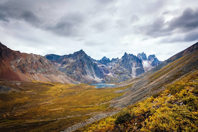
Surfbird Mountain is a beautiful hike through the tundra in the Blackstone Range, which is in the far northern reaches of Tombstone Territorial Park. The primary route heads up through the tundra to a pass in the mountain ridge. Once there, you can head further up and along the ridge to reach an elevated viewpoint with impressive views of the Blackstone Range.
Description
On your way back, you can either follow the same path you originally climbed, or you can turn this hike into a narrow loop, as shown here.
While the trailhead for Surfbird Mountain isn't far off of the Dempster Highway, this area of the world is extremely remote and rugged. Be prepared to be entirely self-sufficient on your hike, and follow all bear safety practices.
Sources: https://www.yukonhiking.ca/surfbird.html https://www.livesmallridefree.com/blog/surfbird-ridge-tombstone-territorial-park-yukon https://www.adventuresoflupe.com/?p=15211
Difficulty
Difficult
Hiking trails where obstacles such as rocks or roots are prevalent. Some obstacles can require care to step over or around. At times, the trail can be worn and eroded. The grade of the trail is generally quite steep, and can often lead to strenuous hiking.
Medium Exposure

The trail contains some obstacles such as outcroppings and rock which could cause injury.
Remoteness

In the high mountains or remote conditions, all individuals must be completely autonomous in every situation.
Best time to visit
Features
- Alpine
- Wildlife
- Picturesque
- Wild flowers
Guidebooks in this area