5.1 km away
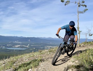
Mother T Loop
A classic black diamond descent with loam, exposure, and high speed ripping!
Severe Mountain Biking
- Distance
- 13 km
- Ascent
- 504 m
- Descent
- 504 m
A fantastic cross county ride touring some of Whitehorse's best trails and affording beautiful views of Miles Canyon.
Mountain Biking Moderate

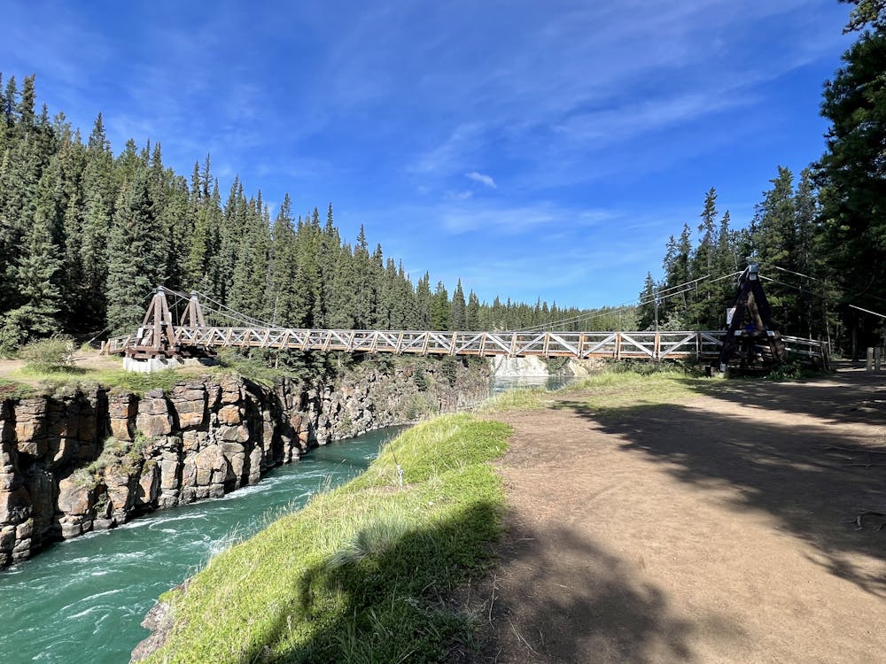
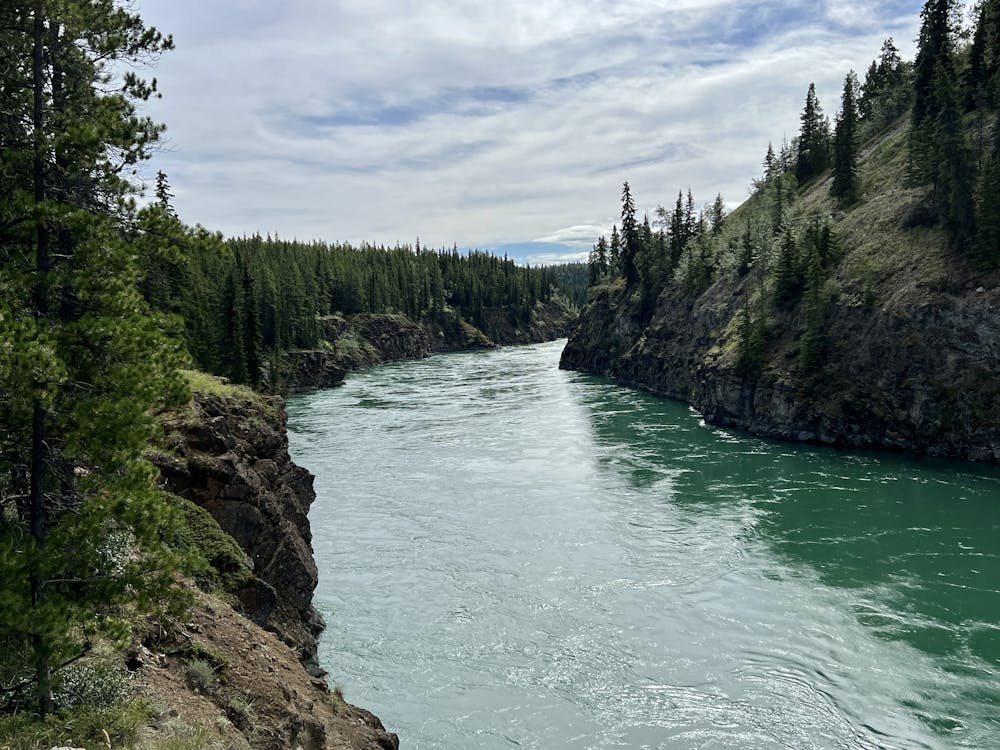
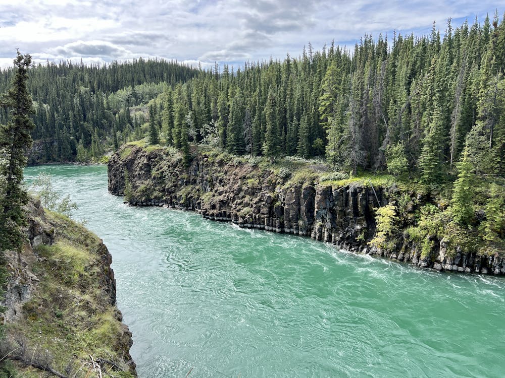
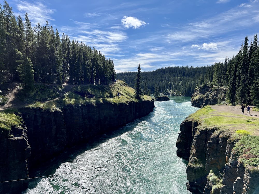
This pedal-forward ride departs from the popular Miles Canyon trailhead and begins by crossing a stunning suspension bridge above the Yukon River, where it rages through the canyon. The walls are formed by pillars of volcanic basalt, forcing the river into a churning, surging ribbon of green water.
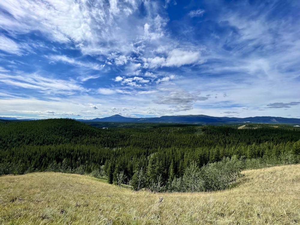
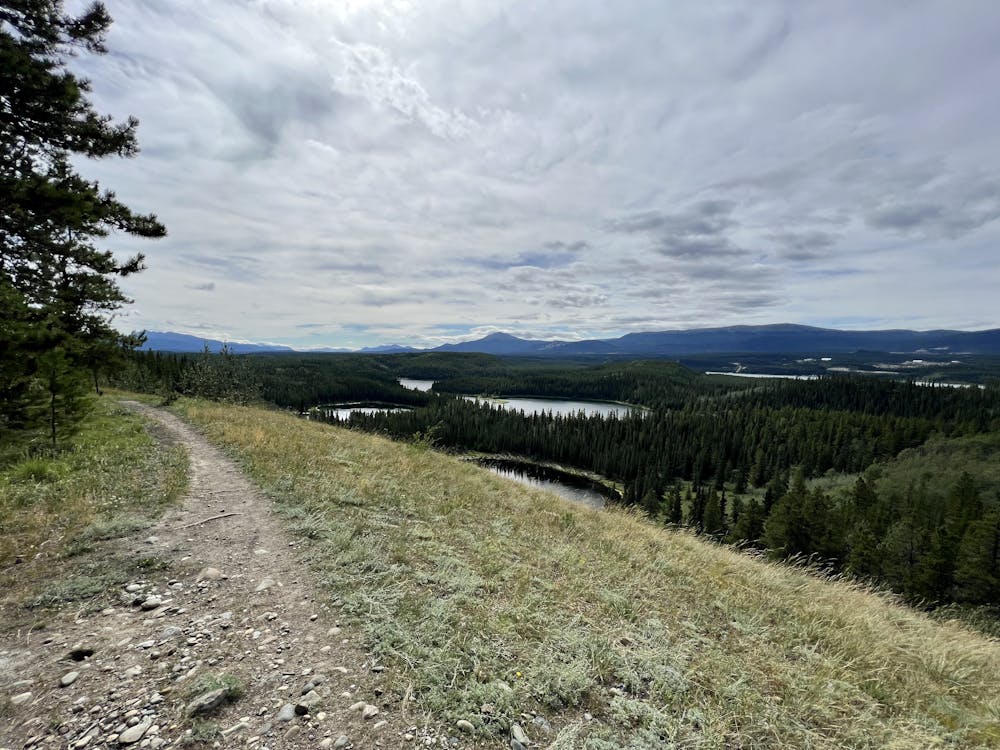
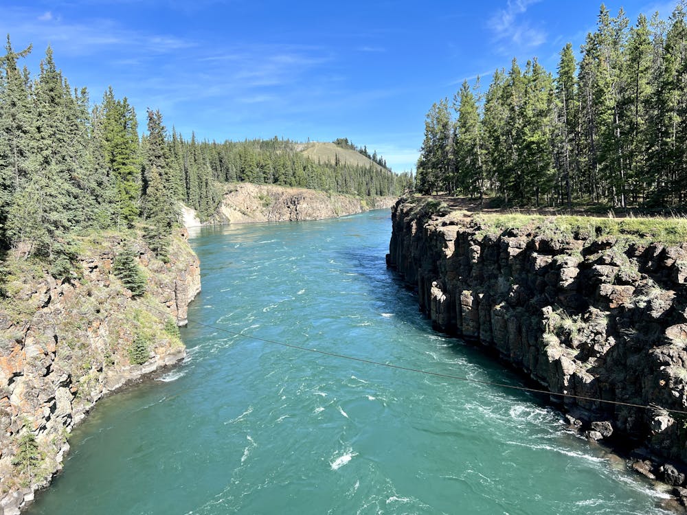
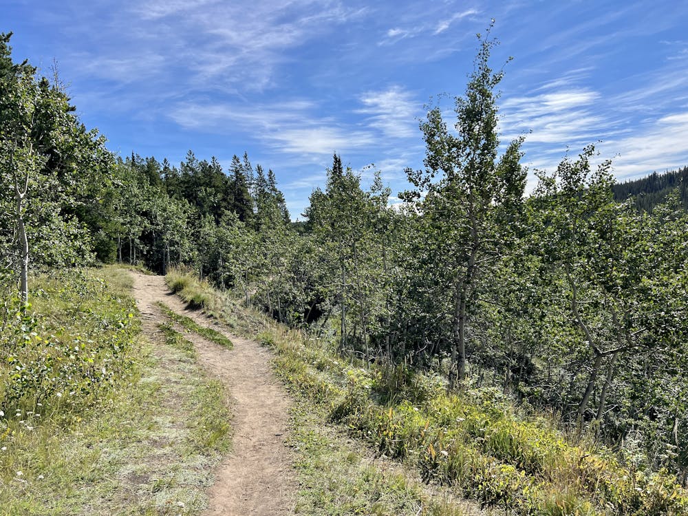
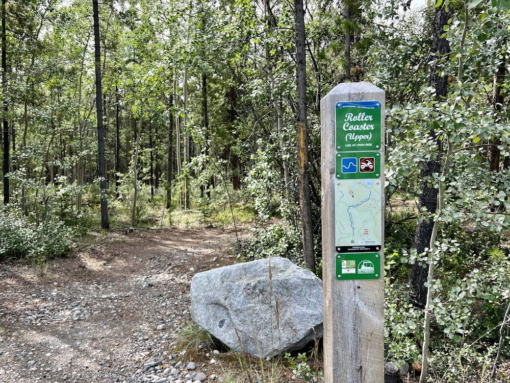
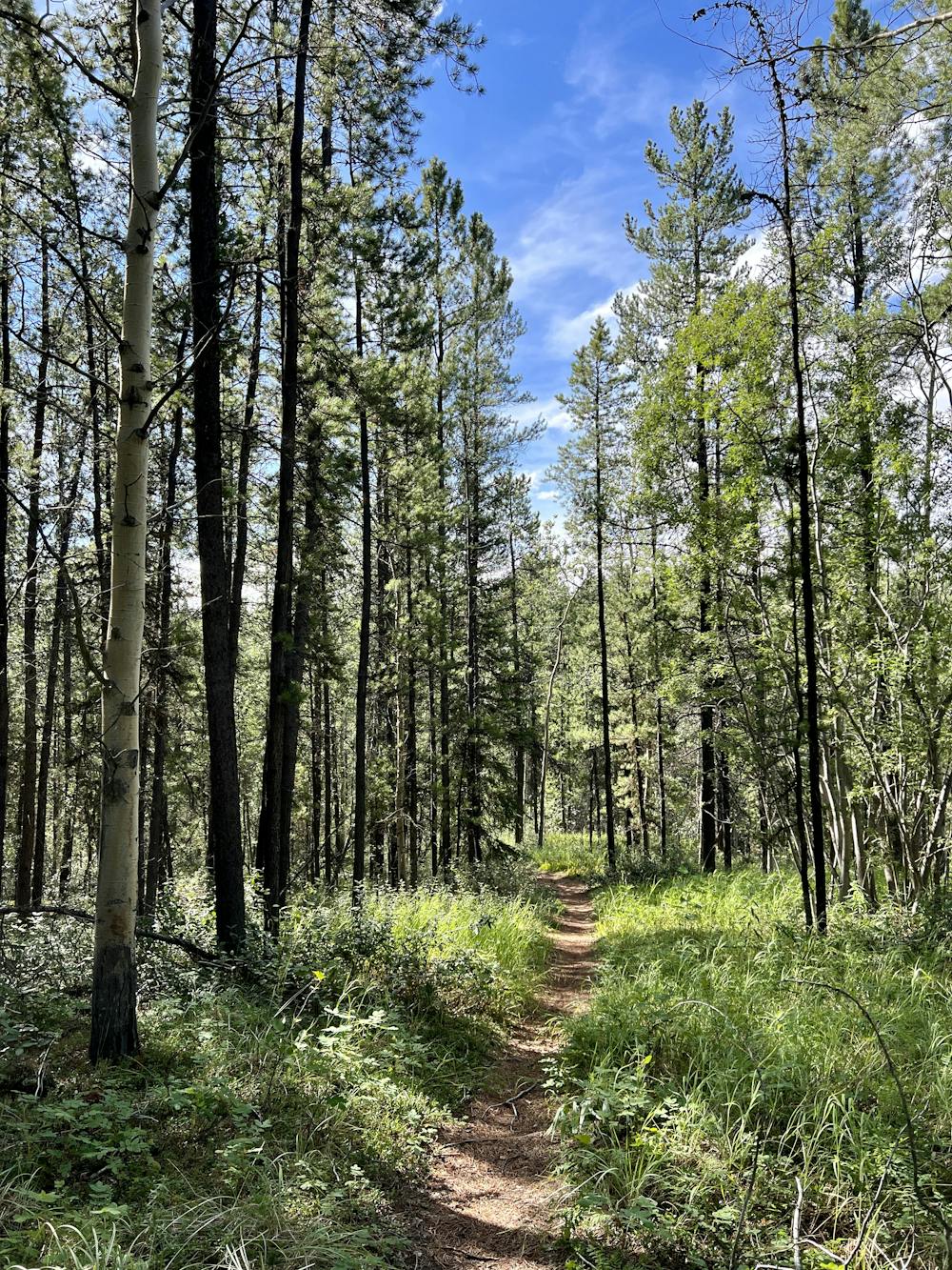
After crossing the bridge, take a right along the canyon to begin the loop with incredible views of the river. After pedaling along the water for a stretch, the route as mapped takes a left and begins working its way up toward Grey Mountain Road. Fair warning: there are a ton of trails that spider through this zone, and all of them look roughly the same. The riding here consists of singletrack and some doubletrack running through a young pine forest, traversing sandy trails laced with tree roots. Not all of the trails will be marked in the OSM layer or even in the most up-to-date online trail maps, so take everything with a grain of salt and just make sure you're moving in the right direction. If you download this route for offline use, it will help you make an efficient path up to Grey Mountain Road.
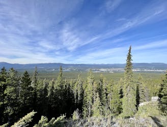
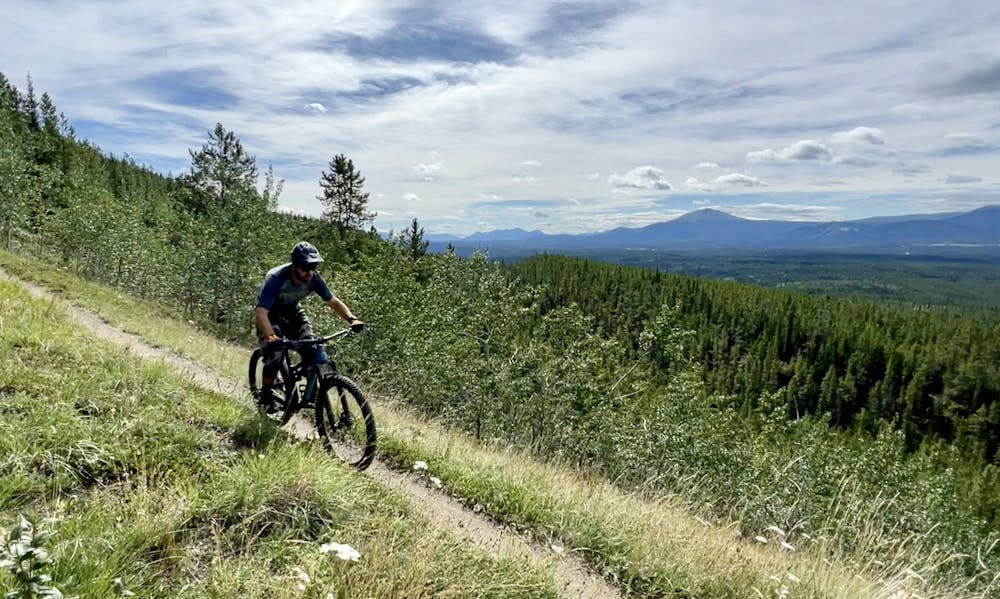
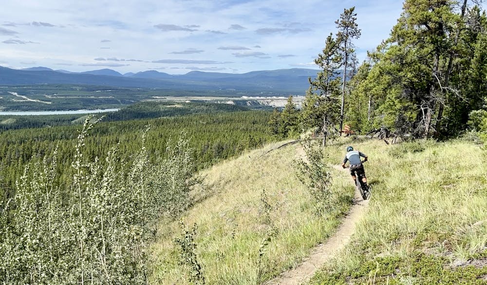
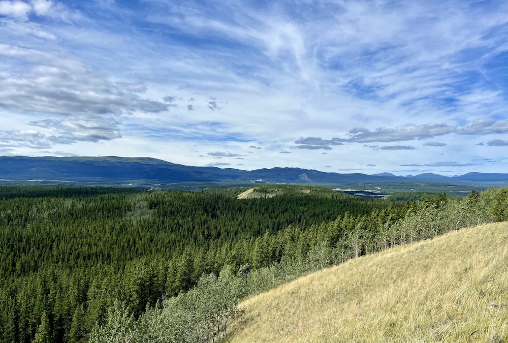
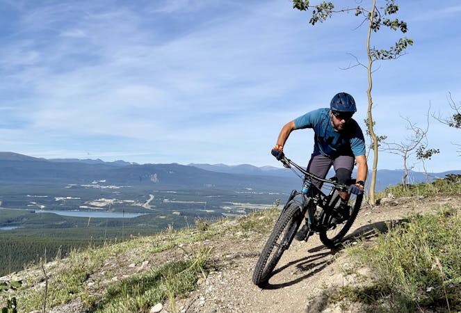
Once at Grey Mountain Road, you could choose to continue beyond the road and further up the mountain for a truly epic ride. (See the Mother T and Gnar Wall loops, mapped separately.) However, the route shown here traverses the road for a bit and then drops into El Camino. This short, flowy trail is the true highlight of this ride! It flows down a steep section of singletrack and then breaks out of the trees to roll through a ridgeline meadow. While the flow is fantastic and the speeds are high, it's worth taking a second to soak in the incredible views of the valley below! The final drop on El Camino is fairly steep, but it's not all that technical.
After El Camino, there are several options for descending back down the mountainside, but the route mapped here is fast, flowy, and drops you down to the river quickly. You'll have to grunt up and over Heartbreak Hill to reach the riverside trail, but if you put your head down and work, it's over quickly.
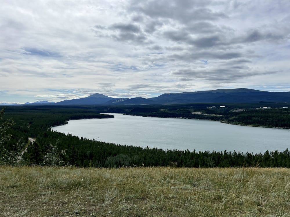
The ride finishes by traversing along the shores of Schwatka lake, which is essentially a widening in the Yukon River created by a dam. After a bit of pedaling along a circuitous lakeshore route, you'll reach Miles Canyon again and spend some time traversing above a gorgeous section of the canyon with incredible views of the Yukon. What a fantastic way to finish this pedal through the woods, mountains, and along the rivers of the Yukon!
Moderate
Mostly stable trail tread with some variability, with unavoidable obstacles 8in/20cm tall or less. Other obstacles such as rock gullies and steep sections may exist. Ideal for lower intermediate riders.

Some trail sections have exposed ledges or steep ascents/descents where falling could cause serious injury.

Away from help but easily accessed.
5.1 km away
A classic black diamond descent with loam, exposure, and high speed ripping!
Severe Mountain Biking
5.1 km away
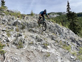
One of Grey Mountain's famous double black diamond tech trails.
Extreme Mountain Biking
5.1 km away
Pair beautiful views and fast ripping with a challenging double black diamond tech trail.
Extreme Mountain Biking
7 routes · Mountain Biking
10 routes · Mountain Biking