La Caceria 1
An unbelievable romp down the flanks of Chimborazo.
Severe Mountain Biking
- Distance
- 8.3 km
- Ascent
- 107 m
- Descent
- 1 km
An absolutely surreal mountain biking experience!
Mountain Biking Severe

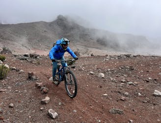
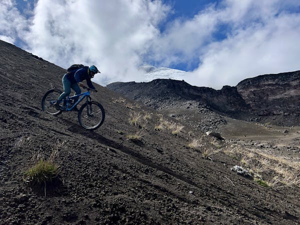
The La Caceria trails are home to some of the best shredding on the flanks of Chimborazo! La Caceria 2—located further to the north—begins with fast downhill surfing through soft sand volcanic sand dunes. It's rare to find true, legal "freeride" mountain biking, but this is it! You can carve beautiful turns down this wide-open sand slope, with impressive views of the mountain behind. Be sure to enjoy this section because it can go by so quickly!
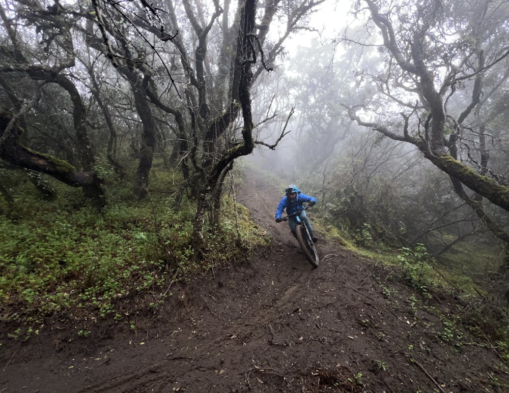
The wide-open freeride section on La Caceria 2 is shorter as the trail drops into a mystical forest filled with gnarly trees. The landscape feels absolutely surreal, in part because the trees are all growing straight out of the silty volcanic sand. You'll find yourself drifting through 6-12 inches of soft sand down a "trail" that winds between the craggy, ancient trees. There might not be another trail like this one anywhere else in the world!
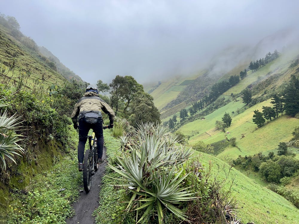
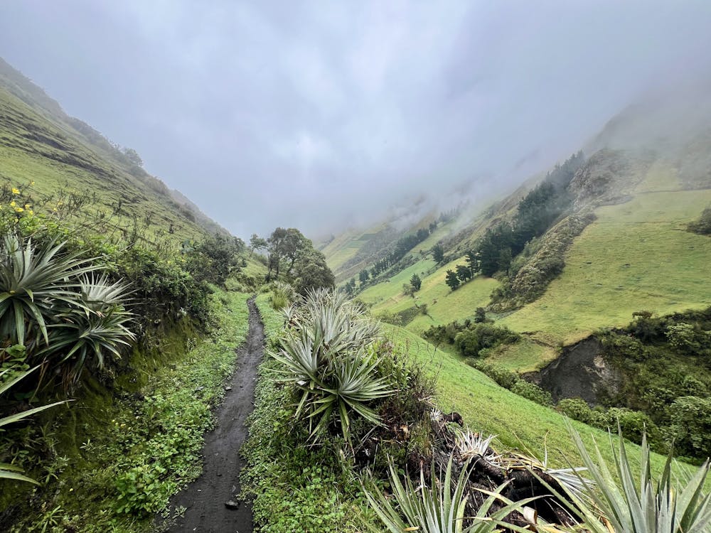
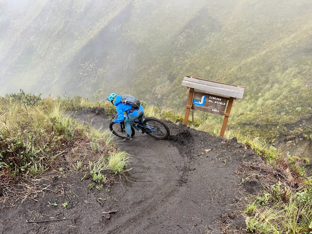
Lower down, the trail drops out of the sand into the paramo landscape and eventually into a lusher climate zone as it descends into a valley lower down the mountainside that's filled with waterfalls and a rushing mountain stream. Here, the quality of the trail improves dramatically, with some true benchcut singletrack clinging to the steep mountainsides. Some of these sections of trail even see routine trail maintenance, making them some of the best sections of singletrack that I rode in Ecuador.
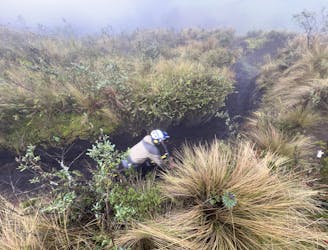
In the middle, the trail drops into steep turns through deeply eroded trenches that can become very slick when wet (which happens a lot in Ecuador). In the midst of the trenches, the route re-joins the La Caceria 1 route. After popping out of the trenches and onto the exposed mountainside, the trail gets progressively slipperier (or looser, if dry), with some seriously exposed sections.
Eventually, the trail crosses the river at the bottom of the valley, followed by a climb up the opposite side before one final descent down to the road. The final section of the descent is very well maintained, offering some fast ripping with chunky rocks for a great finish to this iconic trail!
While the trail might look straightforward on the map, sorting out ride logistics and navigating some of Ecuador's trails can prove to be very difficult. I hired Andrés Chacho López of Epic Andes Tours to guide me on this ride and sort out the logistics, and I was very glad I did! From sorting out all the shuttles and drivers to guiding me down windswept screefields with nary a sign of a trail, working with Andrés in Ecuador was 100% the way to go!
Severe
Widely variable, narrow trail tread with steeper grades and unavoidable obstacles of 15in/38cm tall or less. Obstacles may include unavoidable bridges 24in/61cm wide or less, large rocks, gravel, difficult root sections, and more. Ideal for advanced-level riders.

Some trail sections have exposed ledges or steep ascents/descents where falling could cause serious injury.
Little chance of being seen or helped in case of an accident.
An unbelievable romp down the flanks of Chimborazo.
Severe Mountain Biking
4.3 km away
One of the highest elevation "bike-specific" trails in the world!
Difficult Mountain Biking
6 routes · Mountain Biking