4.3 km away
La Caceria 1
An unbelievable romp down the flanks of Chimborazo.
Severe Mountain Biking
- Distance
- 8.3 km
- Ascent
- 107 m
- Descent
- 1 km
One of the highest elevation "bike-specific" trails in the world!
Mountain Biking Difficult

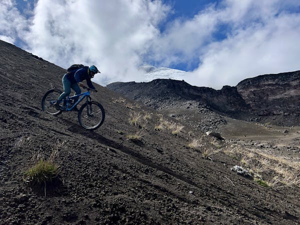
The Prime 1 trail on the flanks of sky-scraping mount Chimborazo might be the highest-elevation "bike-specific" mountain bike trail in the world. However, the so-called bike-specific trail construction consists primarily of wooden stakes pounded into sandy slopes filled with volcanic lava rock, but still—this ride is one hell of an experience!


The trail begins from the Refugio Carrel, high on the flanks of Chimborazo. Chimborazo soars to 20,500 feet above sea level, and due to the planet's equatorial bulge, the summit of this mountain is the furthest point of land from the center of the earth. While the ride mapped here doesn't reach the absolute top of the volcano, it still begins at a sky-scraping 15,909 feet (according to FATMAP). Thankfully, with a 4x4 vehicle, you can easily get shuttled to the highest point of the ride for a raucous 2,600 feet of downhill ripping at a truly oxygen-deprived elevation.
The upper reaches of Prime 1 descend through sandy/rocky terrain, with large lava rocks mixed in. There are some big boulders and tech obstacles to twist around and work through, providing a fun but not too technical ride quality. After threading through some big boulders, the trail drops into a valley, with turns swooping back and forth through the wash.
Next, the trail drops into a steeper section with some wide-open high-speed surfing down loose volcanic pumice. Thanks to wide-open sight lines, this section is FAST (as long as you aren't socked in by clouds).
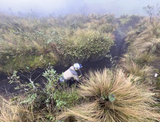
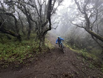
Near the end of the trail, the singletrack drops into the paramo climate zone, consisting of tall grasses and richer dirt. Here, Prime 1 becomes a classic singletrack, with some great sidehilling to finish up this 3.4-mile descent.
While the trail might look straightforward on the map, sorting out ride logistics and navigating some of Ecuador's trails can prove to be very difficult. I hired Andrés Chacho López of Epic Andes Tours to guide me on this ride and sort out the logistics, and I was very glad I did! From sorting out all the shuttles and drivers to guiding me down windswept screefields with nary a sign of a trail, working with Andrés in Ecuador was 100% the way to go!
Difficult
Mostly stable trail tread with some variability featuring larger and more unavoidable obstacles that may include, but not be limited to: bigger stones, roots, steps, and narrow curves. Compared to lower intermediate, technical difficulty is more advanced and grades of slopes are steeper. Ideal for upper intermediate riders.

The trail contains some obstacles such as outcroppings and rock which could cause injury.

Little chance of being seen or helped in case of an accident.
4.3 km away
An unbelievable romp down the flanks of Chimborazo.
Severe Mountain Biking
4.3 km away
An absolutely surreal mountain biking experience!
Severe Mountain Biking
6 routes · Mountain Biking