Holy Ridge
An absolutely stupendous ride down the flanks of one of the world's tallest active volcanoes!
Severe Mountain Biking
- Distance
- 6 km
- Ascent
- 11 m
- Descent
- 766 m
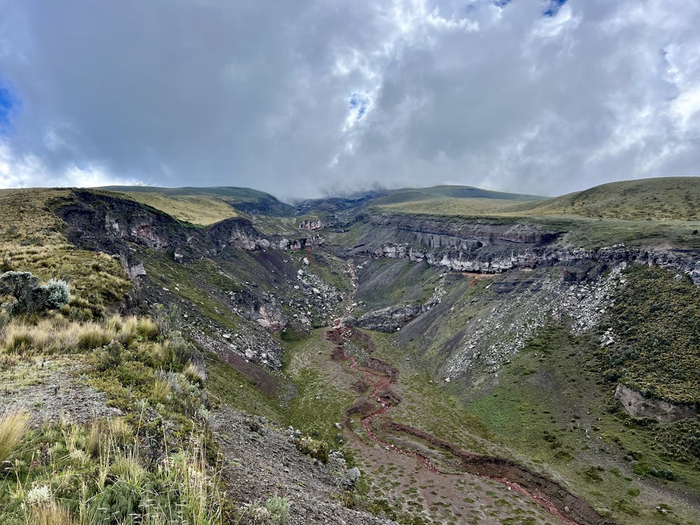
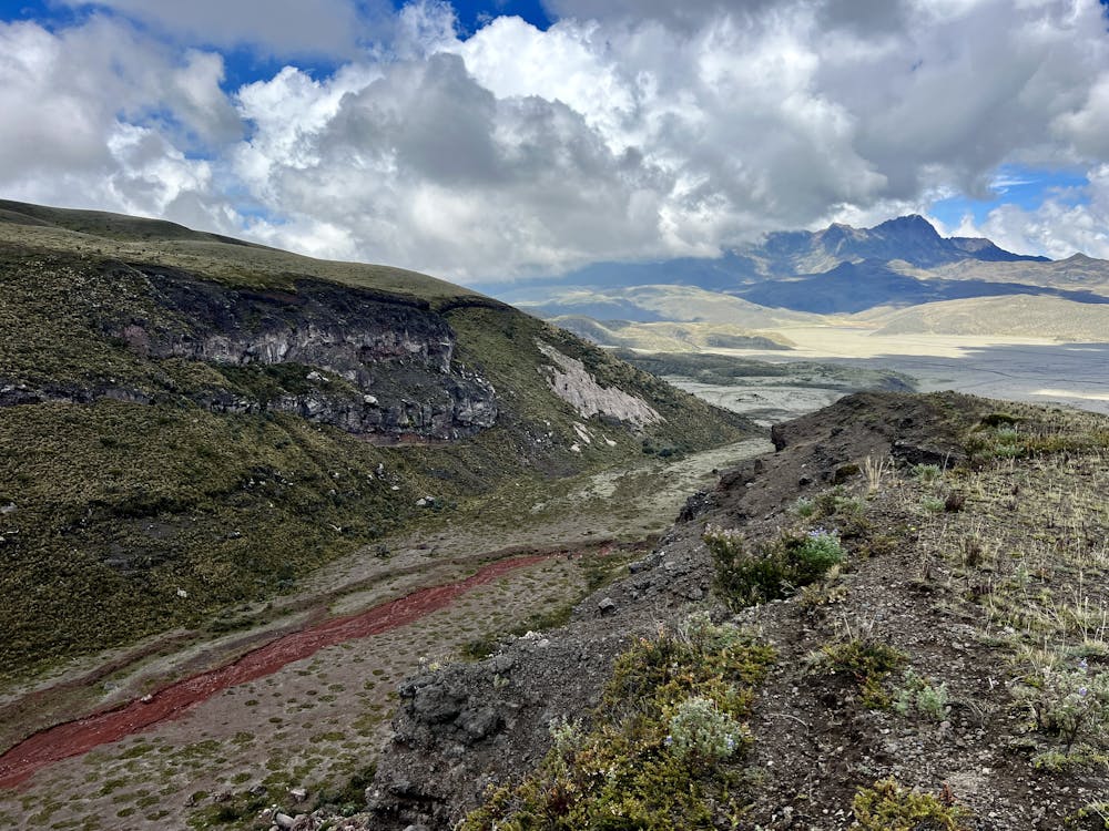
A scenic run along a canyon on the flanks of Cotopaxi.
Also in Pichincha, Ecuador
Mountain Biking Difficult

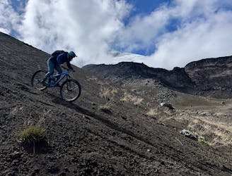
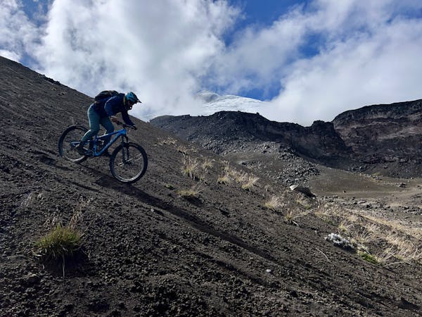
Vuelo del Condor is one of the best singletrack trails on the slopes of Cotopaxi—one of the tallest active volcanoes in the world. This ripping descent combines freeride-shredding on wide-open scree fields with high-speed singletrack and tech features.
After a grueling shuttle up a rutted-out dirt road, you'll unload in a sandy parking lot at 15,132 feet above sea level. Be sure to take a moment to pause and look up at the towering glacier above you and soak in the enormity of the landscape that you're preparing to shred on your mountain bike.
The descent begins on a wide-open slope of volcanic gravel and sand. With free reign to ride wherever you please, you can choose to carve swoopy turns into the loose grit, just like your favorite professional freerider. But as it turns out, carving turns down a volcano is harder than it looks! Just getting down these steep slopes in one piece is an accomplishment. That said, the beginning of Vuelo del Condor isn't nearly as steep as the entrance to nearby Holy Ridge.
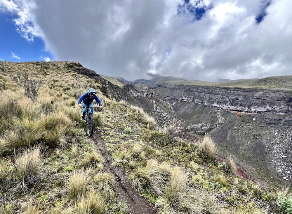
All too soon, the freeride slopes are gone in exchange for a narrow singletrack forming through the paramo. This stretch of trail can be eroded, so watch out for wheel-sucking holes and ditches. In fact, this section culminates in a steep skid down a washed-out trench—not the best stretch of riding by any means.
However, the pain comes before the reward, as you'll soon reach the rim of an incredible canyon running down the side of the volcano. You'll enjoy some sublime singletrack ripping through an absolutely surreal landscape!
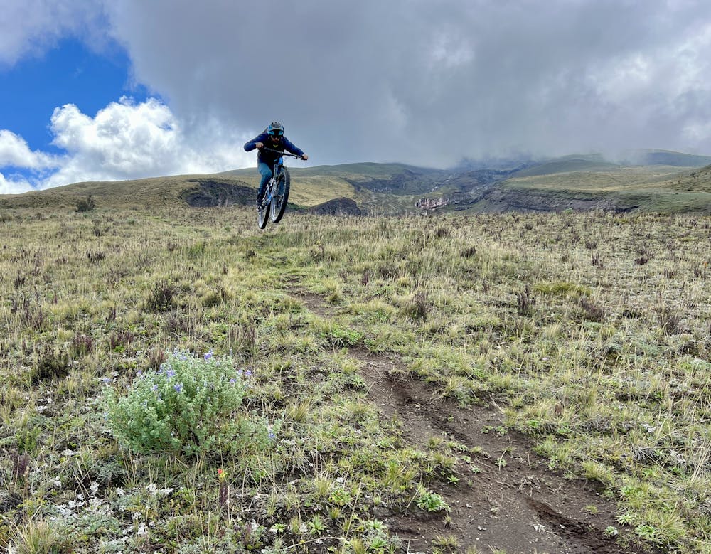
The trail finishes on a fast but non-technical run-out, dropping out at the road all too soon.
While the trail might look straightforward on the map, sorting out ride logistics and navigating some of Ecuador's trails can prove to be very difficult. I hired Andrés Chacho López of Epic Andes Tours to guide me on this ride and sort out the logistics, and I was very glad I did! From sorting out all the shuttles and drivers to guiding me down windswept screefields with nary a sign of a trail, working with Andrés in Ecuador was 100% the way to go!
Difficult
Mostly stable trail tread with some variability featuring larger and more unavoidable obstacles that may include, but not be limited to: bigger stones, roots, steps, and narrow curves. Compared to lower intermediate, technical difficulty is more advanced and grades of slopes are steeper. Ideal for upper intermediate riders.

The trail contains some obstacles such as outcroppings and rock which could cause injury.

Little chance of being seen or helped in case of an accident.
An absolutely stupendous ride down the flanks of one of the world's tallest active volcanoes!
Severe Mountain Biking
6 routes · Mountain Biking