6 routes · Mountain Biking
A brutal death march of an enduro ride.
Mountain Biking Difficult
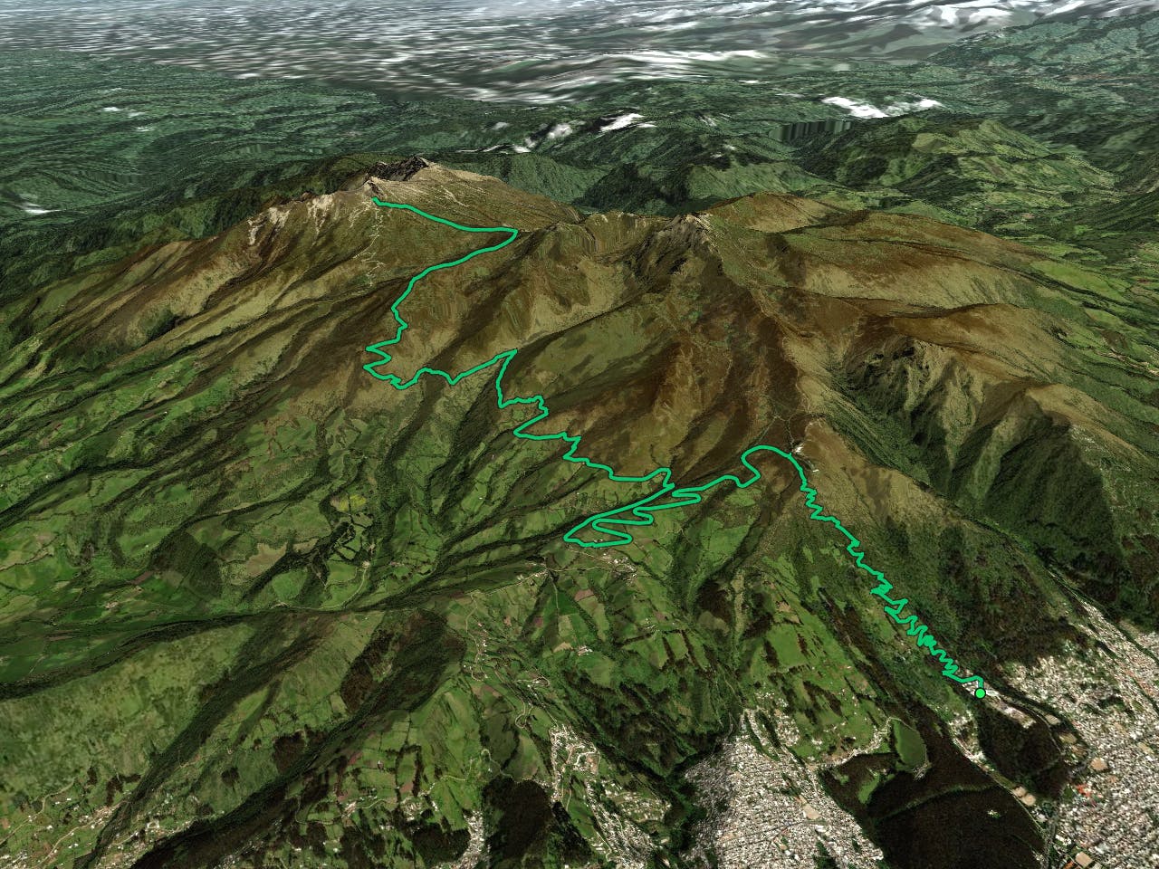
Valle de la Muerte is widely known as one of the premier enduro shuttle runs near the city of Quito, but even so, it's a brutal ride that can turn into a bit of a death march. Based on my personal experience, I'm not sure that I would recommend it... but if you decide that you want to ignore my advice, here's how you would ride it.
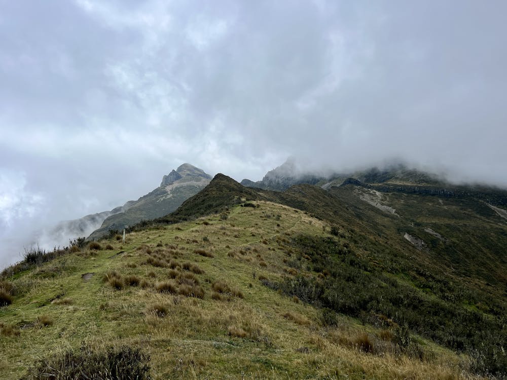
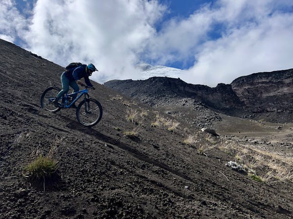
The ride begins at the Refugio del Volcan Pichincha at ~14,918 feet. If you so choose, you can turn uphill from the refuge and push your bike up to the rim of the volcanic crater and take in an incredible view of this otherworldly landscape... that is, if it isn't socked in in fog. If you choose to hike up to the rim, you'll top out at ~15,353 feet, while the top of the volcano—Guagua Pichincha— is 15,696 feet.
The road up to the refugio is a long, rough dirt track that is definitely not the type of terrain that you want to risk with a typical rental car. I hired Xavier from Ecuventures to shuttle me to the top for about $90, and it was absolutely the right call. While that's a bit expensive for just one person, if you can split the ride between two or three people, it's not bad for such an epic ride.
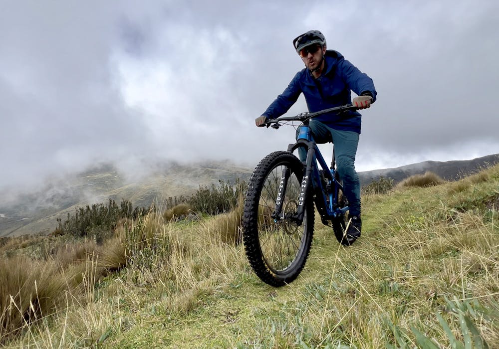
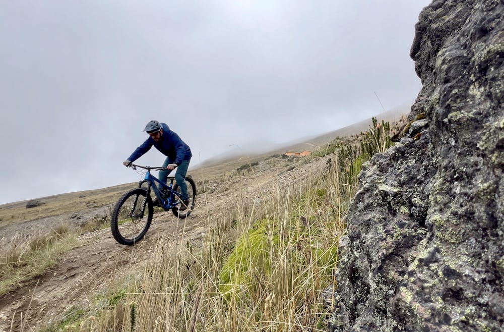
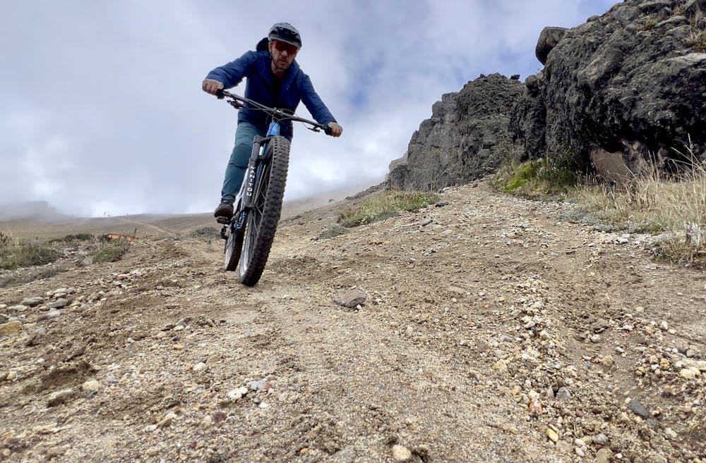
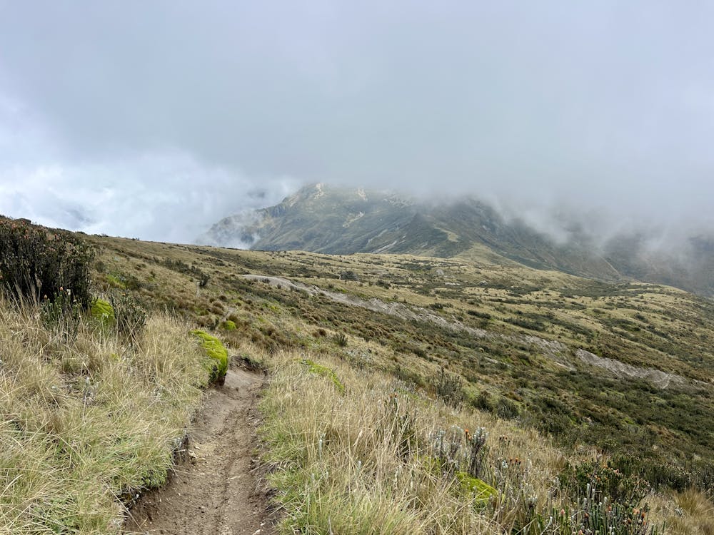
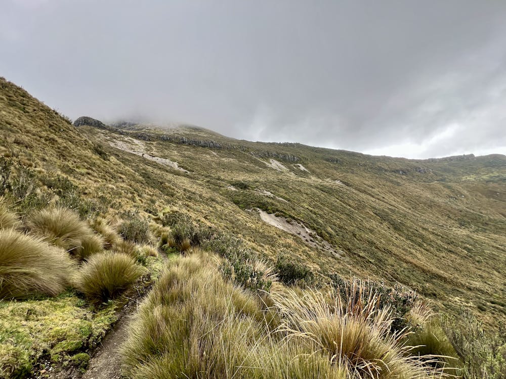
After turning downhill from the refugio, you'll enjoy some steep, sandy descending as the singletrack quickly drops out of the sandy, rocky alpine landscape into the grassy paramo landscape. The initial descent is over pretty quickly. At a fork in the trail, take a right to follow Valle de la Muerte, which will traverse along the side of the mountain ridge, soon crossing a low saddle via a mellow climb. Be sure to enjoy the incredible scenery from this gorgeous section of trail!
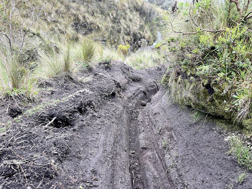
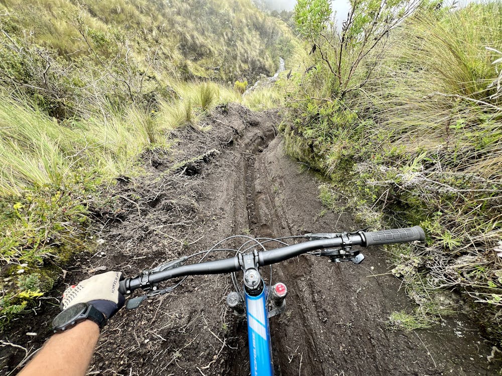
After crossing the low saddle, the route truly turns downhill, but about the time it starts heading down, a never-ending series of ruts and holes begins, eliminating any chance of fun descending. For the worst ruts, riders have to take their feet off the pedals to outrigger as the pedals drag in the dirt on the sides of the ruts. Some of the trenches were even handlebar deep!
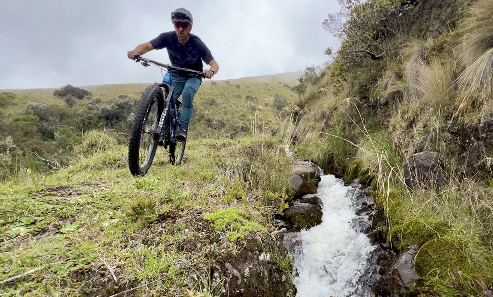
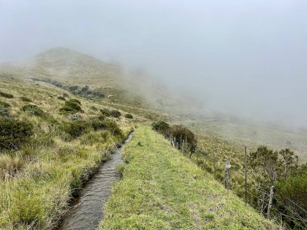
After dropping out of this brutally rutted section, you'll reach a series of irrigation ditches with a faint, grassy trail running alongside them. Some of these sections of trail are scenic and fun (albeit slow going with the grass to pedal through), and others are brutally rutted out and filled with cow manure. There are also some seriously technical stream crossings and several gates to open and close.
Finally, the trail drops out into a dirt road and rolls down to a few houses—but you're still thousands of feet above the city of Quito. From here, there are several different options to get down to the city below. The route that I personally took was so sketchy that I can't recommend it, so the route shown here climbs uphill for about a thousand vertical feet to reach the top of the Teleferiqo downhill trail.
Depending on when you ride it, the Teleferiqo trails can be fun and well-maintained, or they can be eroded, muddy ditches. It's an absolute crap shoot, and you'll have no idea what you're getting into. However, you can be assured that, at the very least, you'll be able to follow the route and not get seriously lost along the way—which is more than can be said for some of the other trails on this mountainside.
If, after reading this description, you're still considering attempting Valle de la Muerte, well then—buen viaje to you!
Difficult
Mostly stable trail tread with some variability featuring larger and more unavoidable obstacles that may include, but not be limited to: bigger stones, roots, steps, and narrow curves. Compared to lower intermediate, technical difficulty is more advanced and grades of slopes are steeper. Ideal for upper intermediate riders.

The trail contains some obstacles such as outcroppings and rock which could cause injury.

In the high mountains or remote conditions, all individuals must be completely autonomous in every situation.
6 routes · Mountain Biking