2 km away
Rochers Rouge

Lots of possible lines offering good variations to the main Lavancher bowl lines with many interesting bumps and rolls.
Difficult Freeride Skiing
- Distance
- 1 km
- Ascent
- 0 m
- Descent
- 510 m
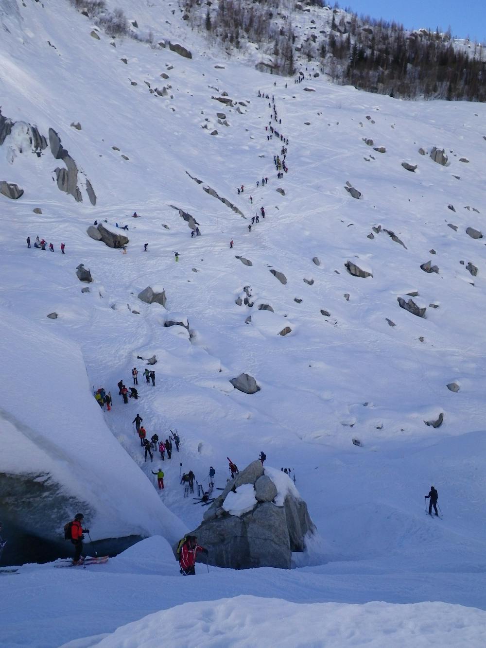
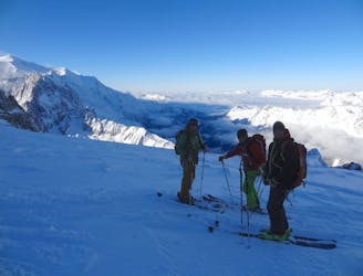
The "James Bond" track; hero skiing home after the Vallée Blanche
Freeride Skiing Moderate

From below the end of the Mer de Glace, look out for the ski tracks leading to the 10-20 min bootpack that leads up to the buvette des Mottets, where you can enjoy a drink after carrying your skis for a while. Enjoy the 4x4 track 'James Bond' style all the way back down to Chamonix. It is not always in good condition early or later in the season - be sure it is OK before planning on going down this way or you are in for an incredibly long walk! When snowy and in good condition, the line features countless fun hairpins and fast straights through the forest.
Moderate
Slopes become slightly steeper at around 25-30 degrees.

As well as the slope itself, there are some obstacles (such as rock outcrops) which could aggravate injury.
Away from help but easily accessed.
2 km away
Lots of possible lines offering good variations to the main Lavancher bowl lines with many interesting bumps and rolls.
Difficult Freeride Skiing
2.1 km away

A great alternative to the main bowl lines with fantastic skiing and reliable powder.
Difficult Freeride Skiing
2.1 km away
One for the poseur! A much-eyed line down a spectacular couloir. Not to be under-estimated
Severe Freeride Skiing
2.2 km away

A classic Grands Montets line; open, varied, great skiing
Difficult Freeride Skiing
2.5 km away
A wonderful variation on the legendary Pas de Chèvre. Serious skiing in a spectacular big mountain environment
Difficult Freeride Skiing
2.5 km away

Slyly crosses the ridge from the Bochard to find fine slopes on skier's right of the Lavancher bowl
Difficult Freeride Skiing
2.7 km away

A narrow hidden bowl at 35 degrees
Difficult Freeride Skiing
2.8 km away

A fun mini-adventure through the forest, with some steep drop-offs, this is particularly good in powder and windy bad vis days.
Difficult Freeride Skiing
2.8 km away
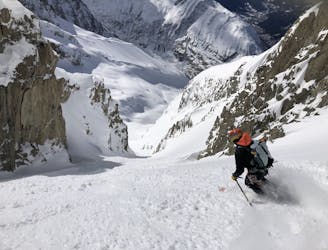
A steep, narrow couloir in wild high mountain terrain
Severe Freeride Skiing
3 km away

A small open bowl between the trees, often bumpy but usually good fun.
Moderate Freeride Skiing

10 routes · Freeride Skiing

10 routes · Freeride Skiing