2.8 km away
Via Alpina: Samoens to Le Buet via the Aiguilles Rouges
A 3-day hike along part of the Via Alpina in the stunning Haute-Savoie region of France.
Moderate Hiking
- Distance
- 53 km
- Ascent
- 3.8 km
- Descent
- 3.2 km
A hike beginning with easy trails and ending by scrambling to a summit.
Hiking Extreme

Although hiking in this part of the Alps is mostly done on well-maintained trails, it’s still possible to add a bit more adventure in one’s day out.
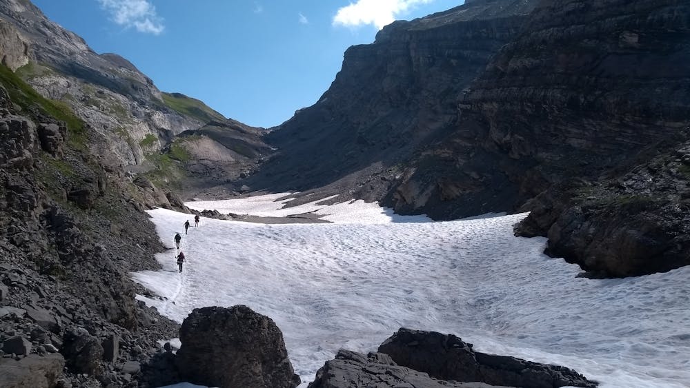
This route starts off along an easy trail in the forest that will take you to refuge de Folly. There will be a few exposed areas after 10 minutes of walking where chains/steps have been bolted in the rock to assist hikers. Eventually, you’ll finally have a more open view of the surrounding area.
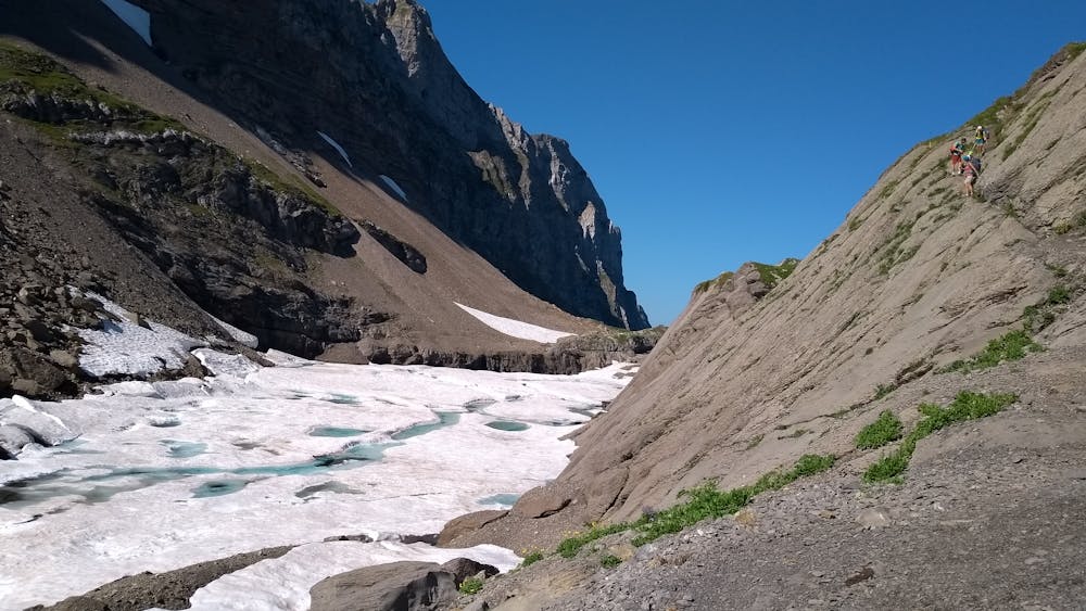
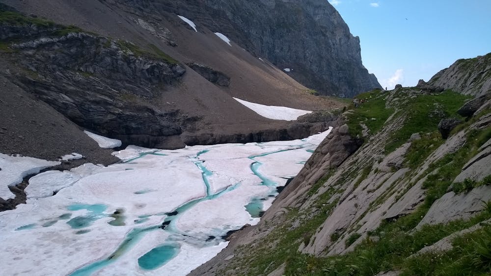
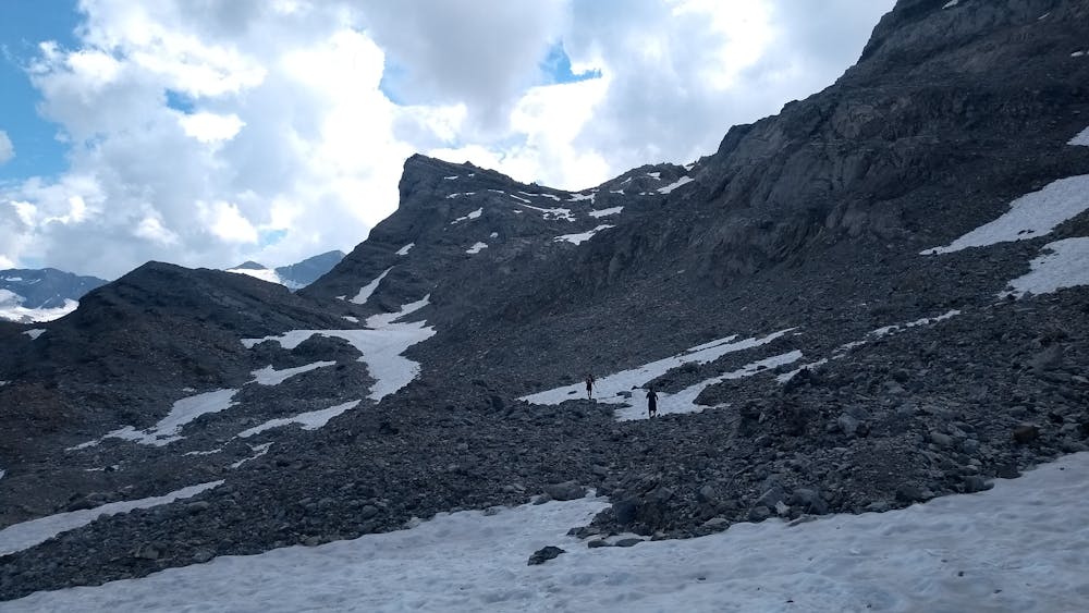
From the refuge, the climb gets steeper, and the vegetation becomes gradually sparser until you reach Lac des Chambres, where any trace of green will be almost gone. As it’s well protected from the sun, small icebergs can be seen floating on the lake well into the summer, and it’s always a new experience to visit it.
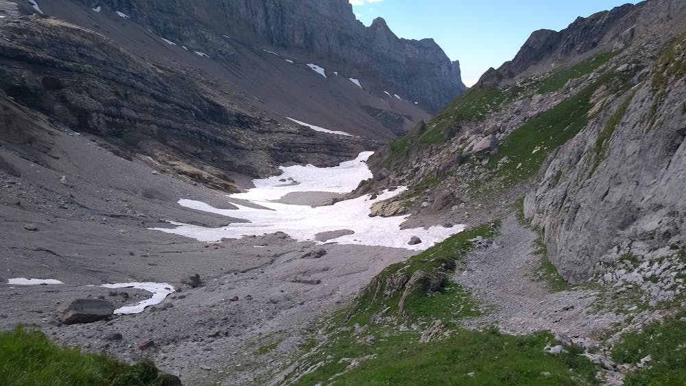
The lake is a great hiking goal in itself, but if you decide to continue, be aware that from that point on, the trail becomes more technical. First, you’ll need to pass the lake with a bit of scrambling on the north side, with chains to help. Be aware that some of them are only put in place when the refuge is open for business. Then, hike towards the Col des Chambres. The trail can be harder to find at times, so look for paint markings and cairns, and be wary of remaining snow accumulations that can be present all summer long.
At about 2300m of altitude, you should finally be able to see the Pointe de Bellegarde on your right and the col straight ahead. To reach the summit from there, you have the option of going straight for it by crossing the “Grand névé” by following scattered cairns, but you’ll probably regularly lose them and will need decent route-finding skills to make your way to the top, as the surrounding terrain is made up of loose rocks on sometimes steep slopes.
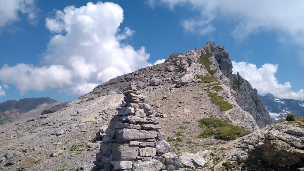
The other option, which is a bit longer, is to continue to the col, where an easier-to-follow trail leads to the summit. Whichever option you choose (the presence of snow that can make the endeavour much easier/harder), you’ll need decent scrambling skills to safely navigate this part of the climb, but the reward will be worth it.
After a final section on impressive limestone pavements, the panorama from the summit will offer a view only obstructed by les Avoudrues; you’ll be able to see the refuge de Vogealle and the Cirque du Fer à Cheval below, as well as Mont Blanc, Buet, and Dents du Midi, to name a few.
The climb down is along the same route, although it might initially be easier to follow the trail to the col des Chambres as it’s generally on more stable rocks.
Extreme
Scrambling up mountains and along technical trails with moderate fall exposure. Handholds are necessary to navigate the trail in its entirety, although they are not necessary at all times. Some obstacles can be very large and difficult to navigate, and the grades can often be near-vertical. The challenge of the trail and the steepness of the grade results in very strenuous hiking. Hikes of this difficulty blur the lines between "hiking" and "climbing".

Some trail sections have exposed ledges or steep ascents/descents where falling could cause serious injury.
Little chance of being seen or helped in case of an accident.
2.8 km away
A 3-day hike along part of the Via Alpina in the stunning Haute-Savoie region of France.
Moderate Hiking
8.1 km away
Visit an alpine lake before discovering one of France's 17 "Grand Sites de France," the glacial cirque of Fer à Cheval.
Difficult Hiking

3 routes · Hiking