8.1 km away
Pointe de Bellegarde
A hike beginning with easy trails and ending by scrambling to a summit.
Extreme Hiking
- Distance
- 18 km
- Ascent
- 1.7 km
- Descent
- 1.7 km
Visit an alpine lake before discovering one of France's 17 "Grand Sites de France," the glacial cirque of Fer à Cheval.
Hiking Difficult
Take advantage of the large gravel road to gently warm up, as once you’ll reach the trail up to Chalet du Boret, the climb will get much steeper. This bit can get fairly technical and exposed at times, but chains have been setup to secure the path in the most dangerous parts. Regular hikers should have no trouble reaching the chalet.
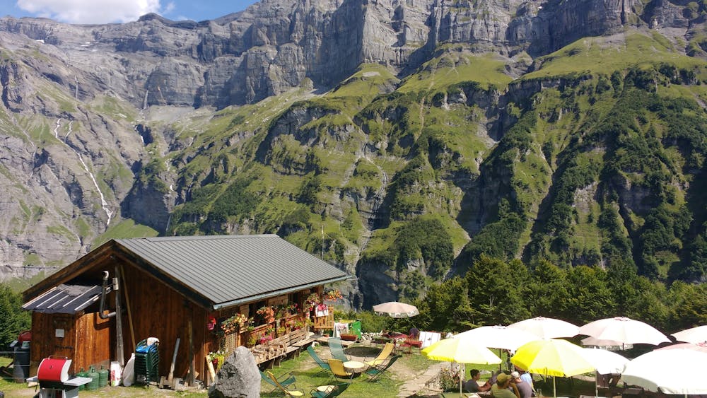
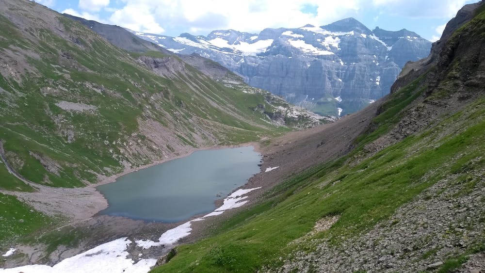
From there, it’s a long, steep climb towards the lake, first in tall grass and between trees, but soon the landscape will turn rockier. About 20 minutes before reaching the lake you will pass the refuge on your right—be sure to stop by either going up or going down, if not to eat/drink something, at least to fill up on water at the fountain.
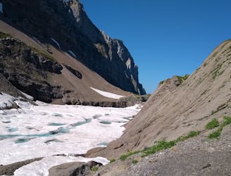
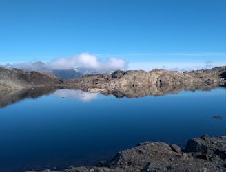
The lake is rather large but its size can change dramatically depending on the time of the year: it can be half covered in snow at the start of the summer, just like it can look almost empty and be a depressing sight in the fall.
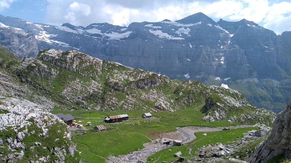
The climb down is quite long and time-consuming, so try to keep your eye on our watch. Retrace your steps until you’re back at the chalet du Boret, but there take the trail on the left that will take you to the deep end of the cirque.
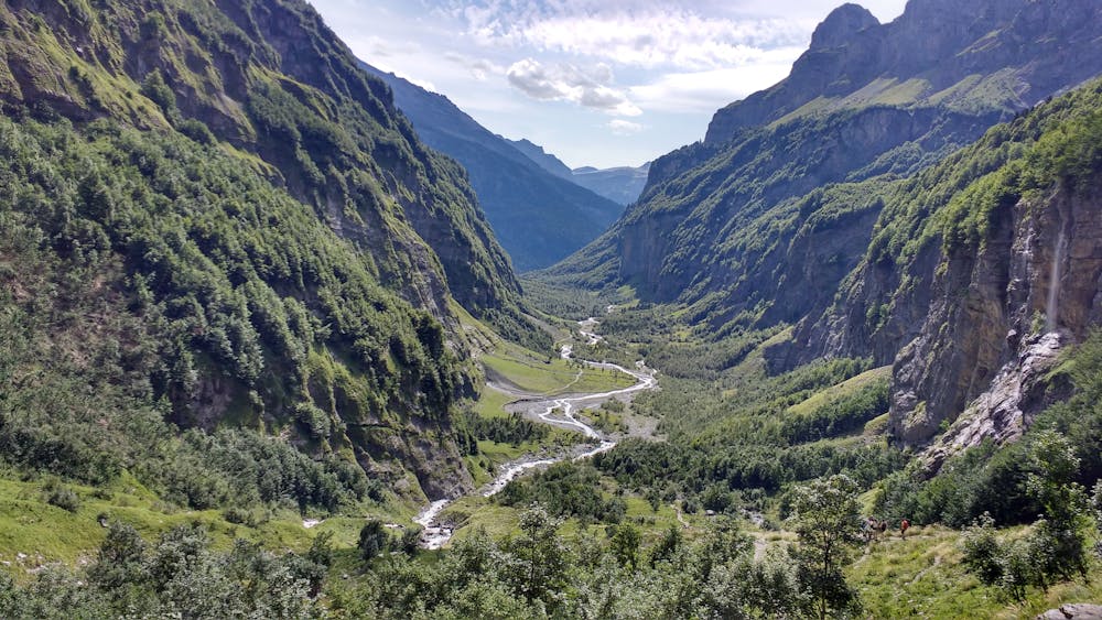
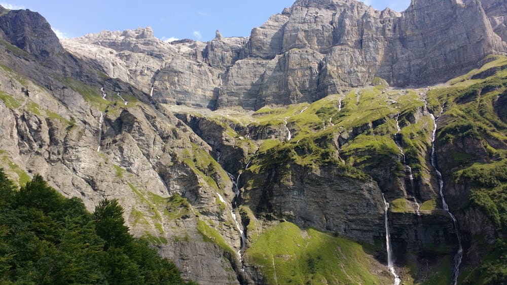
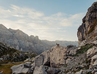
The first part will allow you to enjoy open views of the surrounding 700m high cliffs and waterfalls, but soon the trail will dive below the treeline and there won’t be much to see until you reach the short and steep descent towards the bottom of the cirque, called "Bout du Monde" ("end of the world").
From there, it’s still a long way to the car park, especially if you stop by the multiple waterfalls, but the trail is not difficult, and it runs either flat or downhill. Be aware that this part can be extremely crowded on weekends and during the summer, as the hike to the end of the cirque (fairly accessible as an out-and-back walk) is popular with families with small children.
Difficult
Hiking trails where obstacles such as rocks or roots are prevalent. Some obstacles can require care to step over or around. At times, the trail can be worn and eroded. The grade of the trail is generally quite steep, and can often lead to strenuous hiking.

The trail contains some obstacles such as outcroppings and rock which could cause injury.
Away from help but easily accessed.
8.1 km away
A hike beginning with easy trails and ending by scrambling to a summit.
Extreme Hiking
8.7 km away
A 3-day hike along part of the Via Alpina in the stunning Haute-Savoie region of France.
Moderate Hiking
9 km away
Challenging alpine hike that summits Mont Buet along with other nearby peaks.
Extreme Hiking
9.4 km away
A steep and exposed hike. Beatifull panaromas
Severe Hiking

5 routes · Hiking

3 routes · Hiking