9.4 km away
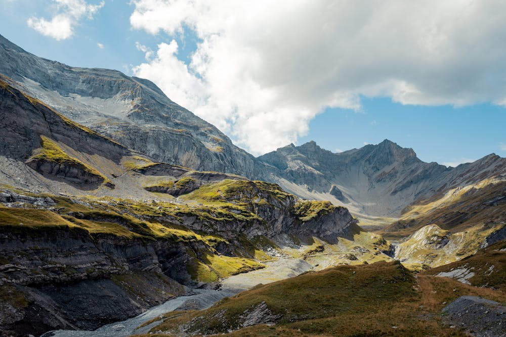
Lac de la Vogealle
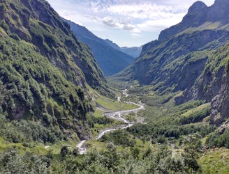
Visit an alpine lake before discovering one of France's 17 "Grand Sites de France," the glacial cirque of Fer à Cheval.
Difficult Hiking
- Distance
- 17 km
- Ascent
- 1.2 km
- Descent
- 1.2 km
A steep and exposed hike. Beatifull panaromas
Hiking Severe

A steep and exposed hike, can be done without equipment in good weather. Sleeping at refuge possible.
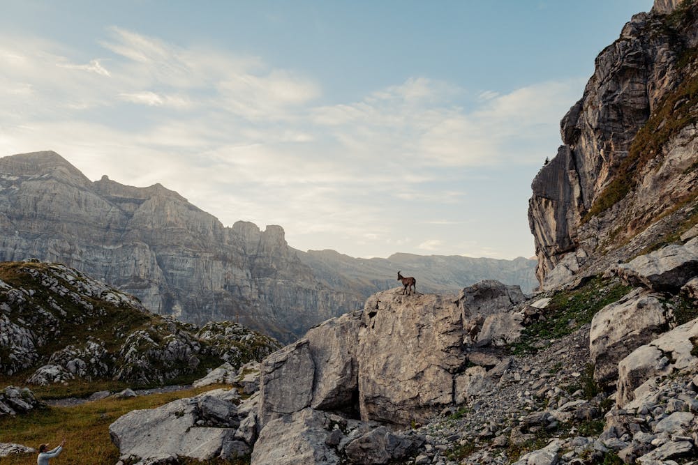
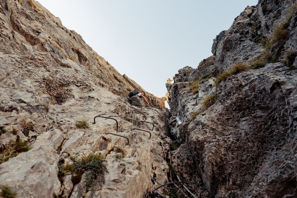
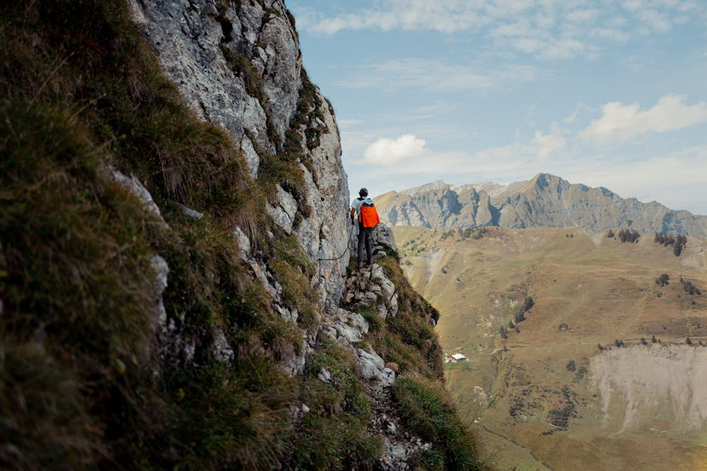
DAY 1 +- 1650m elevation gain +- 15km Start from the valley and ascend up the Pas d'Encel. This is a tight mountain pass with some scrambling involved. Always fixed rope available to hold on. After that, you arrive in the valley with magnificent looks at glaciers all around you. Waterfalls and rivers everywhere. Start the ascent to the Col des Ottans. At the end there is a via ferrata passage which mainly consists of iron ladders. It is around 30m long and can be done without equipment if you are somewhat familiar with climbing and not to scared. After the ascent you walk on Col des Ottans which is the border between France and Switzerland. Beautiful panoramic view. You transverse on the France side while slowly descending towards the refuge. This flank is usually occupied by a lot of sheep. If you encounter the shepherd and can speak french, he is a wonderful men and will answer all your questions. He will also sleep at the refuge.
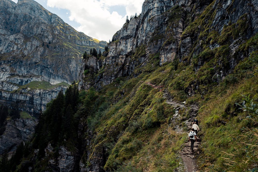
DAY2 Ascend the Pas de Taureau. The ascend is steep and tiring but not difficult or exposed. The descent is more difficult and should be done carefully. There is an option to ascend the Dent Blanche on the right. At col de Bossetan (Bostan) head right. The path leads next to an abandoned hut. From there, start the descent towards Champéry. The last part of the descent (Pas de la Bide) is exposed and should be done carefully. The path is well marked and passes through a rock. Once you arrive in the valley, you just follow the path. Near the end there are some huts to drink or eat something.
A YouTube video of this hike without the refuge can be seen here: https://youtu.be/r54iBq048ko
Visit my photography site here: https://kobedemuelenaere.be/stories
Severe
Hiking challenging trails where simple scrambling, with the occasional use of the hands, is a distinct possibility. The trails are often filled with all manner of obstacles both small and large, and the hills are very steep. Obstacles and challenges are often unexpected and can be unpredictable.

Some trail sections have exposed ledges or steep ascents/descents where falling could cause serious injury.

Away from help but easily accessed.
9.4 km away
Visit an alpine lake before discovering one of France's 17 "Grand Sites de France," the glacial cirque of Fer à Cheval.
Difficult Hiking