65 m away
Le Petit Tour de Chamonix
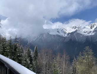
An amazing way to see some of the best view in Chamonix on foot.
Moderate Trail Running
- Distance
- 16 km
- Ascent
- 1 km
- Descent
- 1 km
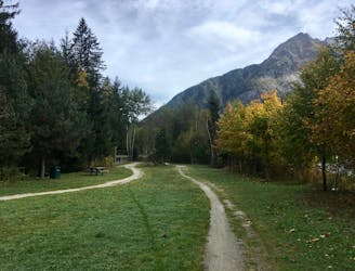
Il s'agit d'une course facile et ombragée. Faites une petite pause à la burette pour profiter de la vue panoramique sur le massif. It is an easy, shaded run. Take a short break at the burette to enjoy the panoramic view of the massif.
Trail Running Moderate

This is a popular trail running route which is generally considered to be moderate. It's an unknown remoteness, it features unknown exposure and is typically done in an unknown time of year. From a low point of 1 km to the maximum altitude of 1.3 km, the route covers 8.5 km, 364 vertical metres of ascent and 364 vertical metres of descent.
Moderate
65 m away
An amazing way to see some of the best view in Chamonix on foot.
Moderate Trail Running
223 m away

La plus longue coure du Marathon
Extreme Trail Running
226 m away

La course nocturne en binome
Difficult Trail Running
231 m away

Epreuve reine de l'événement
Severe Trail Running
253 m away

le kilomètre vertical de Chamonix
Difficult Trail Running
530 m away

A classic loop around the Chamonix Valley.
Easy Trail Running
616 m away

La course format 10k de l'événement
Moderate Trail Running
636 m away

le cross du Mont-blanc
Difficult Trail Running
653 m away

Le mini cross est un petit trail pour les plus jeunes, de 800m à 3km en fonction des catégories.
Easy Trail Running
684 m away
The easiest trail run in Chamonix.
Easy Trail Running

8 routes · Trail Running