3 km away
Kv du Mont-Blanc

le kilomètre vertical de Chamonix
Difficult Trail Running
- Distance
- 3.9 km
- Ascent
- 1 km
- Descent
- 0 m
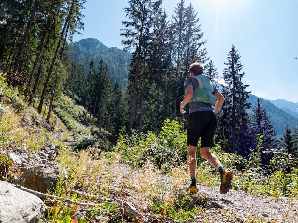
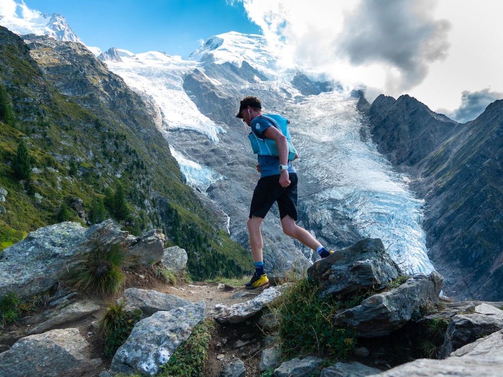
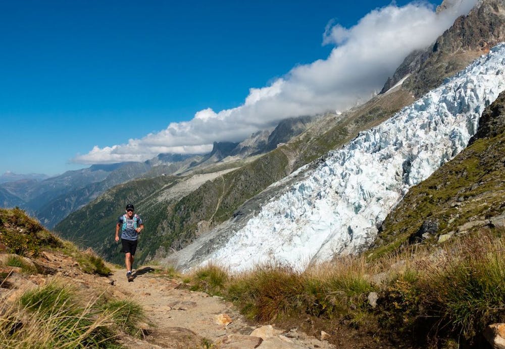
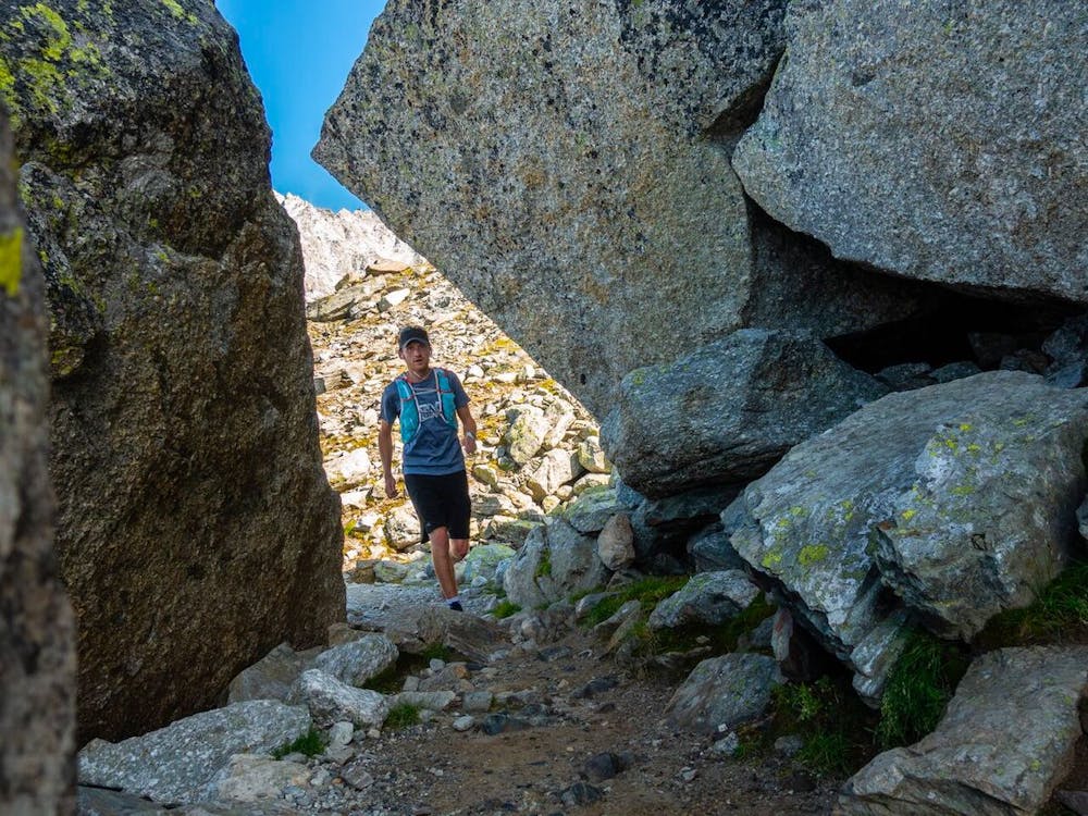
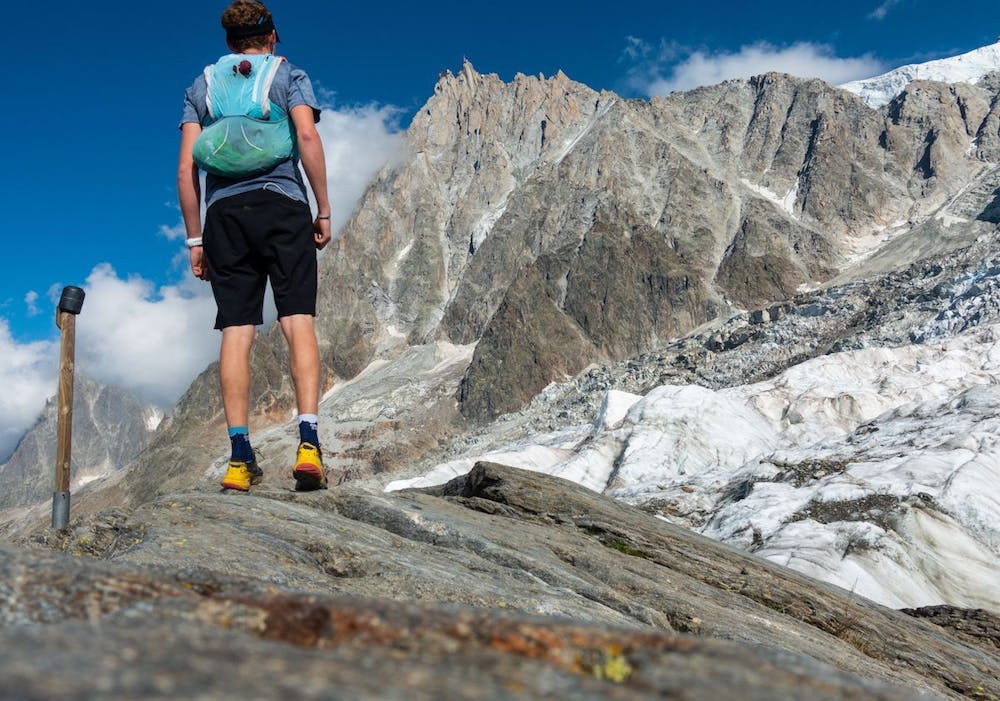
A tough climb to the junction of two glaciers
Trail Running Severe

This route packs in a significant climb from the bottom of the Chamonix valley up to La Jonction – the meeting place of the Bossons and Taconnaz glaciers. You’ll get stunning close-up views of the Bossons glacier – the longest ice-fall in Europe - along the second half of the route, and reach a unique high point at 2589m beside the granite ‘aiguilles’, and creaking glaciers.
Check out Run the Alps trip options here: https://runthealps.com
Severe

Some trail sections have exposed ledges or steep ascents/descents where falling could cause serious injury.

Away from help but easily accessed.
3 km away
le kilomètre vertical de Chamonix
Difficult Trail Running
3 km away

Epreuve reine de l'événement
Severe Trail Running
3 km away

La course nocturne en binome
Difficult Trail Running
3 km away

La plus longue coure du Marathon
Extreme Trail Running
3.2 km away
An amazing way to see some of the best view in Chamonix on foot.
Moderate Trail Running
3.7 km away

A classic loop around the Chamonix Valley.
Easy Trail Running
3.8 km away
Enjoy the open vistas of the north balcony between Montenvers and Plan de l'Aiguille on vintage Chamonix trails.
Moderate Trail Running
3.9 km away

La course format 10k de l'événement
Moderate Trail Running
3.9 km away

le cross du Mont-blanc
Difficult Trail Running
3.9 km away

Le mini cross est un petit trail pour les plus jeunes, de 800m à 3km en fonction des catégories.
Easy Trail Running

8 routes · Trail Running