641 m away
Les Bois
The easiest trail run in Chamonix.
Easy Trail Running
- Distance
- 5.6 km
- Ascent
- 56 m
- Descent
- 56 m
Enjoy the open vistas of the north balcony between Montenvers and Plan de l'Aiguille on vintage Chamonix trails.
Trail Running Moderate

Although this side of the valley has a less developed network of trails than the other one, this route offers everything you'd expect from a Chamonix run.
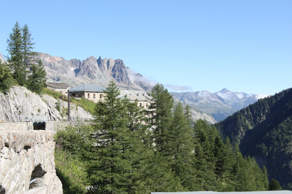
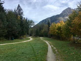
Starting your run near the city center, you'll first follow a large road before soon reaching a fairly technical singletrack that will take you all the way to Montenvers. Until you reach Montenvers, the views will be limited as you will be below the tree cover, but you might as well enjoy the shade... it won't last. Unless you enjoy the crowds, I suggest you don't stay too long at Montenvers train station and keep going until you get to the Signal Forbes, where the view of the Mer de Glace is way better than it is 200m below.
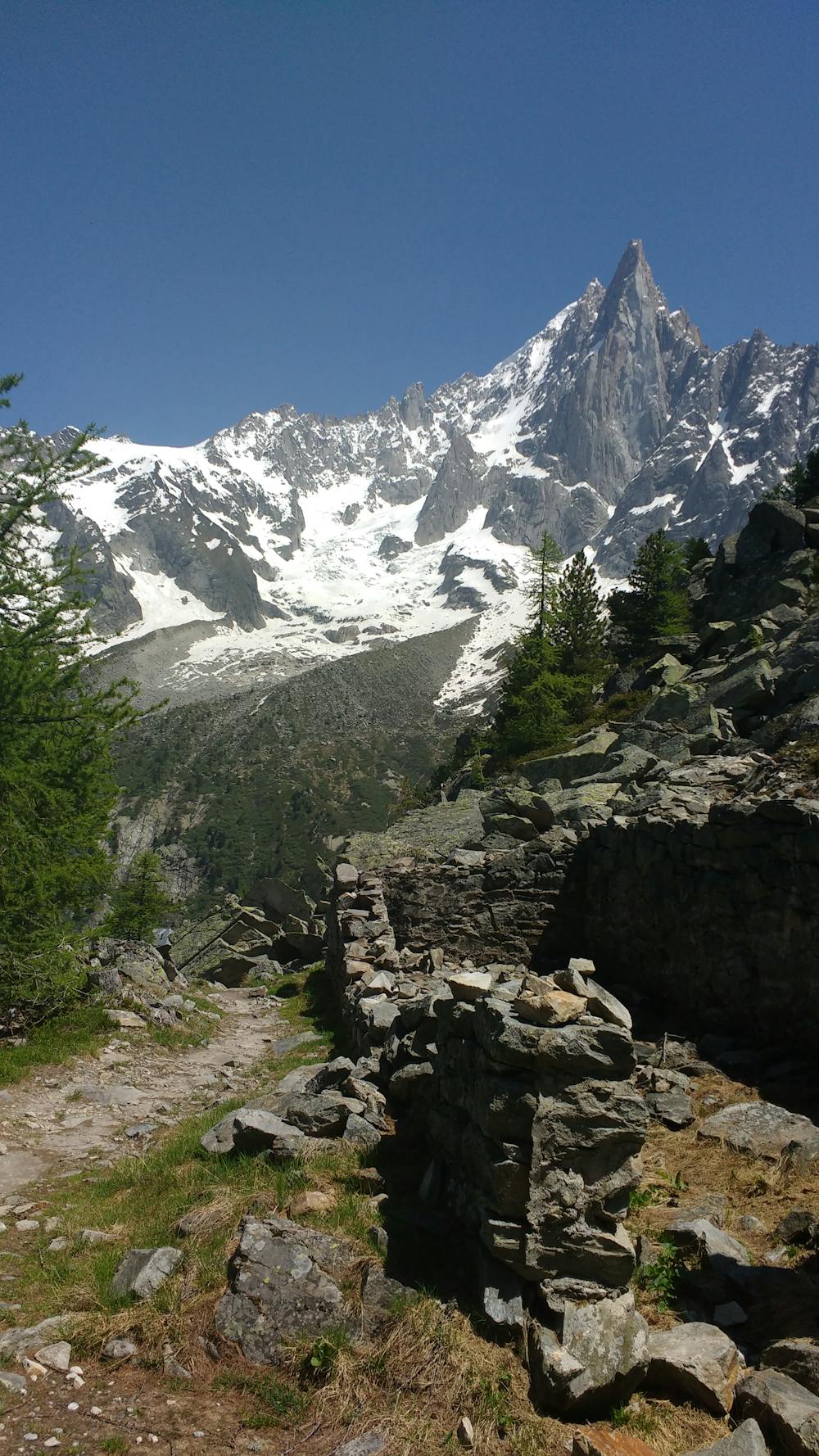
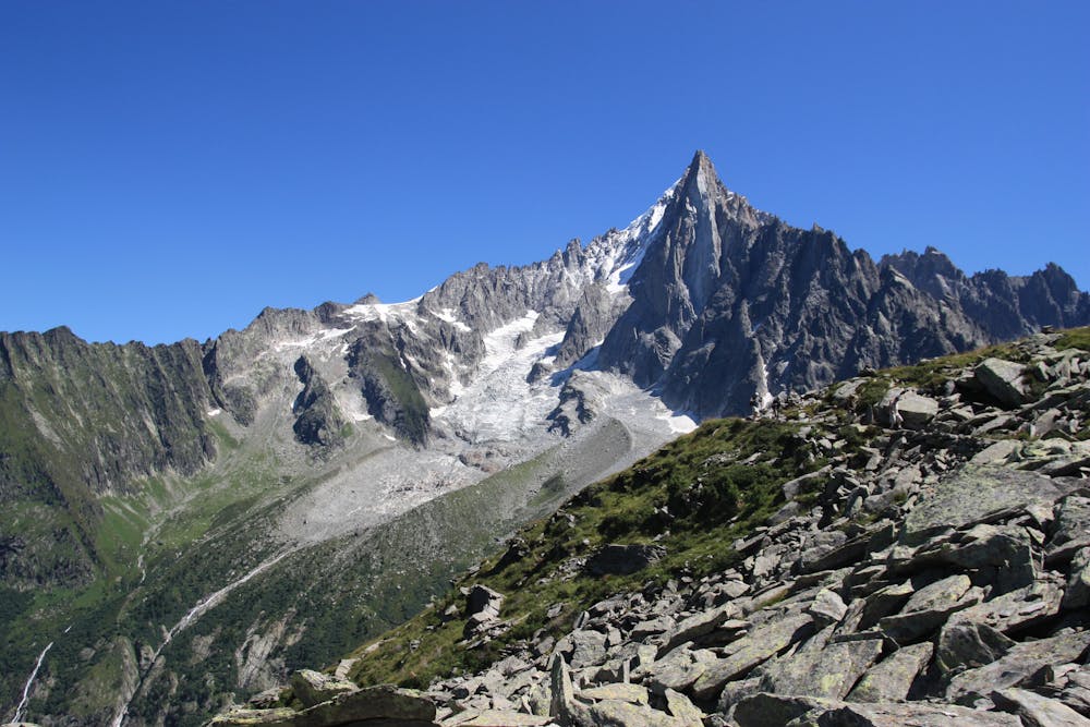
From there, it's time to follow the north balcony, a typical Chamonix trail with expansive views of the surrounding peaks, with Aiguille Verte behind you and Mont Blanc ahead. The trail goes up and down as you traverse towards Plan de l'Aiguille. While you're running, imagine how you'd feel if you were in the final part of the MMB 90k, as you're following the race course. Eventually, you'll reach Plan de l'Aiguille after a short but steep climb. If you still have some energy, make sure to check out the Lac Bleu just before the refuge.
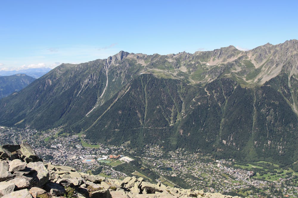
It's always a good idea to stop for drinks at the refuge as the view is well-worth it, and the climb down will require some energy. The downhill trail is easy enough to run at a decent pace, but it's technical and long enough to make it a fun challenge, so plan to take your time reaching the bottom of this 1100m descent. The route finishes back where you started... conveniently close to Chamonix' numerous bars and restaurants.
Moderate

The trail contains some obstacles such as outcroppings and rock which could cause injury.

Close to help in case of emergency.
641 m away
The easiest trail run in Chamonix.
Easy Trail Running
671 m away

La course format 10k de l'événement
Moderate Trail Running
680 m away

le cross du Mont-blanc
Difficult Trail Running
716 m away

Le mini cross est un petit trail pour les plus jeunes, de 800m à 3km en fonction des catégories.
Easy Trail Running
769 m away
An amazing way to see some of the best view in Chamonix on foot.
Moderate Trail Running
863 m away

La plus longue coure du Marathon
Extreme Trail Running
869 m away

La course nocturne en binome
Difficult Trail Running
879 m away

Epreuve reine de l'événement
Severe Trail Running
893 m away

A classic loop around the Chamonix Valley.
Easy Trail Running
901 m away

le kilomètre vertical de Chamonix
Difficult Trail Running

8 routes · Trail Running