8 km away
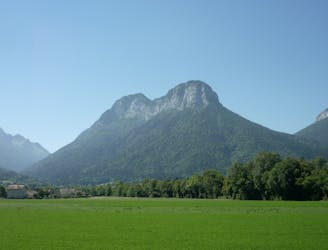
La Montagne du Charbon depuis Saury
Randonnée familiale pour découvrir le massif du Trélod par la commune de Lathuile
Moderate Trail Running
- Distance
- 14 km
- Ascent
- 1 km
- Descent
- 1 km
Balade familiale idéale pour profiter d'un sommet relativement plat
Trail Running Easy

This is a popular trail running route which is generally considered to be easy. It's remote, it features low exposure and is typically done between May and October. From a low point of 1.6 km to the maximum altitude of 1.7 km, the route covers 5.6 km, 152 vertical metres of ascent and 152 vertical metres of descent.
Au départ du parking des chalets de Leschaux prendre le GRP du massif des Bauges en direction du sud. Suivre les panneaux en direction de chalets de Gruffy.
Le retour de la boucle. se fait en passant par le Crêt de L'Aigle puis en rattrapant le GRP par un sentier balisé
Easy

The path is on completely flat land and potential injury is limited to falling over.

Away from help but easily accessed.
8 km away
Randonnée familiale pour découvrir le massif du Trélod par la commune de Lathuile
Moderate Trail Running

15 routes · Hiking · Trail Running