8 m away
Kv du Mont-Blanc

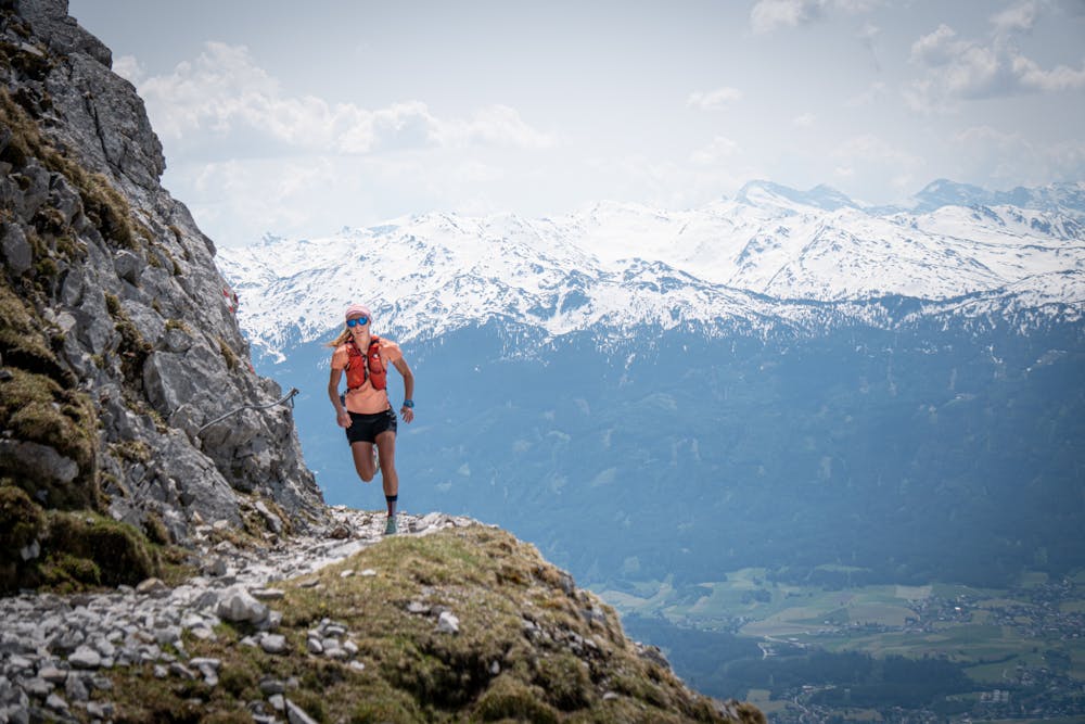
le kilomètre vertical de Chamonix
Difficult Trail Running
- Distance
- 3.9 km
- Ascent
- 1 km
- Descent
- 0 m
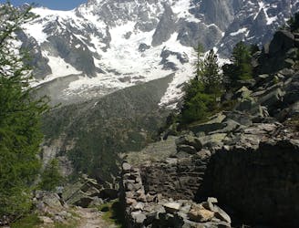
The full 170km Chamonix-Mont-Blanc loop that follows the long-distance hiking trail of the Tour du Mont-Blanc La boucle complète Chamonix-Mont-Blanc de 170 km qui suit le sentier de grande randonnée du Tour du Mont-Blanc.
Trail Running Extreme

This route essentially follows the long-distance hiking trail Tour du Mont-Blanc.
From Chamonix it goes via Les Houches to the first ascent La Charme. Behind Les Contamines-Montjoie, the first high alpine area is reached, with the Croix du Bonhomme (2479 m) as the highest point.
After a descent to the hamlet of Les Chapieux, you reach Italian territory via the Col de la Seigne (2516 m). Above Val Veny you reach Arête Mont Favre (2435 m) and descend via Col Chécrouit to Courmayeur, which you reach after 80 km. Via the Grand Col Ferret (2537 m) you reach the Swiss Val Ferret.
Behind Champex-Lac, which is reached after 125 km, there are still three major climbs to climb: to the hamlet of Bovine (1987 m) and to Catogne (2011 m) on Swiss territory and to Tête aux Vents (2130 m) on French territory.
Cet itinéraire suit essentiellement le chemin de grande randonnée du Tour du Mont-Blanc.
De Chamonix, il passe par Les Houches pour rejoindre la première ascension de La Charme. Derrière Les Contamines-Montjoie, on atteint la première zone de haute montagne, avec comme point culminant la Croix du Bonhomme (2479 m).
Après une descente vers le hameau des Chapieux, on rejoint le territoire italien par le col de la Seigne (2516 m). Au-dessus du Val Veny, vous atteignez l'Arête Mont Favre (2435 m) et descendez par le Col Chécrouit jusqu'à Courmayeur, que vous atteignez après 80 km. Par le Grand Col Ferret (2537 m), on atteint le Val Ferret suisse.
Derrière Champex-Lac, que l'on atteint après 125 km, il reste encore trois grandes ascensions à franchir : vers le hameau de Bovine (1987 m) et vers Catogne (2011 m) en territoire suisse et vers la Tête aux Vents (2130 m) en territoire français.
Extreme
8 m away
le kilomètre vertical de Chamonix
Difficult Trail Running
16 m away

Epreuve reine de l'événement
Severe Trail Running
27 m away

La course nocturne en binome
Difficult Trail Running
34 m away

La plus longue coure du Marathon
Extreme Trail Running
210 m away
An amazing way to see some of the best view in Chamonix on foot.
Moderate Trail Running
718 m away

A classic loop around the Chamonix Valley.
Easy Trail Running
853 m away

La course format 10k de l'événement
Moderate Trail Running
873 m away

le cross du Mont-blanc
Difficult Trail Running
888 m away

Le mini cross est un petit trail pour les plus jeunes, de 800m à 3km en fonction des catégories.
Easy Trail Running
895 m away
Enjoy the open vistas of the north balcony between Montenvers and Plan de l'Aiguille on vintage Chamonix trails.
Moderate Trail Running

8 routes · Trail Running