Refuge Chancel
La Grave
Les Deux Alpes and La Grave
Minimal effort for huge rewards high above La Grave.
Hiking Moderate
- Distance
- 4.6 km
- Ascent
- 296 m
- Descent
- 296 m
- Duration
- 1-2 hrs
- Low Point
- 2.3 km
- High Point
- 2.5 km
- Gradient
- 11˚

Provided the La Grave cable car is open, this is a cruisy hike which provides amazing rewards for little effort. The cable car is generally running from mid June to mid September, and it's recommended to not only ride it to the mid station (the start and finish point for this hike) but also to detour to the very top of the lift system at 3200m. The amazing views from the top station of La Meije and the Glacier de la Girose are worth spending a little extra money for. The hike described here is pretty short so there should be plenty of time for the detour either before or after doing your walk.
Description
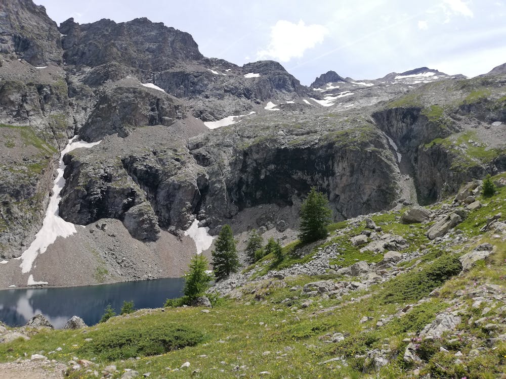
From the mid station, descend a rocky path north and then north-west to where the path flattens out and begins to traverse vaguely westwards towards the Lac de Puy Vachier. The traverse path is great, and enjoys huge views across the wild mountains north of La Grave.
The path soon leads you to the shores of Lac de Puy Vachier - a classic high mountain lake nestled just below a cliff band which, in winter, is home to some of La Grave's better known ski lines such the Couloir de la Terrace and the Banana Couloir. The VERY bravest of hikers might consider a swim in the lake but it is frigidly cold so most opt for dipping their toes rather than full immersion!
From the lake it's a short climb up to the Refuge Chancel and the hut offers excellent, locally sourced food, cold beer and a warm welcome. In winter it is full of skiers enjoying the gorgeous terrace and in summer it is full of hikers doing much the same. The salads are the hut are particularly good but all the food is tasty and typically French.
Luxuriate in the sun for a while before hiking back to the cable car via the ascent route.
Difficulty
Moderate
Hiking along trails with some uneven terrain and small hills. Small rocks and roots may be present.
Medium Exposure

The trail contains some obstacles such as outcroppings and rock which could cause injury.
Remoteness
Away from help but easily accessed.
Best time to visit
Features
- Alpine
- Picturesque
- Dog friendly
- Family friendly